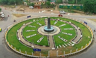
Kohalpur is a municipality in Banke District of Lumbini province of Nepal. The municipality was established on 18 May 2014 merging the existing two Village Development Committees i.e. Rajhena and Kohalpur. The town is in East-West highway and one of the fastest developing places in Nepal. A neighboring city Nepalgunj is on South (16 km [9.9 mi]), with Ghorahi city (135 km [84 mi]) to west in Dang District and further 6 km (3.7 mi) is the Indian border. In fact it is a growing city in the western region of Nepal. It has a junction to diverse the roadway transport to east, west, north and south from the city.
Lomanthang is a rural municipality in Mustang district in Gandaki Province of western Nepal. It is located at the northern end of the district, bordering the Tibet Autonomous Region of China to the north and Dalome rural municipality of Mustang in the south.
Saudiyar is a town and Village Development Committee in Dang Deokhuri District in Lumbini Province of south-western Nepal. At the time of the 1991 Nepal census it had a population of 8,052 persons living in 1067 individual households.
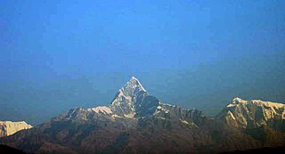
Machhapuchchhre is a Gaunpalika and former village development committee in Kaski District in the Gandaki Province of northern-central Nepal. At the time of the 1991 Nepal census it had a population of 1,881 persons living in 378 individual households.
Dullu is an urban Municipality in Dailekh District of Karnali Province in Nepal.
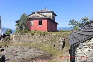
Kaskikot, commonly known as Kaski, is a Ward no. 24 of the Pokhara metropolitan city. It was earlier a part of the village development committee in Kaski District, a region in northern-central Nepal.
Banau is a village development committee in Parbat District in the Dhawalagiri Zone of central Nepal. At the time of the 1991 Nepal census it had a population of 1432 people living in 251 individual households.
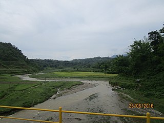
Bhangara, Nepal is a village development committee of the Parbat District of the Dhawalagiri Zone in central Nepal. It is located approximately 75 km from Pokhara City and 15 km from the district headquarters Kusma. At the time of the 1991 Nepal census, it had a population of 2242 people living in 421 households.
Mohanyal is a former village development committee that is now a rural municipality in Kailali District in Sudurpashchim Province of western Nepal. At the time of the 1991 Nepal census it had a population of 3917 living in 614 individual households.
Khairenitar is a main market center in Shuklagandaki Municipality in Tanahu District in the Gandaki Zone of central Nepal. The formerly Village Development Committee was merged to form the new municipality on 18 May 2014.. It is a beautiful town with strong potentiality to flourish on tourism sector. Recently, Bhujikot hill-point is being a popular tourist attraction, where lots of local tourists visit to observe the Himalayan range to the North, as well as sunrise and sunset. Akaladevi, Tinkhole and Dhorbarahi are nearby popular holy places. There are numerous mini shopping centre around the town. Tanahun Chamber of Commerce annually organizes Khairenitar Mahotsav to promote business, culture and heritage.
Bigu is a former village development committee that is now a ward-7 rural municipality in Dolakha District in Bagmati Province of northeastern Nepal. At the 1991 Nepal census, Bigu had a population of 1,736 people living in 361 individual households.

Dudhauli is a municipality of the Sindhuli District in the Janakpur Zone of south-eastern Nepal.

Hariharpur Gadhi is a Gaunpalika and former village development committee in Sindhuli District in Bagmati Province of central Nepal. At the time of the 1991 Nepal census it had a population of 3,113 people living in 437 individual households.
Triveni is a rural municipality in Salyan District in the Karnali Province of western-central Nepal. At the time of the 1991 Nepal census it had a population of 3789 people living in 710 individual households.
Belauri, The former village development committee was converted into Municipality merging with existing Rampur Bilaspur, Laxmipur, Mahakali and Sripur village development committee on 18 May 2014. At the time of the 1991 Nepal census it had a population of 14,280 people living in 1877 individual households.
Takasera was a village development committee in Rukum District but with new political division it is in East Rukum in Lumbini Province of western Nepal. At the time of the 2011 Nepal census it had a population of 3698 people living in 902 individual households. It has altogether 6 clustered villages in different locations within the Takasera VDC and the clustered village names are Taka, Upallo (upper) Sera, Lower (down) Sera, BachiGaun, Ghumlibang, Damchan and Tupa. As per the new federal government system, Takasera has been in the Putha Utterganga Rural Municipality (Ga.Pa.) wards being 10 and 11, in the Rukum Purba (East) district.
Siluwa is a village development committee in Palpa District in the Lumbini Zone of southern Nepal. At the time of the 1991 Nepal census, it had a population of 4616 people living in 827 individual households. Villages within it include Romandi. Maslang is one of the main village ward no 1 which is mostly occupied by Ale magar Thar people you can find the Rana magar and masrangi magar aswel, one of the old school shree janamarga higher secondary school also in Maslang
and in siluwa, it coveres Darsing bhanjyang, Hatiya, and siluwa, all cast Bhahun, Magar, Newar, Darji, and Biswakarma people leaving in siluwa, Mandali baraju world famous temple also there in Siluwa ..
Dhobadi is a village development committee in Nawalparasi District in the Lumbini Zone of southern Nepal. At the time of the 1991 Nepal census it had a population of 4077 people living in 607 individual households.
Khairahani is a municipality in Chitwan District in Bagmati Province of southern Nepal. The municipality was established on 8 May 2014 by merging the existing Khairahani, Kumroj and Chainpur VDCs. At the time of the 1991 Nepal census it had a population of 13,629 people living in 2262 households.

Kalinchowk is a Rural municipality located within the Dolakha district of the Bagmati province of Nepal. The municipality spans 132.49 square kilometres (51.15 sq mi) of area, with a total population of 22,954 according to a 2011 Nepal census.


