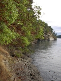
The Gulf Islands are the islands in the Strait of Georgia, between Vancouver Island and the mainland of British Columbia, Canada.

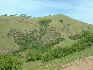
The Sunol Regional Wilderness is a regional park in Alameda County, the eastern San Francisco Bay Area, Northern California. It is located near the town of Sunol, south of Pleasanton and east of Fremont.

Greater Victoria is located in British Columbia, Canada, on the southern tip of Vancouver Island. It is a cultural rather than political entity, usually defined as the thirteen easternmost municipalities of the Capital Regional District (CRD) on Vancouver Island as well as some adjacent areas and nearby islands. The Capital Regional District administers some aspects of public administration for the whole metro region; other aspects are administered by the individual member municipalities of Greater Victoria. Roughly, Greater Victoria consists of all land and nearby islands east of a line drawn from the southern end of Finlayson Arm to the eastern shore of Sooke Harbour, along with some lands on the northern shore of Sooke Harbour.

Galiano Island is one of the Southern Gulf Islands between Vancouver Island and the Lower Mainland of British Columbia, Canada. Located on the west side of the Strait of Georgia, it is 27.5 km (17.1 mi) long, 6 km (3.7 mi) at its widest point, and 1.6 km (1.0 mi) across at its narrowest point and is separated from Saltspring Island by Trincomali Channel. On the western side of the island there are a series of sandstone caves. The island is northwest of Mayne Island, northeast of Saltspring Island and southeast of Valdes Island. It is part of the Capital Regional District Electoral Area G, and has a population of 1044 inhabitants.

Oak Bay is a municipality incorporated in 1906 that is located on the southern tip of Vancouver Island, in the Canadian province of British Columbia, Canada. A member municipality of the Capital Regional District, it is a community east of and adjacent to the city of Victoria. It is one of the 13 municipalities of Greater Victoria.

The Golden Gate Biosphere is a biosphere reserve in Northern California. It was created by UNESCO in 1988 and encompasses 13 protected areas in the San Francisco Bay Area. It extends through the central California coastal region from the Bodega Marine Reserve in the north to Jasper Ridge in the south and includes the Farallon Islands, Angel Island, and Alcatraz within the San Francisco Bay. The biosphere reserve is situated on both sides of the San Andreas Fault. Each side has a completely different type of bedrock, and the western side of the rift is moving northward. It encompasses a diverse range of marine, coastal, and upland habitats of the California chaparral and woodlands and Northern California coastal forests ecoregions, including mixed evergreen forests, Coast Redwood forests, Douglas-fir forests, Bishop pine forests, oak forests, woodlands and savannas, northern coastal scrub, chaparral, coastal dune, coastal strand, tidepools, kelp forests, coastal grasslands, and marshes. The associated fauna is also rich with cougars, Tule elk, California sea lions, elephant seals, and many shorebirds.

Collinson Point Provincial Park is a provincial park on Galiano Island, British Columbia, Canada. It is located between Mount Galiano and the western approaches to Active Pass. The area is 24 hectares, with c. 500 metres of waterfront.

Discovery Island Marine Provincial Park is a provincial park located about two nautical miles east of Oak Bay on the coast of British Columbia. It is about a mile long and one-half mile wide and looks out into the Juan de Fuca Strait.
Willows Beach, Victoria is a beachfront in the Municipality of Oak Bay, in Victoria, British Columbia. Along Willows Beach is Willows Park, where a tea-room is run by the Kiwanis Club in spring and summer. It takes its name from the Willows Fairground built in 1891 and which remained Greater Victoria's main horse-racing venue during the early years of the twentieth century. The Willows Racetrack was situated nearly a kilometre inland from the beach, so named because of the willow trees that grew there.

Discovery Island is located off the eastern side of Vancouver Island and is viewable from Ten Mile Point, near Cadboro Bay, and Oak Bay. Discovery Island Marine Provincial Park occupies the southern portion of Discovery Island, 3 miles (4.8 km) east of Oak Bay. The northern portion of the island is part of Discovery Island Indian Reserve 3, under the control of the Songhees First Nation.

Cadboro Bay is a bay near the southern tip of Vancouver Island and its adjacent neighbourhood in the municipalities of Saanich and Oak Bay in Greater Victoria, British Columbia, Canada.
Waterbird Regional Preserve is a 192 acres (0.78 km2) regional park located in Contra Costa County, California, adjacent to the city of Martinez, CA. It is part of the East Bay Regional Park District (EBRPD). It primarily consists of an area known as McNabney Marsh, which lies alongside Interstate 680 near the Sacramento-San Joaquin Delta and between two large and active oil refineries. The marsh drains into Suisun Bay via Peyton Slough. The area provides habitat for a wide variety of waterfowl and shorebirds for resting and feeding.

Victoria Harbour is a harbour, seaport, and seaplane airport in the Canadian city of Victoria, British Columbia. It serves as a cruise ship and ferry destination for tourists and visitors to the city and Vancouver Island. It is both a port of entry and an airport of entry for general aviation. Historically it was a shipbuilding and commercial fishing centre. While the Inner Harbour is fully within the City of Victoria, separating the city's downtown on its east side from the Victoria West neighbourhood, the Upper Harbour serves as the boundary between the City of Victoria and the district municipality of Esquimalt. The inner reaches are also bordered by the district of Saanich and the town of View Royal. Victoria is a federal "public harbour" as defined by Transport Canada. Several port facilities in the harbour are overseen and developed by the Greater Victoria Harbour Authority, however the harbour master's position is with Transport Canada.

Salt Point State Marine Conservation Area (SMCA) is a marine protected area that lies onshore from Fisk Mill Cove and south along Salt Point State Park in Sonoma County on California’s north central coast. The marine protected area covers 3.12 square miles. Salt Point SMCA prohibits the take of all living marine resources, except the recreational take of abalone and finfish.
South Oak Bay is a neighbourhood located in the Municipality of Oak Bay, British Columbia, to the south of Oak Bay Avenue and lying east of the boundary between Oak Bay and Victoria, British Columbia.

The Oak Bay Marina is located in South Oak Bay, adjacent to the city of Victoria, British Columbia, Canada. Built on Turkey Head Point, the Oak Bay Marina is operated by The Oak Bay Marine Group. It is home to a fuel dock, gift shop, coffee shop and restaurant as well as some private and community organisations: C-Tow Victoria, Gartside Marine boat repairs, Vela Yacht Sales, Oak Bay Sailing School, 12th Garry Oak Sea Scouts, Oak Bay Sea Rescue RCM-SAR Station #33, and the Oak Bay Recreation sailing program.
Fleming Bay is located in Esquimalt, adjacent to the city of Victoria, British Columbia, Canada. Fleming Bay is one of entrances to Macaulay Point and Buxton Green.

The Torrance Barrens is a conservation area and dark-sky preserve in the District Municipality of Muskoka in Central Ontario, Canada. The reserve consists of Crown Lands in the municipalities of Gravenhurst and Muskoka Lakes. It is notable as the first dark-sky preserve in Canada and for its geological and environmental features.


