Upoto

Last updated
Upoto
CH-NB - Belgisch-Kongo, Upoto-Lisala- Landschaft - Annemarie Schwarzenbach - SLA-Schwarzenbach-A-5-25-104.jpg
Upoto Mission Building
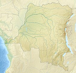
Democratic Republic of the Congo relief location map.jpg
Red pog.svg
Upoto
Coordinates: 2°08′27″N21°29′40″E / 2.14082°N 21.49432°E / 2.14082; 21.49432 Coordinates: 2°08′27″N21°29′40″E / 2.14082°N 21.49432°E / 2.14082; 21.49432
CountryDemocratic Republic of the Congo
Province Mongala
Elevation
399 m (1,309 ft)

Upoto was a village on the right bank of the Congo River, now a district of Lisala in the Mongala province of the Democratic Republic of the Congo. [1]
Contents

History

Captain Hanssens of the International Association of the Congo founded the Upoto station, on the right bank of the Congo above the confluence of the Mongala River, in June 1884. [2] A military post was founded there in 1888–1889 by a Belgian expedition led by Francis Dhanis. [3]

Notes

    1. Upoto Geonames.
    2. Bartholomew 1885, p. 47.
    3. Coosemans 1946.

    Sources

    Related Research Articles

    The Royal Academy for Overseas Sciences or RAOS is a Belgian federal academy that contributes to the progress of scientific knowledge about overseas regions. It is located in Uccle, Brussels and is one of Belgium's numerous academies.

    Overseas France Collective grouping of all French-administered territories and collectivities outside Europe

    Overseas France consists of all the French-administered territories outside Europe, mostly remains of the French colonial empire. These territories have varying legal status and different levels of autonomy, although all have representation in both France's National Assembly and Senate, which together make up the French Parliament. Their citizens have French nationality and vote for the president of France. They have the right to vote in elections to the European Parliament. Overseas France includes island territories in the Atlantic, Pacific and Indian Oceans, French Guiana on the South American continent, and several periantarctic islands as well as a claim in Antarctica.

    Karema, Tanzania Place in Katavi, Tanzania

    Karema is a settlement in Tanzania, on the east shore of Lake Tanganyika, once the location of a White Fathers mission station.

    Haut-Uele District District in Orientale, Democratic Republic of the Congo

    Haut-Uele District was a district of the Belgian Congo and the Democratic Republic of the Congo. It was formed from part of Uele District in 1912. It roughly corresponded in area to the present Haut-Uélé province.

    Paul Panda Farnana Congolese politician (1888-1930)

    Paul Panda Farnana M'Fumu was a Congolese agronomist and expatriate who lived in Europe in the first decades of the 1900s. He has been considered to be the first Congolese intellectual.

    Marcel Maquet

    Marcel Maquet was a Belgian colonial administrator who became commissioner of Stanleyville Province in 1940, then governor of Léopoldville Province in 1943.

    Ernest-Camille Bock

    Ernest-Camille Bock was a Belgian lawyer and colonial administrator. He was governor of Orientale Province in the Belgian Congo from 1945 to 1952.

    Adolphe De Meulemeester

    Adolphe De Meulemeester was a Belgian soldier and colonial administrator. He was deputy governor-general and then governor of the Orientale Province of the Belgian Congo from 1917 to 1926. He introduced many innovations including a road network, schools and clinics, chiefdom and sector councils, and cotton plantations.

    Rodolphe Dufour was a Belgian colonial administrator. From 1933 to 1940 he was commissioner (governor) of the Orientale Province.

    Firmin Peigneux (1904–1968) was a Belgian colonial administrator. He was governor of Kasaï Province in the Belgian Congo from 1948 to 1952.

    Uele District District in Orientale, Belgian Congo

    Uele District was a district of the Congo Free State and the Belgian Congo. It roughly corresponded to the current provinces of Bas-Uélé and Haut-Uélé.

    Bangala District District in Orientale, Belgian Congo

    Bangala District was a district of the Congo Free State and the Belgian Congo. It went through various significant changes in extent. The eastern part very roughly corresponded to the present province of Mongala.

    Banana District District in Banana, Belgian Congo

    Banana District was a district of the Congo Free State and Belgian Congo. It disappeared in a reorganization of 1910.

    Itimbiri River river in Democratic Republic of the Congo

    The Itimbiri River is a right tributary of the Congo River, which it joins above Bumba. At one time it was important as a navigable waterway for transporting good from the northeast of the country down to the Congo.

    Jules Alexandre Milz was a Belgian soldier who was active in exploring the northeast of the Congo Free State. He traveled extensively in Uele District, where he resolved the question of whether the Uele River was the upper portion of the Ubangi River. He was second in command of an expedition to the Nile in 1891–1892, and took over command after the leader died.

    Bomane Place in Tshopo, Democratic Republic of the Congo

    Bomane is a village on the Aruwimi River in the Tshopo province of the Democratic Republic of the Congo.

    Ibembo Place in Tshopo, Democratic Republic of the Congo

    Ibembo is a village on the Itimbiri River in the Tshopo province of the Democratic Republic of the Congo.

    Umangi Place in Mongala, Democratic Republic of the Congo

    Umangi is a village on the right bank of the Congo River downstream from Lisala in the Mongala province of the Democratic Republic of the Congo.

    Gada River, Uele

    The Gada River is a left tributary of the Uele River, which it joins downstream from Niangara in the Haut-Uélé province of the Democratic Republic of the Congo.

    Amadi, Congo Town in Bas-Uélé, DR Congo

    Amadi is a town in the Bas-Uélé province of the Democratic Republic of the Congo (DRC).