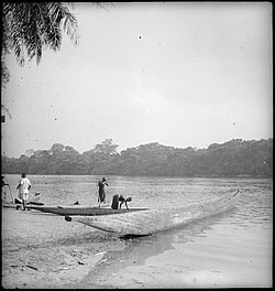
The Ebola River, also commonly known by its Ngbandi name Legbala, is the headstream of the Mongala River, a tributary of the Congo River, in northern Democratic Republic of the Congo. It is roughly 250 kilometers (160 mi) in length.
The Ubangi River, also spelled Oubangui, is a river in Central Africa, and the largest right-bank tributary of the Congo River. It begins at the confluence of the Mbomou and Uele Rivers and flows west, forming the border between Central African Republic (CAR) and the Democratic Republic of the Congo (DRC). Subsequently, the Ubangi bends to the southwest and passes through Bangui, the capital of the CAR, after which it flows south – forming the border between the DRC and the Republic of the Congo. The Ubangi finally joins the Congo River at Liranga.

The Uele, also known by the phonetically identical Uélé, Ouélé, or Welle River, is a river in the Democratic Republic of the Congo.

Équateur District was a former district of the Congo Free State, Belgian Congo and Democratic Republic of the Congo. In 1914, it became part of former Équateur Province. The district went through various changes of extent and name over the years. The original district roughly corresponds to the current provinces of Équateur and Tshuapa.

Tshuapa District, was a district of the Belgian Congo and the Democratic Republic of the Congo created in 1933 in the Coquilhatville Province. At its greatest extent it roughly corresponded to the present provinces of Équateur and Tshuapa.

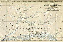
Mongala District was a district of the Belgian Congo and the Democratic Republic of the Congo. It went through various changes in extent. It covered roughly the same area as the present Mongala province and most of Nord-Ubangi province.

Alphonse van Gèle, also written van Gele or Vangele, was a Belgian soldier who served as the Vice-Governor General of the Congo Free State from December 1897 until January 1899. He established the Equator Station, or Station de l’Équateur, today Mbandaka, and concluded a treaty with the powerful Zanzibar trader Tippu Tip at the Stanley Falls station, today Kisangani. He is known for having confirmed that the Uele River was the upper part of the Ubangi River.
Uele District was a district of the Congo Free State and the Belgian Congo. It roughly corresponded to the current provinces of Bas-Uélé and Haut-Uélé.
Ubangi District was a district of the Congo Free State, Belgian Congo and Democratic Republic of the Congo. It went through various significant changes in extent.
Bangala District was a district of the Congo Free State and the Belgian Congo. It went through various significant changes in extent. The eastern part very roughly corresponded to the present province of Mongala.
Lulonga District was a district of the Belgian Congo created in 1912 and dissolved in 1933. Today part of Lulonga is in the current province of Équateur, and part in the province of Tshuapa.
Congo-Ubangi District, was a district of the Belgian Congo created in 1933 in the Coquilhatville Province. It had been dissolved by 1954.
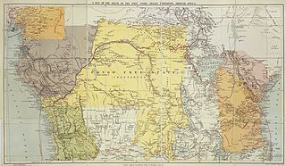
The Districts of the Congo Free State were the primary administrative divisions of the Congo Free State from 1885 to 1908. There were various boundary changes in the period before the Congo Free State was annexed by Belgium to become the Belgian Congo.

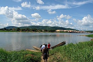
Upoto was a village on the right bank of the Congo River, now a district of Lisala in the Mongala province of the Democratic Republic of the Congo.

Léon Roget was a Belgian soldier and colonial administrator who was active in the Congo Free State. He was the first commander of the Force Publique, the armed force used to police the colony.

Willem Frans Van Kerckhoven, or Guillaume François van Kerckhoven was a Belgian soldier, explorer, colonial administrator who was active in the service of the International Association of the Congo and the subsequent Congo Free State. He is known for his extended expedition through the Uele River basin and onward towards the Nile, which was responsible for the deaths of over 1,800 people and established a Belgian presence in the region. Van Kerckhoven died in an accident before reaching the Nile.

Ernest Baert was a Belgian soldier, explorer and colonial administrator who was active in the Congo Free State.
Gombari is a populated place in the Democratic Republic of the Congo.

The En Avant (Forward) was a small steam launch used in the early days of European exploration of the Congo River basin. It was carried in sections past the cataracts of the lower Congo, reassembled at Stanley Pool and launched in December 1881, the first powered vessel on the long navigable section between the cataracts and the Stanley Falls . In the years that followed it played an important role in exploring the Congo river system and carrying Europeans up and down the river and the tributaries as they established trading stations.
Bokoyo is a settlement in Dungu Territory, Haut-Uélé, Democratic Republic of the Congo.