
The Congo River, formerly also known as the Zaire River, is the second-longest river in Africa, shorter only than the Nile, as well as the third-largest river in the world by discharge volume, following the Amazon and Ganges rivers. It is the world's deepest recorded river, with measured depths of around 220 m (720 ft). The Congo–Lualaba–Luvua–Luapula–Chambeshi River system has an overall length of 4,700 km (2,900 mi), which makes it the world's ninth-longest river. The Chambeshi is a tributary of the Lualaba River, and Lualaba is the name of the Congo River upstream of Boyoma Falls, extending for 1,800 km (1,100 mi).
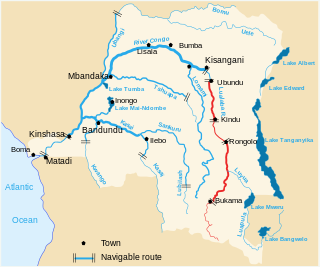
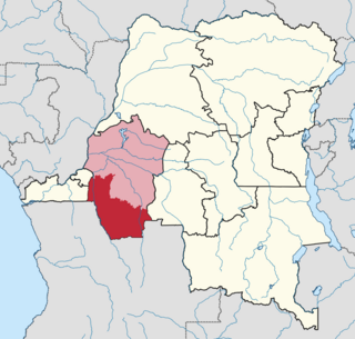
The Lualaba River flows entirely within the eastern part of Democratic Republic of the Congo. It provides the greatest streamflow to the Congo River, while the source of the Congo is recognized as the Chambeshi. The Lualaba is 1,800 kilometres (1,100 mi) long. Its headwaters are in the country's far southeastern corner near Musofi and Lubumbashi in Katanga Province, next to the Zambian Copperbelt.

The Luvua River is a river in the Katanga Province of the Democratic Republic of the Congo (DRC). It flows from the northern end of Lake Mweru on the Zambia-Congo border in a northwesterly direction for 350 kilometres (220 mi) to its confluence with the Lualaba River opposite the town of Ankoro. The Lualaba becomes the Congo River below the Boyoma Falls.

The Lukuga River is a tributary of the Lualaba River in the Democratic Republic of the Congo (DRC) that drains Lake Tanganyika. It is unusual in that its flow varies not just seasonally but also due to longer term climate fluctuations.
The Luama River is a tributary of the Lualaba River in the Democratic Republic of the Congo (DRC).
The Ulindi River is a tributary of the Lualaba River in the Democratic Republic of the Congo (DRC). There is a proposal to build a hydroelectric power plant on the river to power a gold mining project.
Daniel P. Biebuyck was a Belgian scholar of Central African art.

Pweto Territory is a territory in the Haut-Katanga Province of the Democratic Republic of the Congo (DRC). The headquarters are in the town of Pweto.
Bena Kamba is a community on the Lomami River in Maniema province of the Democratic Republic of the Congo.
Pangi Territory is an administrative area in Maniema Province of the Democratic Republic of the Congo. The headquarters is the town of Pangi.

The Lega people are a Bantu ethnic group of the Democratic Republic of the Congo. In 1998 their population was about 250,000.
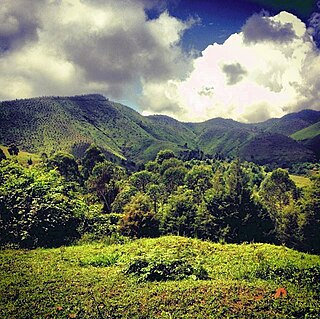
The Itombwe Mountains are a range of mountains in the South Kivu province of the Democratic Republic of the Congo (DRC). They run along the west shore of the northern part of Lake Tanganyika. They contain a vast area of contiguous montane forest and are home to a rich diversity of wildlife.
Yakoma is a town in the Nord-Ubangi province of the Democratic Republic of the Congo (DRC) and is the headquarters of the Yakoma Territory.
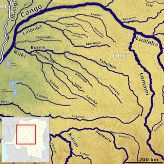
The Lokoro River is a river in the Democratic Republic of the Congo, one of the largest affluents of Lake Mai-Ndombe.
Kwango District was a district of the Congo Free State, Belgian Congo and the Democratic Republic of the Congo. It went through various changes in extent. It roughly corresponded to the present provinces of Kwilu and Kwango.

The Districts of the Belgian Congo were the primary administrative divisions when Belgium annexed the Congo Free State in 1908, each administered by a district commissioner. In 1914 they were distributed among four large provinces, with some boundary changes. In 1933 the provinces were restructured into six, again with boundary changes. The number of districts fluctuated between 12 and 26 through splits and consolidations, first rising, then falling, then rising again.
Kayuyu is a settlement in Maniema province, Democratic Republic of the Congo.
Kasika is a village located in the Luindi Chiefdom within the Mwenga Territory of the South Kivu Province, situated in the eastern region of the Democratic Republic of the Congo (DRC). Geographically positioned at 965 meters above sea level, Kasika strategically lies near Kihovu and Kahulile, approximately 108 kilometers from Bukavu, near the Rwandan border. The region is more than clusters of mud huts built around a Catholic parish on a hill overlooking a valley. It was the headquarters of the customary chief of the Nyindu ethnic community, whose house and office sat on a hill opposite the parish, a series of large, red-brick structures with cracked ceramic shingles as roofing, laced with vines.
The Kilungutwe River is a watercourse located in the Mwenga Territory of the South Kivu Province, situated in the eastern part of the Democratic Republic of the Congo (DRC). With an elevation of 882 meters, it functions as a tributary to the Ulindi River. Following the confluence with the Ulindi River approximately 30 km northwest, the Ulindi River proceeds on its course, eventually joining the Congo River. The Kilungutwe River was historically known as the gateway to the jungle from the highlands to the northeast.
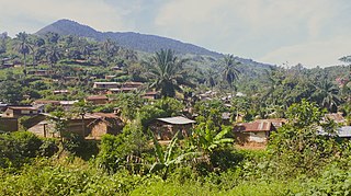
Kilungutwe is a small village in the Luindi Chiefdom, located in the valley of the Kilungutwe River in the Mwenga Territory of the South Kivu Province. Situated in the eastern part of the Democratic Republic of the Congo (DRC), Kilungutwe is positioned nearby neighboring villages of Kirukungutu and Chowe. The region is a melting pot for many ethnic groups, boasting a diverse ethnocultural landscape. It is also a point of confluence for numerous ethnic groups, including the Lega, Nyindu, Shi, Fuliiru, Holoholo, Bwari, Vira, Hunde, Nyanga, Bembe, and Amba people.

