Itombwe Mountains

Last updated
Itombwe Mountains
Miki, dans le plateau d'Itombwe, 2005.jpg
Miki, on the plateau of Itombwe
Highest point
Elevation 3,475 m (11,401 ft)
Coordinates 3°30′0″S28°55′0″E / 3.50000°S 28.91667°E / -3.50000; 28.91667
Geography
Democratic Republic of the Congo relief location map.jpg
Red triangle with thick white border.svg
Itombwe Mountains
Democratic Republic of the Congo
Location South Kivu, Democratic Republic of the Congo

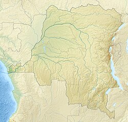
The Itombwe Mountains (or Itombwe Massif, Plateau) are a range of mountains in the South Kivu province of the Democratic Republic of the Congo (DRC). They run along the west shore of the northern part of Lake Tanganyika. They contain a vast area of contiguous montane forest and are home to a rich diversity of wildlife. [1]

Contents

Geography

The Itombwe mountains are a section of the Albertine Rift Mountains, which border the western branch of the East African Rift. [1] These mountains extend from the Rwenzori Mountains in the north to the Marungu highlands in the south. [2] They are made up of uplifted Pre-Cambrian basement rocks overlaid in places by recent volcanic activity. Both of these are caused by the forces that created the Great Rift Valley, where tectonic stresses are causing parts of East Africa to separate from the continent. The highest peak of the Albertine Rift Mountains is further north in the Rwenzori Mountains, at 5,100 metres (16,700 ft). [3]

The highest peak in the Itombwe range is Mount Mohi, at 3,475 metres (11,401 ft). Several other peaks are higher than 3,000 metres (9,800 ft). The mountains drop sharply in the east to the Ruzizi plain bordering Lake Tanganyika. They form a plateau that slopes down more gently to the west. [1] The Elila River rises in the mountains, which are covered by forest except where rock bluffs emerge from the steepest slopes. [4]

Temperatures range from about 50 °F (10 °C) to 70 °F (21 °C), with a mean temperature of about 60 °F (16 °C) all year round. Frost is occasionally experienced at night. Average annual precipitation is around 65 inches (1,700 mm). There is a relatively cool, dry season with little rain between June and August. [5]

Flora

The Itombwe Forest of the southern Rift covers a huge area that has had little attention from botanists. [3] Montane forest covers around 650,000 hectares (1,600,000 acres) above 1,500 metres (4,900 ft), the largest block of such forest in the region. The forest is patchy on the east slopes. On the west there is an exceptional progression of bamboo, montane forest, grassland, and then more montane forest with a canopy reaching 25 metres (82 ft) blending into lowland forest. [1]

Fauna

Eastern lowland gorilla Gorilla beringei graueri Flachlandgorilla.jpg
Eastern lowland gorilla Gorilla beringei graueri

The mountains are home to endangered Eastern lowland gorillas, chimpanzees and African bush elephants. [1] Rudolf Grauer spent three months in the mountains in 1908, collecting twelve gorillas for the Vienna Museum. [4] A survey in 1996 estimated that there were at least 860 gorillas in the massif. [6] The Grauer population of gorillas in the Itombwe mountains and the region to the north and west is one of three gorilla populations in East Africa, the others being the Bwindi and Virunga populations. [7]

The survey recorded fifty-six species of mammals. [6] A type of shrew that has only been collected once is most likely the oldest of all shrew species in Africa. [8] The Itombwe Mountains are much the most important part of the Albertine Rift Highlands for bird conservation, being home to 32 of the 37 species of bird endemic to the highlands. [9] They include the most important site in the region for montane forest birds, with 565 species identified. Of these, 31 are endemic to the Albertine Rift and three have only been found here. [10]

People

The northern Itombwe region is inhabited by Banyamulenge, Bafuliiru, Babembe, Banyindu and Bashi people, with population densities in 1998 of over 100 people per square kilometer. Population densities on the western slope and the high plateau of Itombwe are lower at between 10 and 20 people per square kilometer. The related Balega and Babembe people live in this area. Banyamulenge (ethnic Tutsi), who migrated from present-day Rwanda, Burundi, and Tanzania have moved into the territory starting in the 19th century. The Bavira people live in the Ruzizi Plain and on the shore of Lake Tanganyika. [11] [2] [12] [13] [14]

With the conflict of the Second Congo War (1998-2003) and subsequent instability many displaced people have entered the region. [1] The region has been the scene of struggles between different armed groups, causing severe humanitarian and environmental problems. NGOs have been attempting to help local communities recover and develop sustainable agricultural and practices while conserving the forest. [15] The major mining center of Kamituga is near the north-west edge of the montane forest. [1]

Conservation issues

Babembe village on the Itombwe plateau Un village Babembe, plateau d'Itombwe, 2005.jpg
Babembe village on the Itombwe plateau

The range is still not protected, although there have been proposals to designate all the montane forest and two patches of lowland forest to the south of the upper Elila River as conservation areas. [1] As of 2010 the mountains were inaccessible to tourists. [10] In some areas they have low human populations and the environment is relatively undisturbed. However, the population around the forest is growing, the forest around the villages is being cleared for agriculture and firewood, and the grasslands at higher levels are used to graze cattle. Mining and hunting are other causes of stress to the environment. [1] Perhaps the main concern of conservationists is that the forests, which are the largest and least fragmented in the region, may be logged. [3]

The Itombwe mountains were given a high conservation priority at a World Wide Fund for Nature (WWF) conference held in Libreville, Gabon in 2000 since they are a globally important biodiversity region for birds, mammals and reptiles. At first it was expected that they would be covered by a conservation program for the Albertine Rift. By 2006 it had been accepted that they should be included in a program specifically for the DRC. In late 2006 the Institut Congolais pour la Conservation de la Nature (ICCN), helped by the (WWF), had managed to obtain a declaration from the DRC Ministry of Environment that created the Itombwe Nature Reserve. The declaration did not define the completely protected core zone, mixed-use zones and development zones but left settlement of the zone boundaries to a later process involving consultation with the local communities. [16]

A book published in 2011 said the Itombwe Massif was undergoing severe destruction. Law and order had broken down. People were moving in to grow crops or to mine for gold, diamonds and columbo-tantalite, which is used in semiconductors and computer chips. [17]

Related Research Articles

<span class="mw-page-title-main">Geography of the Democratic Republic of the Congo</span> Geography

The Democratic Republic of the Congo (DRC) is the largest country of sub-Saharan Africa, occupying some 2,344,858 square kilometres (905,355 sq mi). Most of the country lies within the vast hollow of the Congo River basin. The vast, low-lying central area is a plateau-shaped basin sloping toward the west, covered by tropical rainforest and criss-crossed by rivers. The forest center is surrounded by mountainous terraces in the west, plateaus merging into savannas in the south and southwest. Dense grasslands extend beyond the Congo River in the north. High mountains of the Ruwenzori Range are found on the eastern borders with Rwanda and Uganda.

<span class="mw-page-title-main">Geography of Rwanda</span>

Rwanda is located in East Africa, to the east of the Democratic Republic of the Congo, at the co-ordinates 2°00′S30°0′E.

<span class="mw-page-title-main">North Kivu</span> Province of the Democratic Republic of the Congo

North Kivu is a province bordering Lake Kivu in the eastern Democratic Republic of the Congo. Its capital is Goma. The 2020 population was estimated to be 8,147,400.

<span class="mw-page-title-main">South Kivu</span> Province of the Democratic Republic of the Congo

South Kivu is one of 26 provinces of the Democratic Republic of the Congo (DRC). Its capital is Bukavu.

<span class="mw-page-title-main">Virunga National Park</span> National park in the Democratic Republic of the Congo

Virunga National Park is a national park in the Albertine Rift Valley in the eastern part of the Democratic Republic of the Congo. It was created in 1925. In elevation, it ranges from 680 m (2,230 ft) in the Semliki River valley to 5,109 m (16,762 ft) in the Rwenzori Mountains. From north to south it extends approximately 300 km (190 mi), largely along the international borders with Uganda and Rwanda in the east. It covers an area of 8,090 km2 (3,120 sq mi).

Banyamulenge is a community from the Democratic Republic of the Congo's South Kivu province. The Banyamulenge are culturally and socially distinct from the Tutsi of North Kivu, with most speaking Kinyamulenge, a mix of Kinyarwanda, Kirundi, Ha language, and Swahili. Banyamulenge are often discriminated against in the DRC due to their Tutsi phenotype, similar to that of people living in the Horn of Africa, their insubordination towards colonial rule, their role in Mobutu's war against and victory over the Simba Rebellion, which was supported by the majority of other tribes in South Kivu, their role during the First Congo War and subsequent regional conflicts (Rally for Congolese Democracy–Goma, Movement for the Liberation of the Congo, National Congress for the Defence of the People, and more importantly for the fact that two of the most influential presidents of their country declared them as enemy of the State both in 1996 and 1998.

<span class="mw-page-title-main">Ruzizi River</span> River in Central Africa

The Ruzizi is a river, 117 kilometres (73 mi) long, that flows from Lake Kivu to Lake Tanganyika in Central Africa, descending from about 1,500 metres (4,900 ft) to about 770 metres (2,530 ft) above sea level over its length. The steepest gradients occur over the first 40 kilometres (25 mi), where hydroelectric dams have been built. Further downstream, the Ruzizi Plain, the floor of the Western Rift Valley, has gentle hills, and the river flows into Lake Tanganyika through a delta, with one or two small channels splitting off from the main channel.

<span class="mw-page-title-main">Mgahinga Gorilla National Park</span> National Park in Uganda

Mgahinga Gorilla National Park is a national park in southwestern Uganda. It was created in 1991 and covers an area of 33.9 km2 (13.1 sq mi).

<span class="mw-page-title-main">Albertine Rift</span> Western branch of the East African Rift

The Albertine Rift is the western branch of the East African Rift, covering parts of Uganda, the Democratic Republic of the Congo (DRC), Rwanda, Burundi and Tanzania. It extends from the northern end of Lake Albert to the southern end of Lake Tanganyika. The geographical term includes the valley and the surrounding mountains.

The Mitumba Mountains stretch along the Western Rift Valley in Eastern Congo (DRC), west of Lake Tanganyika and Lake Kivu. The two main peaks, Mount Kahuzi (3,308 m) and Mount Biéga (2,790 m) are dormant volcanoes. The northern portion of the range is also known as the Itombwe Mountains or Itombwe Plateau.

<span class="mw-page-title-main">Eastern gorilla</span> Species of ape

The eastern gorilla is a critically endangered species of the genus Gorilla and the largest living primate. At present, the species is subdivided into two subspecies. There are 6,800 eastern lowland gorillas or Grauer's gorillas and 1,000 mountain gorillas. Illegal hunting threatens the species.

<span class="mw-page-title-main">Albertine Rift montane forests</span> Ecoregion in east-central Africa

The Albertine Rift montane forests is a tropical moist broadleaf forest ecoregion in east-central Africa. The ecoregion covers the mountains of the northern Albertine Rift, and is home to distinct Afromontane forests with high biodiversity.

<span class="mw-page-title-main">Index of Democratic Republic of the Congo–related articles</span>

Articles related to the Democratic Republic of the Congo include:

The Albertine owlet is a small species of small owl in the family Strigidae, native to the Albertine Rift montane forests.

<span class="mw-page-title-main">Wildlife of Rwanda</span>

The wildlife of Rwanda comprising its flora and fauna, in prehistoric times, consisted of montane forest in one third the territory of present-day Rwanda. However, natural vegetation is now mostly restricted to the three national parks and four small forest reserves, with terraced agriculture dominating the rest of the country.

<span class="mw-page-title-main">Congo–Nile Divide</span> Continental divide in Africa

The Congo–Nile Divide or the Nile–Congo Watershed is the continental divide that separates the drainage basins of the Congo and Nile rivers. It is about 2,000 kilometres (1,200 mi) long.

<span class="mw-page-title-main">Kahuzi-Biéga National Park</span> National park in the Democratic Republic of the Congo

The Kahuzi-Biega National Park is a protected area near Bukavu town in eastern Democratic Republic of the Congo. It is situated near the western bank of Lake Kivu and the Rwandan border. Established in 1970 by the Belgian photographer and conservationist Adrien Deschryver, the park is named after two dormant volcanoes, Mount Kahuzi and Mount Biega, which are within its limits. With an area of 6,000 square kilometres (2,300 sq mi), Kahuzi-Biega is one of the biggest national parks in the country. Set in both mountainous and lowland terrain, it is one of the last refuges of the rare species of Eastern lowland gorilla, an endangered category under the IUCN Red List. The park is a UNESCO World Heritage Site, inscribed in 1980 for its unique biodiversity of rainforest habitat and its eastern lowland gorillas. In 1997, it was listed on the List of World Heritage in Danger because of the political instability of the region, an influx of refugees, and increasing wildlife exploitation.

The Kabobo Massif is a mountain region in Tanganyika and South Kivu Provinces, Democratic Republic of the Congo known for its unique flora and fauna. One of its most prominent peaks is Mount Kabobo, while another is known as Misotshi. While Misotshi-Kabogo appears to be a more appropriate name for the massif, it is most commonly referred to in the literature by the misinterpreted name Kabobo.

<span class="mw-page-title-main">Lulenge</span> Sector in the DRC

Lulenge is one of the four sectors of Fizi Territory of the South Kivu Province in the eastern region of the Democratic Republic of the Congo (DRC). It is situated near the Kiloba and Makena villages, at an altitude of 943 meters. Its capital is Kilembwe. Lulenge is bordered to the north by the Itombwe sector and Mwenga Territory. In the east, it is bordered by Lake Tanganyika and the Mutambala sector. In the south, it is bordered by the N'gangya sector, and in the west by Shabunda Territory.

<span class="mw-page-title-main">Ruzizi Plain</span> River valley in eastern Democratic Republic of the Congo

The Ruzizi Plain is a valley situated between the Mitumba mountain chain and the Ruzizi River. It serves as a natural border, separating the Democratic Republic of the Congo (DRC) from Burundi and Rwanda on the other side. The Ruzizi Plain is an integral part of the larger Western Rift Valley, which stretches across several African countries. It is traversed by the Ruzizi River, which flows from Lake Kivu through the plain and into Lake Tanganyika. It covers an area of 175,000 hectares divided between Burundi, Rwanda and the DRC. In Burundi, the plain extends to the northern sector of Imbo. It is bounded by parallels 2°36′ and 3°26′ south latitude and by meridians 29°00′ and 29°26 east longitude—an area of 1025 km2. The Congolese side is bounded to the north by the plain of Bugarama (Rwanda), to the east by the plain of Imbo (Burundi), to the West by the chain of Mitumba and to the South by Lake Tanganyika. The region covers thus about 80,000 hectares with 80 kilometers in length.

References

  1. 1 2 3 4 5 6 7 8 9 Birdlife 2011.
  2. 1 2 Doumenge 1998, pp. 249–264.
  3. 1 2 3 Albertine Rift.
  4. 1 2 Schaller 1988, p. 86.
  5. Climate Data Itombwe.
  6. 1 2 Omari et al 1999, pp. 301–322.
  7. Stoinski, Steklis & Mehlman 2007, p. 7.
  8. Briggs & Roberts 2010, p. 51.
  9. Stuart & Adams 1990, p. 33.
  10. 1 2 Briggs & Roberts 2010, p. 50.
  11. Moeller, Alfred (1936). "Les grandes lignes des migrations des Bantus de la province orientale du Congo belge" (PDF) (in French). Brussels, Belgium: G. van Campenhout. Retrieved 2023-04-29.
  12. Muchukiwa, Bosco. Enjeux des conflits ethniques dans les hauts plateaux d’Itombwe au Sud - Kivu (Zaïre) (in French). Tervuren, Belgium: Institut Africain CEDAF. pp. 6–7.
  13. Verweijen, Judith; Brabant, Justine (March 2017). "Cows and guns. Cattle-related conflict and armed violence in Fizi and Itombwe, eastern DR Congo*". The Journal of Modern African Studies. 55 (1): 1–27. doi: 10.1017/S0022278X16000823 . ISSN   0022-278X.
  14. Mararo, Stanislas Bucyalimwe (2005). Marysse, Stefaan; Ryntjens, Filip (eds.). "Kivu and Ituri in the Congo War: The Roots and Nature of a Linkage" (PDF). New York, United States: Palgrave Macmillan. p. 8. Retrieved 2023-04-29.
  15. IUCN Netherlands 2006.
  16. Yanggen, Angu & Tchamou 2010, p. 17.
  17. Bruijnzeel, Scatena & Hamilton 2011, p. 168.

Sources