This article needs additional citations for verification .(September 2022) |
| Mbomou River Bomu River | |
|---|---|
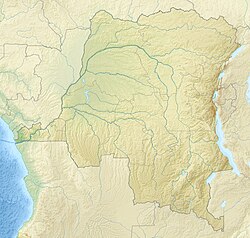
 Map showing the Mbomou River within the Ubangi River drainage basin | |
 | |
| Native name | French: M'bomou |
| Physical characteristics | |
| Source | |
| • coordinates | 4°07′44″N22°26′10″E / 4.129°N 22.436°E |
| Basin features | |
| River system | Congo Basin |
The Mbomou River or Bomu (also spelled M'bomou in French) forms part of the boundary between the Central African Republic (CAR) and the Democratic Republic of the Congo (DRC). [1] [2]
Contents
The Mbomou merges with the Uele River to form the Ubangi River. [3] The Ubangi, a tributary of the Congo, also serves as part of the border between the CAR and the DRC.