Related Research Articles

Lincoln County is a county located in the U.S. state of Mississippi. As of the 2020 census, the population was 34,907. Its county seat is Brookhaven.

The Pearl River is a river in the U.S. states of Mississippi and Louisiana. It forms in Neshoba County, Mississippi from the confluence of Nanih Waiya and Tallahaga creeks, and has a meander length of 444 miles (715 km). The lower part of the river forms part of the boundary between Mississippi and Louisiana.

USS Bogue (AVG/ACV/CVE/CVHE-9) was the lead ship in the Bogue class of escort carriers in the United States Navy during World War II. The ship was named for Bogue Sound in North Carolina.
The Sunflower River is one of the main tributaries of the Yazoo River in the U.S. state of Mississippi. It is navigable by barge for 50 miles. It rises in DeSoto County, Mississippi near the Tennessee border and flows south for 100 miles to the Yazoo River, a major tributary of the Mississippi River. At Clarksdale, the county seat of Coahoma County, the annual Sunflower River Blues & Gospel Festival is held.

The Tombigbee River is a tributary of the Mobile River, approximately 200 mi (325 km) long, in the U.S. states of Mississippi and Alabama. Together with the Alabama, it merges to form the short Mobile River before the latter empties into Mobile Bay on the Gulf of Mexico. The Tombigbee watershed encompasses much of the rural coastal plain of western Alabama and northeastern Mississippi, flowing generally southward. The river provides one of the principal routes of commercial navigation in the southern United States, as it is navigable along much of its length through locks and connected in its upper reaches to the Tennessee River via the Tennessee-Tombigbee Waterway.

The Yalobusha River is a river, 165 miles (266 km) long, in north-central Mississippi in the United States. It is a principal tributary of the Yazoo River, via which it is part of the watershed of the Mississippi River.
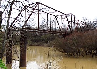
Bogue Chitto is an unincorporated community in Dallas County, Alabama. It was named for the nearby creek of the same name, which in the Choctaw language means "big stream."
Batupan Bogue is a stream in the U.S. state of Mississippi. It is a tributary to the Yalobusha River. It has an average discharge of 409 cubic feet per second near Grenada, MS.
Big Bogue is a stream in the U.S. state of Mississippi.
Bogue Culley is a stream in the U.S. state of Mississippi.
Bogue Faliah is a stream in the U.S. state of Mississippi.
Bogue Fallah is a stream in the U.S. state of Mississippi.
Bogue Flower is a stream in the U.S. state of Mississippi. It is a tributary to Eucutta Creek.
Bogue Hasty is a stream in the U.S. state of Mississippi.
Bogue Homo is a stream in the U.S. state of Mississippi. It is a tributary to the Chickasawhay River.
Little Bogue is a stream in the U.S. state of Mississippi.
Bogue Phalia is a stream in the U.S. state of Mississippi. It is a tributary to the Big Sunflower River.
Sugar Bogue is a stream in the U.S. state of Mississippi. It is a tributary to Coffee Bogue.
Tilda Bogue is a stream in the U.S. state of Mississippi.
Topisaw Creek is a stream in the U.S. state of Mississippi. It is a tributary to Bogue Chitto.
References
- ↑ U.S. Geological Survey Geographic Names Information System: Upper Bogue
- ↑ Baca, Keith A. (2007). Native American Place Names in Mississippi. University Press of Mississippi. p. 15. ISBN 978-1-60473-483-6.
33°59′31″N90°52′11″W / 33.9920530°N 90.8698264°W