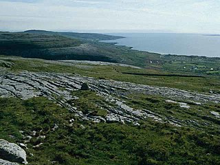
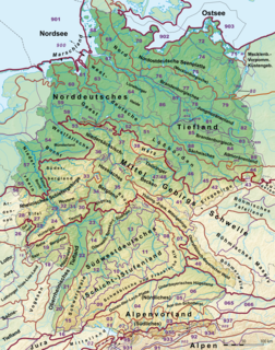
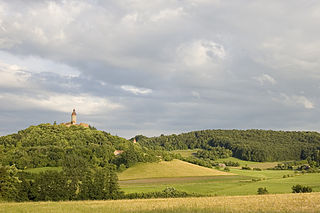
The Upper Palatine-Upper Main Hills (German : Oberpfälzisch-Obermainisches Hügelland), also called the Upper Palatine-Upper Main Hills and Uplands (Oberpfälzisch-Obermainisches Hügel- und Bergland) form a landscape of low, rolling hills between the Franconian Jura in the southwest and (from northwest to southeast) the Franconian Forest, Fichtel Mountains and Upper Palatine Forest in the northeast.
German is a West Germanic language that is mainly spoken in Central Europe. It is the most widely spoken and official or co-official language in Germany, Austria, Switzerland, South Tyrol (Italy), the German-speaking Community of Belgium, and Liechtenstein. It is also one of the three official languages of Luxembourg and a co-official language in the Opole Voivodeship in Poland. The languages which are most similar to German are the other members of the West Germanic language branch: Afrikaans, Dutch, English, the Frisian languages, Low German/Low Saxon, Luxembourgish, and Yiddish. There are also strong similarities in vocabulary with Danish, Norwegian and Swedish, although those belong to the North Germanic group. German is the second most widely spoken Germanic language, after English.
The Franconian Jura is an upland in Bavaria, Germany. Located between two rivers, the Danube in the south and the Main in the north, its peaks reach elevations of up to 600 metres (2,000 ft) and it has an area of some 7053.8 km2.
The Franconian Forest, is a mid-altitude mountain range in Northern Bavaria, Germany. It is located in the district of Upper Franconia (Oberfranken) and forms the geological connection between the Fichtelgebirge and the Thuringian Forest. It is a broad well-wooded plateau, running for about 45 kilometres (28 mi) in a northwesterly direction, descending gently on the north and eastern sides towards the Saale river, but more precipitously to the Bavarian plain in the west, and attaining its highest elevation in the Döbraberg near Schwarzenbach am Wald. Along the centre lies the watershed between the basins of the Main and the Saale, belonging to the systems of the Rhine and Elbe respectively.
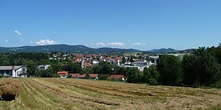
The region runs from northwest to southeast and is about 170 kilometres long, but only 7 to 35 kilometres wide [1] and lies mainly in the Bavarian administrative provinces of Upper Franconia and Upper Palatinate; small elements, however, also lie within the Thuringian county of Sonneberg. Its best known settlements are (from northwest to southeast) Sonneberg (in the extreme northeast), Kulmbach, Marktzeuln near Lichtenfels (at the northwest edge), Bayreuth, Weiden (Ostrand), Amberg and Schwandorf.
Bavaria, officially the Free State of Bavaria, is a landlocked federal state of Germany, occupying its southeastern corner. With an area of 70,550.19 square kilometres, Bavaria is the largest German state by land area comprising roughly a fifth of the total land area of Germany. With 13 million inhabitants, it is Germany's second-most-populous state after North Rhine-Westphalia. Bavaria's main cities are Munich and Nuremberg.
Upper Franconia is a Regierungsbezirk of the state of Bavaria, southern Germany. It forms part of the historically significant region of Franconia, all now part of the German Federal State of Bayern (Bavaria).
The Upper Palatinate is one of the seven administrative districts of Bavaria, Germany, located in the east of Bavaria.
The Upper Palatine-Upper Main Hills are, according to the Handbook of the Natural Region Divisions of Germany, a natural region major unit group. They are generally seen as part of the South German Scarplands, but there are also levels, which it - just as with the major landscapes and hill regions bordering it to the southwest and northeast - covers as an independent "2nd order major landscape". [2]
The Handbook of Natural Region Divisions of Germany was a book series resulting from a project by the former German Federal Institute for Regional Studies to determine the division of Germany into natural regions. It was published in several books over the period 1953-1962. Around 400 authors, mostly geographers, took part. This natural region division of Germany is still used, with amendments, today.
A natural region is a basic geographic unit. Usually it is a region which is distinguished by its common natural features of geography, geology, and climate.
The South German Scarplands is a geological and geomorphological natural region or landscape in Switzerland and the south German states of Bavaria and Baden-Württemberg. The landscape is characterised by escarpments.
The Upper Palatine-Upper Main Hills is subdivided into major units (three figures) as follows: [3] [1]
The Upper Palatine Hills is a Hercynian range of rolling hills (Hügelland) and valleys running from the Upper Palatine-Bavarian Forest in the (north-)east and the Franconian Jura in the (south-)west. It lies mostly within the Bavarian province of Upper Palatinate, hence the name. The range, which is oriented northwest to southeast, is about 100 kilometres long, but only between 7 and 35 kilometres wide and covers and area of 2,000 km². The best known settlements are Weiden (Ostrand), Amberg and Schwandorf.
The dividing line between the two landscapes is mainly the watershed between the Main (north) and Naab (south).
The Main is a river in Germany. With a length of 525 kilometres (326 mi), it is the longest right tributary of the Rhine. It is also the longest river lying entirely in Germany. The largest cities along the Main are Frankfurt am Main and Würzburg.
The Naab is a river in Bavaria, Germany, and is a left tributary of the Danube. Including its main source river Waldnaab, it is 196.6 km (122 mi) long.
The Upper Palatine Hills contain practically all the rock periods between the Permian and the current period, whilst the surface rocks of the Upper Main Hills are predominantly of Black and Brown Jurassic. [1]
The Fichtel Mountains, form a small horseshoe-shaped mountain range in northeastern Bavaria, Germany. They extend from the valley of the Red Main River to the Czech border, a few foothills spilling over into the Czech Republic. They continue in a northeasterly direction as the Ore Mountains, and in a southeasterly direction as the Bohemian Forest. The Fichtel Mountains contain an important nature park, the Fichtel Mountain Nature Park, with an area of 1,020 square kilometres (390 sq mi).
The Bavarian Forest is a wooded, low-mountain region in Bavaria, Germany that is about 100 kilometres long. It runs along the Czech border and is continued on the Czech side by the Bohemian Forest. Most of the Bavarian Forest lies within the province of Lower Bavaria, but the northern part lies within Upper Palatinate. In the south it reaches the border with Upper Austria.
The Rhön Mountains are a group of low mountains in central Germany, located around the border area where the states of Hesse, Bavaria and Thuringia come together. These mountains, which are at the extreme southeast end of the East Hesse Highlands, are partly a result of ancient volcanic activity. They are separated from the Vogelsberg Mountains by the river Fulda and its valley. The highest mountain in the Rhön is the Wasserkuppe which is in Hesse. The Rhön Mountains are a popular tourist destination and walking area.
The Upper Palatine Forest is a mountain range in Central Europe that is divided between Germany and the Czech Republic. It is part of the larger Bohemian Massif and the German Central Uplands.
This division of Germany into major natural regions takes account primarily of geomorphological, geological, hydrological, and pedological criteria in order to divide the country into large, physical units with a common geographical basis. Political boundaries play no part in this, apart from defining the national border.
The Upper Palatine-Bavarian Forest, is a natural region in Germany in the northeast of Bavaria. It mainly comprises the low mountain ranges of the Bavarian Forest and Upper Palatine Forest which are up to 1456 m high and border on the Bohemian Massif immediately inside the Czech Republic's southwestern border with Germany.
The Saxon Highlands and Uplands refer to a natural region mainly in the south of Saxony with small elements also in southeast Thuringia and northeast Bavaria. It comprises, from (south)west to (north)east, of the Vogtland, the Ore Mountains, Saxon Switzerland, the Upper Lusatian Plateau and the Zittau Hills.
The Gäu Plateaus form the largest natural region in the German state of Baden-Württemberg. Not surprisingly, the individual geographical units of this large region show considerable variations in climate and soil types. A common feature of the region, however, is its landscape of flat-topped hills of Muschelkalk, gently rolling tracts of loess and plateaus in which the layers of Muschelkalk have been covered by sediments of Gipskeuper and Lettenkeuper.
The Waldnaab is the left-hand, eastern and longest headstream of the River Naab in the Upper Palatinate. At its confluence with the Haidenaab near Luhe-Wildenau, the Naab is formed. The Waldnaab is 99.1 km long; combined with the Naab, the total length is 196.6 kilometres (122.2 mi).
The Franconian Keuper-Lias Plains or Franconian Keuper-Lias Lands are a major natural region in the South German Scarplands in Upper Franconia and to a lesser extent in the north, in the Thuringian district of Hildburghausen. As the name betrays, the term embraces both the Keuper landscapes and lias landscapes in Franconia. In addition, the foreland of the Franconian Jura, in which part of the Brown Jurassic occurs, as well as parts of the former volcanic region of Heldburger Gangschar belong to this region.
The Steigerwald is a hill region up to 498.5 m above sea level (NHN) in the Bavarian-Franconian part of the South German Scarplands between Würzburg and Nuremberg. It is part of the Keuper Uplands, and within it, it is continued to the north-northeast and right of the River Main, by the Haßberge, and to the south-southwest by the Franconian Heights. Part of the region is a designated as the Steigerwald Nature Park.
The Saar-Nahe Hills or Saar-Nahe Uplands is a major natural region in the German states of Rhineland-Palatinate and the Saarland. The region of hills and mountains covers an area of 4,185 km² running from Saarbrücken, Kaiserslautern and the Palatine Forest in the south to the Hunsrück in the northeast. It contains the catchment area of the Nahe as far as Bad Kreuznach as well as small sections of the Middle Saar in the west.
The Frankenweide is a hill region in the German state of Rhineland-Palatinate. It forms the central part of the Palatine Forest in the Palatinate region.
The Welzheim Forest is a wooded, hill ridge, up to 585.2 m above sea level (NHN), in the counties of Rems-Murr, Ostalb and Schwäbisch Hall in Baden-Württemberg (Germany).
The Murrhardt Forest in the Baden-Württemberg county of Rems-Murr-Kreis is part of the natural region known as the Swabian-Franconian Forest. It reaches a maximum height of 572 m above sea level (NHN). It takes its name from the town of Murrhardt in the centre.
The Franconian Heights are a hill ridge, up to 554 m above sea level (NN), in Bavaria and Baden-Württemberg in South Germany.
The Regen Depression is a wide river valley in the Bavarian Forest along the River Regen.