The national flag of Bhutan is one of the national symbols of Bhutan. The flag is based upon the tradition of the Drukpa Lineage of Tibetan Buddhism and features Druk, the Thunder Dragon of Bhutanese mythology. The basic design of the flag by Mayum Choying Wangmo Dorji dates to 1947. A version was displayed in 1949 at the signing of the Indo-Bhutan Treaty. A second version was introduced in 1956 for the visit of Druk Gyalpo Jigme Dorji Wangchuk to eastern Bhutan; it was based upon photos of its 1949 predecessor and featured a white Druk in place of the green original.
Jigme Dorji Wangchuck was the Druk Gyalpo of Bhutan.
Gross National Happiness is a philosophy that guides the government of Bhutan. It includes an index which is used to measure the collective happiness and well-being of a population. Gross National Happiness is instituted as the goal of the government of Bhutan in the Constitution of Bhutan, enacted on 18 July 2008.

The Urban Renewal Authority is a quasi-governmental, profit-making statutory body in Hong Kong responsible for accelerating urban redevelopment.
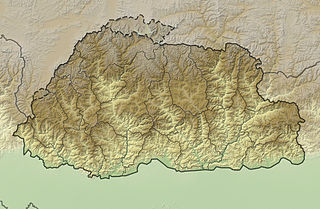
Bhutan, officially the Kingdom of Bhutan, is a landlocked country in South Asia. Located in the Eastern Himalayas, it is bordered by Tibet Autonomous Region of China in the north, the Sikkim state of India and the Chumbi Valley of Tibet in the west, the Arunachal Pradesh state of India in the east, and the states of Assam and West Bengal in the south. Bhutan is geopolitically in South Asia and is the region's second least populous nation after the Maldives. Thimphu is its capital and largest city, while Phuntsholing is its financial center.

Jaigaon is a census town in Alipurduar subdivision of Alipurduar district in the state of West Bengal, India. It is located on the country's border with Bhutan. The main overland entrance to Bhutan is through Jaigaon and Bhutan Gate separates the two countries. Bhutan does not have domestic roads linking to all its towns, so Bhutan uses Indian roads passing through Jaigaon to reach such destinations as Samtse, Gomtu, Nganglam and Samdrup Jongkhar.
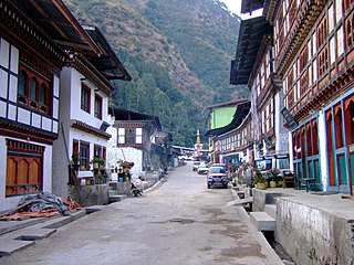
Trashigang, or Tashigang, is a town in eastern Bhutan and the district capital of the Trashigang Dzongkhag (district).

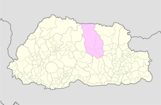
Bumthang Valley is the main inhabited valley in the Bumthang district of Bhutan.
Sobrang Monastery is a Buddhist monastery in Ura Gewog, Bhutan. It is one of the most important Bhutanese monasteries as descendants from its lineage include Pema Lingpa and hence the Wangchuck Royal family.

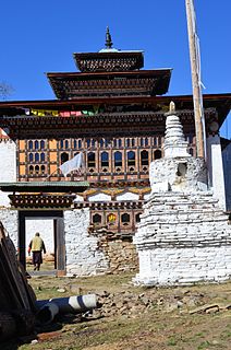
Ura Monastery is a Buddhist monastery in Bhutan.

Desi Jigme Namgyal of Bhutan is a forefather of the Wangchuck Dynasty. He served as 48th Druk Desi of Bhutan (1870–1873), and held the hereditary post of 10th Penlop of Trongsa. He was called the Black Ruler.
The Kingdom of Bumthang was one of several small kingdoms within the territory of modern Bhutan before the first consolidation under Zhabdrung Ngawang Namgyal in 1616. After initial consolidation, the Bumthang Kingdom became Bumthang Province, one of the nine Provinces of Bhutan. The region was roughly analogous to modern day Bumthang District. It was again consolidated into the modern Kingdom of Bhutan in 1907.
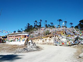
Thrumshing La, also called Thrumshingla Pass and Donga Pass,, is the second-highest mountain pass in Bhutan, connecting its central and eastern regions across the otherwise impregnable Donga range that has separated populations for centuries. It is located on a bend of the Lateral Road at the border of Bumthang District and Mongar District, along the border with Lhuntse District to the east. The Lateral Road bisects Thrumshingla National Park, named after the pass. The World Wildlife Fund also maintains operations in the park.

The valleys of Bhutan are carved into the Himalaya by Bhutan's rivers, fed by glacial melt and monsoon rains. As Bhutan is landlocked in the mountainous eastern Himalaya, much of its population is concentrated in valleys and lowlands, separated by rugged southward spurs of the Inner Himalaya. Despite modernization and development of transport in Bhutan, including a national highway system, travel from one valley to the next remains difficult. Western valleys are bound to the east by the Black Mountains in central Bhutan, which form a watershed between two major river systems, the Mo Chhu and the Drangme Chhu. Central valleys are separated from the east by the Donga Range. The more isolated mountain valleys protect several tiny, distinct cultural and linguistic groups. Reflecting this isolation, most valleys have their own local protector deities.
Lopen Karma Phuntsho was born in Ura gewog in Bumthang district of central Bhutan. He was born as the third child of Tothchukpo House to his mother who is a scion of Gaden Lam family which traces its origin to Phajo Drukgom Zhigpo, the priest who brought Drukpa Kagyu tradition of Tibetan Buddhism to western Bhutan. Karma learnt basic Chokey alphabets and prayers from his father, who is an incarnate priest and farmer from the Tsakaling Choje family, a religious nobility which claims descent from Bhutan's foremost spiritual saint Pema Lingpa and Tarshong Chukpo house of Ura. He attended Ura Primary School until Class III. Because the school did not have Class IV and he was too small to travel, his parents begged the headmaster to keep him in Ura and repeat. The following year, he travelled to Jakar School with a few friends. The headmaster at the new school mistakenly put Karma again in Class III. Karma today humorously claims that he is perhaps the only person who studied in Class III for three years and received first prizes thrice. Karma spent most of his school winter breaks helping the family cow herder in the neighbouring district of Lhuntse.
The Dochula Pass is a mountain pass in the snow covered Himalayas within Bhutan on the road from Thimpu to Punakha where 108 memorial chortens or stupas known as "Druk Wangyal Chortens" have been built by Ashi Dorji Wangmo Wangchuk, the eldest Queen Mother. Apart from the chortens there is a monastery called the Druk Wangyal Lhakhang (temple), built in honour of the fourth Druk Gyalpo, Jigme Singye Wangchuck; the open grounds in its front yard is a venue for the annual Dochula Druk Wangyel Festival. The pass with 108 memorial chortens is adjacent to the country's first Royal Botanical Park.
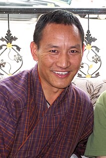
DrungtshoKarma Wangchuk is a Bhutanese politician who has been a member of the National Assembly of Bhutan, since October 2018.