The Cotabambas Province is a province located in the Apurímac Region of Peru. The province has a population of 44,028 inhabitants. The capital of this province is the city of Tambobamba.

The Abancay Province is one of seven provinces of the Apurímac Region in Peru. The capital of the province is the city of Abancay.

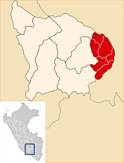
Grau Province is one of the seven provinces of the Apurímac Region in Peru. The capital of the province is the city of Chuquibambilla.

Antabamba Province is one of the seven provinces of the Apurímac Region in Peru. The capital of the province is the city of Antabamba.

Aymaraes Province is the largest of seven provinces of the Apurímac Region in Peru. The capital of the province is the city of Chalhuanca. The province was founded by General Simón Bolívar on June 21, 1824.

Curahuasi District is one of the nine districts of the Abancay Province in Peru.
Oropesa District is one of the seven districts of the province Antabamba in Peru.

Q'illu Urqu is a 5,038-metre-high (16,529 ft) mountain in the Wansu mountain range in the Andes of Peru. It is situated in the Apurímac Region, Antabamba Province, Oropesa District, and in the Arequipa Region, La Unión Province, on the border of the districts of Huaynacotas and Puyca District. Q'illu Urqu lies southeast of the mountains Wilaquta, Allqa Walusa and Taruja Marka.
Quri Waraqa or Quri Warak'a is a mountain in the Wansu mountain range in the Andes of Peru, about 5,000 metres (16,404 ft) high. It is situated in the Apurímac Region, Antabamba Province, in the districts of Antabamba and Juan Espinoza Medrano. Quri Waraqa lies north of Sara Sara, Panti Pata and Huch'uy Sara Sara.
Wallqa Wallqa is a mountain in the Andes of Peru, about 5,200 metres (17,060 ft) high. It is situated in the Apurímac Region, Antabamba Province, Antabamba District. Wallqa Wallqa lies south-west of the mountains Sara Sara and Runtu Quri, near the northern border of the Arequipa Region.
Hatun Qillqa is a mountain in the Wansu mountain range in the Andes of Peru, about 5,000 metres (16,404 ft) high. It is situated in the Apurímac Region, Antabamba Province, Antabamba District. Hatun Qillqa lies southeast of Qillqa, southwest of Sisiwa and Yuraq Urqu and northwest of Wank'ayuq Saywa.
Wila Quta is a mountain in the Wansu mountain range in the Andes of Peru, about 5,100 metres (16,732 ft) high. It is situated in the Apurímac Region, Antabamba Province, Antabamba District, and in the Arequipa Region, La Unión Province, Huaynacotas District. Wila Quta lies west of Taruja Marka and Allqa Walusa and southeast of Wallqa Wallqa.
Qillqa is a mountain in the Wansu mountain range in the Andes of Peru, about 5,000 metres (16,404 ft) high. It is situated in the Apurímac Region, Antabamba Province, Antabamba District. Qillqa lies northwest of Hatun Qillqa.
Huch'uy Sara Sara is a 5,131-metre-high (16,834 ft) mountain in the Wansu mountain range in the Andes of Peru. It is situated in the Apurímac Region, Antabamba Province, in the districts of Antabamba and Juan Espinoza Medrano. Huch'uy Sara Sara lies south of Quri Waraqa and north of Sara Sara.
Sara Sara is a 5,195-metre-high (17,044 ft) mountain in the Wansu mountain range in the Andes of Peru. It is situated in the Apurímac Region, Antabamba Province, in the districts of Antabamba and Juan Espinoza Medrano. Sara Sara lies south of Quri Waraqa and Huch'uy Sara Sara.
Quri Pawkara is a mountain in the Wansu mountain range in the Andes of Peru, about 5,000 metres (16,404 ft) high. It is situated in the Apurímac Region, Antabamba Province, in the districts of Antabamba and Juan Espinoza Medrano. Its three peaks lie in a row from north to south northwest of Quri Waraqa.
Utkhu is a mountain in the Wansu mountain range in the Andes of Peru, about 4,800 metres (15,748 ft) high. It is situated in the Apurímac Region, Antabamba Province, in the districts of Antabamba and Juan Espinoza Medrano. Utkhu lies northeast of Quri Pawkara.
Yana Ranra is 5,002-metre-high (16,411 ft) mountain in the Wansu mountain range in the Andes of Peru. It is situated in the Apurímac Region, Antabamba Province, Antabamba District. Yana Ranra lies west of Paqu Qhawana, north of Quri Waraqa and south of Puka Urqu. South of Yana Ranra there is a small lake name Qiñwaqucha
Paychi is a mountain in the Wansu mountain range in the Andes of Peru, about 5,000 metres (16,404 ft) high. It is located in the Apurímac Region, Antabamba Province, Antabamba District. Paychi lies north of Phuk'iña and northeast of Runtu Quri and Sara Sara.


