Urququcha | |
---|---|
Location | Peru Arequipa Region, Arequipa Province |
Coordinates | 16°06′32″S70°54′15″W / 16.10889°S 70.90417°W Coordinates: 16°06′32″S70°54′15″W / 16.10889°S 70.90417°W |
Urququcha (Quechua urqu male, qucha lake, [1] "male lake", also spelled Orcococha) is a lake in the Arequipa Region in Peru. It is located in the Arequipa Province, Tarucani District. Urququcha lies southeast of Chinaqucha, northwest of a mountain named Suri Wasi. [2]
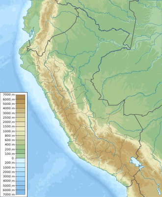
Arequipa is a department and region in southwestern Peru. It is the sixth largest department in Peru, after Puno, Cuzco, Madre de Dios, Ucayali, and Loreto, its sixth most populous department, and its eleventh least densely populated department. It is bordered by the departments of Ica, Ayacucho, Apurímac and Cusco in the north, the Department of Puno in the east, the Department of Moquegua in the south, and the Pacific Ocean in the west. Its capital, also called Arequipa, is Peru's second-largest city.
Huancavelica is a department and region in Peru with an area of 22,131.47 km2 (8,545.01 sq mi) and a population of 347,639. The capital is the city Huancavelica. The region is bordered by the departments of Lima and Ica in the west, Junín in the north, and Ayacucho in the east.
Puno is a department and region in southeastern Peru. It is the fifth largest department in Peru, after Cuzco, Madre de Dios, Ucayali, and Loreto It is bordered by Bolivia on the east, the departments of Madre de Dios on the north, Cusco and Arequipa on the west, Moquegua on the southwest, and Tacna on the south. Its capital is the city of Puno, which is located on Lake Titicaca in the geographical region known as the Altiplano or high sierra.
Arequipa is a province in the Arequipa Region, Peru. Its capital, Arequipa, is Peru's third most populous province of Peru. It borders the provinces of Islay, Camaná, Caylloma, and the Cusco and Puno regions. According to INEI in the year 2014 it has a population of 958.351 people.
The General Sánchez Cerro Province is the smallest of three provinces in the Moquegua Region of Peru. The capital of the province is Omate. The province was named after the former Peruvian army officer and president Luis Miguel Sánchez Cerro.
Machucocha is a lake in Peru located in the Arequipa Region, Castilla Province, in the districts of Chachas and Orcopampa. It is situated at a height of about 4,659 m (15,285 ft), about 6.77 km long and 1.89 km at its widest point. Machucocha lies southeast of Huajrahuire and northwest of Pillune.
Warmiqucha is a lake in Peru located in the Cusco Region, Chumbivilcas Province, Velille District. It is situated at a height of about 4,596 metres (15,079 ft), about 1.02 km long and 0.55 km at its widest point. Warmiqucha lies northeast of the larger lakes named Urququcha and Khirkiqucha.
Chilcayoc is a volcano in the Andes of Peru, about 3,347 metres (10,981 ft) high. It is situated in the "Valley of the Volcanoes" in the Arequipa Region, Castilla Province, Andagua District. Chilcayoc lies west of the Chachas Lake and north of the volcano Jechapita.
Callumayo is a river in the Andes of Peru located in the Arequipa Region, Caylloma Province, Lari District. It is a right tributary of the Colca River.
Quehuisha, Quehuicha, Queshihua, or Quihuisha is a mountain in the Chila mountain range in the Andes of Peru, about 5,514 metres (18,091 ft) high. It is located in the Arequipa Region, Caylloma Province, Lari District, west of the mountain Mismi.
Wansuqucha is a lake in Peru located in the Arequipa Region, La Unión Province, Huaynacotas District. It is situated at a height of about 4,807 m (15,771 ft), at the foot of the mountain Wansu.
Urququcha, Urqu Qucha, Urqunqucha, or Orconcocha may refer to any of the following lakes:
Urququcha is a lake in Peru located in the Apurímac Region, Grau Province, Curpahuasi District. It is situated west of Chinaqucha, at the foot of Waman Ch'arpa.
Chinaqucha is a lake in Peru located in the Apurímac Region, Grau Province, Curpahuasi District. It is situated east of Urququcha.
Yuraq Punta is a mountain in the Wansu mountain range in the Andes of Peru, about 5,100 metres (16,732 ft) high. It is located in the Arequipa Region, La Unión Province, Puyca District. Yuraq Punta lies west of Minata, northeast of Chawpi Chawpi and Chunta, and east of Tintaya, north of a lake named Ikmaqucha.
Chuqi Warmi or Chuki Warmi is a 5,049-metre-high (16,565 ft) mountain in the Andes of southern Peru. It is situated in the Huancavelica Region, Castrovirreyna Province, on the border of the districts of Castrovirreyna and Santa Ana, and in the Huaytará Province, Pilpichaca District. Chuqi Warmi lies south of the lake Urququcha, between Yuraq Pata in the northeast and Yana Ranra in the southwest.
Yana Ranra is a mountain in the Andes of Peru, about 4,800 metres (15,748 ft) high. It is situated in the Huancavelica Region, Castrovirreyna Province, on the border of the districts of Castrovirreyna and Santa Ana. Chuqi Warmi lies south of the lake Urququcha, southwest of Yuraq Pata and Chuqi Warmi, and southeast of Runa Wañusqa Urqu.
Lake Ecma or Lake Igma is a lake in the Wansu mountain range in Peru. It lies in the Arequipa Region, La Unión Province, Puyca District. It is situated at a height of 5,034 metres (16,516 ft) at the foot of Huachuhuilca.
Waman Ch'arpa is a mountain in the Andes of Peru, about 4,600 metres (15,092 ft) high. It is located in the Apurímac Region, Abancay Province, Lambrama District, and in the Grau Province, Curpahuasi District. It lies west of the lakes named Chinaqucha and Urququcha.
Chinaqucha is a lake in the Arequipa Region in Peru. It is located in the Arequipa Province, Tarucani District. Chinaqucha lies northwest of Urququcha and the mountain named Suri Wasi.