
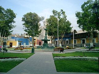
Arequipa is a province in the Arequipa Region, Peru. Its capital, Arequipa, is Peru's third most populous province of Peru. It borders the provinces of Islay, Camaná, Caylloma, and the Cusco and Puno regions. According to INEI in the year 2014 it has a population of 958.351 people.

San Román is a province in the Puno Region of Peru. It borders the provinces of Lampa, Azángaro, Puno, Huancane, the Arequipa Province of the Arequipa Region and Moquegua Region's province of General Sánchez Cerro. Its capital is the city of Juliaca which is also second-largest city of the region.

The General Sánchez Cerro Province is the smallest of three provinces in the Moquegua Region of Peru. The capital of the province is Omate. The province was named after the former Peruvian army officer and president Luis Miguel Sánchez Cerro.
Inka Wasi or Inkawasi may refer to:
The Mariscal Nieto Province is the largest of three provinces that make up the Moquegua Region of Peru. The capital of the province is the city of Moquegua.

Chojata District is one of eleven districts of the General Sánchez Cerro Province in Peru.
Ubinas District is one of eleven districts of the province General Sánchez Cerro in the Moquegua Region in Peru.

San Juan de Tarucani District is one of 29 districts of the province Arequipa in Peru.

Llamuqa is a mountain with archaeological remains in the Andes of Peru, about 4,794 metres (15,728 ft) high. It is situated in the Arequipa Region, La Unión Province, Huaynacotas District.

Pachakutiq is a 5,173-metre-high (16,972 ft) mountain in the Andes of Peru. It is located southeast of Lake Salinas in the Arequipa Region, Arequipa Province, Tarucani District, and in the Moquegua Region, General Sánchez Cerro Province, Coalaque District. Pachakutiq lies northwest of Q'uwa Laki and Qillqata.
Pukara is a mountain in the Moquegua Region in the Andes of Peru, about 4,400 metres (14,436 ft) high. It is located in the General Sánchez Cerro Province, Ubinas District. Pukara is situated northeast of the active volcano Ubinas and southwest of Wit'uni. The Para River flows along its western slopes.
Parwayuni is a mountain in the Andes of Peru, about 4,600 metres (15,092 ft) high. It is located in the Arequipa Region, Arequipa Province, Tarucani District, and in the Moquegua Region, General Sánchez Cerro Province, Ubinas District. Parwayuni is situated northwest of the active Ubinas volcano and the 4,647-metre (15,246 ft) high Qhuyu Parwayuni.
Yuraq Urqu is a 4,858-metre-high (15,938 ft) mountain in the Andes of Peru. It is located in the Arequipa Region, Arequipa Province, Tarucani District, and in the Moquegua Region, General Sánchez Cerro Province, Ubinas District. Yuraq Urqu lies east of Piñani Lake (Peñane).
Wilani is a mountain in the Andes of Peru, about 5,200 metres (17,060 ft) high. It is located in the Arequipa Region, Arequipa Province, Tarucani District, and in the Moquegua Region, General Sánchez Cerro Province, on the border of the districts Coalaque and Matalaque. Wilani lies southwest of Pukasaya, northwest of Ch'awarani and northeast of Qillqata.
Pukara is a mountain in the Andes of Peru, about 5,000 metres (16,404 ft) high. It is located in the Arequipa Region, Arequipa Province, Tarucani District. Pukara lies north of Wilani and northeast of Qillqata.
Sawsi is a 4,942-metre-high (16,214 ft) mountain in the Andes of Peru. It is situated in the Arequipa Region, Castilla Province, on the border of the districts of Chachas and Orcopampa. Sawsi lies at a lake named Machuqucha.
Llamahuasi is a 4,728-metre-high (15,512 ft) mountain in the Vilcabamba mountain range in the Andes of Peru. It is located in the Cusco Region, Anta Province, Limatambo District, and in the Urubamba Province, Ollantaytambo District. Llamahuasi lies southwest of Huayanay and Ocobamba.
Qullpani is a mountain in the Andes of Peru which reaches a height of approximately 4,800 m (15,700 ft). It is located in the Arequipa Region, Arequipa Province, Tarucani District, and in the Moquegua Region, General Sánchez Cerro Province, Matalaque District. Qullpani lies southwest of the Ubinas volcano.
Chinaqucha is a lake in the Arequipa Region in Peru. It is located in the Arequipa Province, Tarucani District. Chinaqucha lies northwest of Urququcha and the mountain named Suri Wasi.
Urququcha is a lake in the Arequipa Region in Peru. It is located in the Arequipa Province, Tarucani District. Urququcha lies southeast of Chinaqucha, northwest of a mountain named Suri Wasi.


