The Huari Province is one of twenty provinces of the Ancash Region in Peru. Its seat is Huari.

The Huarmey Province is one of 20 provinces in the Ancash Region in Peru. It is located around 4 hours by bus from Lima and its main economic activities are agriculture, fishing and mineral shipping.
Pumaq Hirka is an archaeological site in Peru. It is situated in the Huánuco Region, Huamalíes Province, Miraflores District, at a height of about 3,696 metres (12,126 ft).
Markahirka or Marka Hirka is an archaeological site with cave paintings and stone tombs (chullpa) on a mountain of the same name in Peru. It is located in the Ancash Region, Huari Province, in the districts of Cajay and Masin. It is situated at a height of 3,580 metres (11,745 ft). Markahirka is also a good viewpoint with views into the Puchka valley (Puchca) and to the towns of Huari (Wari) and Huachis (Wachis).
Warahirka or Wara Hirka is a mountain with an archaeological site of the same name in Peru. It is situated in the Huánuco Region, Yarowilca Province, Pampamarca District, about 1.5 km from Pampamarca, near La Florida and Warahirka (Huarajirca).

Waylla Hirka is a mountain in the Andes of Peru, about 4,800 metres (15,748 ft) high. It is located in the Lima Region, Cajatambo Province, Cajatambo District. Waylla Hirka lies at the Pumarinri valley south of the Waywash mountain range, southwest of Pukaqaqa and north of Millpu. The lakes Quyllurqucha, Warmiqucha and Challwaqucha lie northeast of Waylla Hirka.
Millu Hirka is a mountain in the Cordillera Blanca in the Andes of Peru, about 4,900 m (16,076 ft) high. It is situated in the Ancash Region, Huari Province, Huari District. Millu Hirka lies northeast of Antap'iti and southeast of Tullparahu. Milluqucha is the name of the lake north of the mountain.
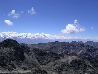
Puka Hirka is a 4,870-metre-high (15,980 ft) mountain in the Cordillera Negra in the Andes of Peru. It is situated in the Ancash Region, Huaraz Province, on the border of the districts of Cochabamba and Pariacoto, and in the Yungay Province, Shupluy District. It lies southwest of Willka Wayin.
Puka Hirka is a mountain in the Cordillera Negra in the Andes of Peru, about 4,600 m (15,100 ft) high. It is situated in the Ancash Region, Aija Province, on the border of the districts of Aija and La Merced, in the Huaraz Province, Huaraz District, and in the Recuay Province, Recuay District.
Huayllajirca is a mountain in the Andes of Peru, about 5,000 m (16,000 ft) high. It is located in the Lima Region, Cajatambo Province, Cajatambo District, and in the Oyón Province, Oyón District. Huayllajirca lies northwest of the mountain named Chalhuacocha and northeast of Pishtac and Tocto lake.
Yanajirca or Yana Hirka is a mountain in the Andes of Peru, about 4,600 m (15,100 ft) high. It is located in the Lima Region, Cajatambo Province, Cajatambo District. Yana Hirka is southwest of Mishi Waqanan and northwest of Pishtaq.
Sach'a Hirka is a mountain in the Cordillera Negra in the Andes of Peru which reaches a height of approximately 4,600 m (15,100 ft). It lies in the Ancash Region on the border of the Aija Province, Aija District, and the Recuay Province, Catac District. Sach'a Hirka lies northwest of Yana Kunkush.
Kushuru Hirka is a mountain in the Cordillera Negra in the Andes of Peru which reaches a height of approximately 4,600 m (15,100 ft). It lies in the Ancash Region, Recuay Province, on the border of the districts of Cotaparaco and Tapacocha.
Winchus Hirka is a mountain in the northern part of the Cordillera Blanca in the Andes of Peru which reaches a height of approximately 4,200 m (13,780 ft). It is located in the Ancash Region, Corongo Province, Cusca District. It lies south of a mountain named Winchus (Guinchos).
Hatun Hirka is a mountain in the Cordillera Negra in the Andes of Peru which reaches a height of approximately 3,400 m (11,200 ft). It is located in the Ancash Region, Huaylas Province, Pamparomas District, and in the Santa Province, Cáceres del Perú District, northwest of Pamparomas.
Quinuajirca or Kinwa Hirka is a mountain in the eastern extensions of the Cordillera Blanca in the Andes of Peru which reaches a height of approximately 4,400 m (14,400 ft). It is located in the Ancash Region, Huari Province, Huari District. Quinuajirca lies at the Rurichinchay valley, northeast of the peak of Chinchey.
Qullpa Hirka is a mountain in the Cordillera Negra in the Andes of Peru which reaches a height of approximately 4,400 m (14,400 ft). It lies in the Ancash Region, Recuay Province, in the northern part of the Cotaparaco District.
Munti Hirka is a mountain in the eastern extensions of the Wallanka mountain range in the Andes of Peru which reaches a height of approximately 4,400 m (14,400 ft). It is located in the Ancash Region, Bolognesi Province, Huallanca District.
Yanajirca or Yana Hirka is a mountain in the Andes of Peru which reaches an altitude of approximately 4,800 m (15,700 ft). It is located in the Ancash Region, Bolognesi Province, on the border of the districts of Huallanca and Huasta. Yana Hirka lies east of Wamash Mach'ay.
Yanajirca or Yana Hirka is a mountain in the Andes of Peru which reaches an altitude of approximately 4,600 m (15,100 ft). It is located in the Ancash Region, Bolognesi Province, Huallanca District. Yana Hirka lies southeast of the Wallanka mountain range.