Kancheepuram district is one of the 38 districts in the state of Tamil Nadu in India. The area comprising the present day Kancheepuram district was earlier a part of Chingleput district. The original Chingleput district was split in 1997 into form the present day Kancheepuram and Tiruvallur districts.
Tiruvallur district, also spelled as Thiruvallur district, is one of the 38 districts in the Indian state of Tamil Nadu. The fast developing city of Tiruvallur is the district headquarters. The district has a mixture of urban and rural characteristics. The eastern part of Tiruvallur district is dominated by urban characteristics while the Northern part of the district has influence of Andhra culture due to its position. In 2011, the district had a population of 3,728,104 with a sex-ratio of 987 females for every 1,000 males.

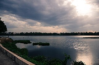
Tiruvallur is a Grade I municipality in the Indian state of Tamil Nadu. It is located on the banks of Coovum river about 46 km (29 mi) from downtown Chennai (Madras) and just 5 km from megacity border, in the western part of the Chennai Metropolitan Area (CMA). It is a satellite town of Chennai and is the administrative headquarters of Tiruvallur district. The city is known for the Veera Raghavar temple, one of the 108 sacred shrines of Vaishnavites. The tank festival is held at a pond near this temple. A Shiva temple near this shrine which is popular among the locals. There is also a 40-foot (12 m) tall Viswaroopa Panchamukha Hanuman temple, where the murti is made of a single green granite stone.

Madurai district is one of the 38 districts of the state of Tamil Nadu in southeastern India. The city of Madurai serves as the district headquarters. It houses the famous Sri Meenakshi Sundareshwarar temple and is situated on the banks of the river Vaigai. Thiruparankundram is one of the major tourist place in the district. As of 2011, the district had a population of 3,038,252 with a sex-ratio of 990 females for every 1,000 males. Aside from the city of Madurai, the larger towns are Melur, Vadipatti, Thirumangalam, Thirupparankundram, Peraiyur, and Usilampatti. It is an important hub for various film shootings. Alanganallur is a popular spot in the district for Jallikattu, as are Palamedu and Avaniyapuram.

Melur is the Northern entrance of Madurai district. It is the town and municipality in the Madurai North in the Indian state of Tamil Nadu. Melur Old Name is Called Naduvi Nadu. The name Melur name comes from "Mela Nadu". Melur is called Thaigramam. It is the biggest taluk within the Madurai District. As of 2011, the town had a population of 40,017. Melur is an agricultural land in Madurai and the climate around the area is tropical.
Virudhunagar District is a district of Tamil Nadu state in south India. Virudhunagar is the district headquarters of Virudhunagar district. Virudhunagar district was formed by the separation of Old Ramanathapuram District in 1987 into Ramanathapuram District, Sivagangai District and the west part as Virudhunagar District. Virudhunagar District was formerly called Karmavirer Kamarajar District. As of 2011, Virudhunagar district had a population of 1,942,288 with a sex-ratio of 1,007 females for every 1,000 males. Sivakasi is the most populous and largest city in the district.

Injambakkam is a locality in the south of Chennai in the Indian state of Tamil Nadu. Being a part of the Walajabad block of the district, its panchayat is part of Walajabad panchayat union. Injambakkam is located along the ECR.
Naranammalpuram is a panchayat town in Tirunelveli district in the Indian state of Tamil Nadu.

Valangaiman is a town Panchayat in the Valangaiman taluk of Thiruvarur district in the Indian state of Tamil Nadu. It is the headquarters of Valangaiman Taluk.
Uthukottai is a town in Suburbs of Chennai, one of the taluk headquarters in Thiruvallur District Tamil Nadu, also one of the border towns of Tamilnadu - Andhra Pradesh, located on the banks of the Arani river. This town is the central hub for many nearby towns and villages for their needs of education, markets, shops, businesses, banks, travel, transport and entertainment(Movie Theatres, badminton courts, cricket grounds, Gyms). The town features a channel which helps to direct water from the Krishna river for local irrigation.
Pennalurpet (Tamil: Velamakandriga is a village in India located on the Andhra Pradesh and Tamil Nadu border. The village is under the control of Tamil Nadu government. Farming is the main income source for this village.
Periapalayam is a village about 40 km north of Chennai, in Tiruvallur district, Tamil Nadu State, India. The nearest Railway station is Thiruninravur.It is in Ellapuram block which stretches from east Thanakulam village, west Uthukottai, north Kosavanpettai and in the south up to Komakambedu village. It has one of the main routes to Andhra Pradesh.
Uthukkottai taluk is a taluk of Tiruvallur district of the Indian state of Tamil Nadu. The headquarters of the taluk is the town of Uthukkottai.
Manellore is a village in the Tiruvallur district of Tamil Nadu, India. It is located in the Gummidipoondi taluk.
Mathur is a residential area located north of Chennai, a metropolitan city in Tamil Nadu, India. Mathur is administered by the Greater Chennai Corporation and belongs to Madhavaram taluk of Chennai district.
Gunadal is a panchayat village in the state of Karnataka, India. Administratively it is under Bijapur Taluka of Bijapur district, Karnataka. Located in the far southwestern corner of the district, Gunadal is nearly 45 km by road from the district headquarters, the city of Bijapur. In Gunadal there is a Government Ayurvedic Hospital, Government Veterinary Hospital, Post Office, Police Station and gram panchayat headquarters.
Adaiyur is a panchayat village in the Indian state of Tamil Nadu. Administratively, Adaiyur is under Idappadi taluk of Salem district in Tamil Nadu. It is 45 km by road west of Salem.
Pettai is a panchayat village in the southern state of Tamil Nadu. Administratively, Pettai is under the Gingee Taluk of Villupuram District, Tamil Nadu. Pettai is 18.5 km by road west of the village of Gingee, and 24 km east of the town of Tiruvannamalai.
Arumbanur is a census town in Madurai-North, Madurai district in the state of Tamil Nadu, India. It is 4.5 by road northeast of the village of Kadachanendal.
Venkatachalapuram is a small village situated in Theni District, Tamil Nadu, India and with direct road connectivity to Theni and Odaipatti. The district headquarters, Theni, is situated 11 kilometres (6.8 mi) north of this village.

