This article needs additional citations for verification .(February 2026) |
Vadavalli | |
|---|---|
Neighbourhood | |
 Marudamalai Road, Mullai Nagar, Vadavalli | |
 Vadavalli Location in Tamil Nadu, India | |
| Coordinates: 11°01′29″N76°53′53″E / 11.024745°N 76.898036°E | |
| Country | |
| State | Tamil Nadu |
| District | Coimbatore |
| • Rank | 1 |
| Elevation | 450 m (1,480 ft) |
| Population (2001) | |
• Total | 444,700 |
| Languages | |
| • Official | Tamil |
| Time zone | UTC+5:30 (IST) |
| PIN | 641041 |
| Telephone code | 0422 |
| Vehicle registration | TN-66; TN-38 |
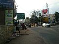
Vadavalli is a neighbourhood in Coimbatore in the Indian state of Tamil Nadu. It is located on the Marudamalai Road and has been under the jurisdiction of the Coimbatore City Municipal Corporation limits since 2007. It is located at the foothills of the Western Ghats.