Val Viola Pass

Last updated
Val Viola Pass
Alps location map.png
Red pog.svg
Val Viola Pass
Location in the Alps
Elevation 2,468 m (8,097 ft) [1]
Traversed by Trail
Location Graubünden, Switzerland
Lombardy, Italy
Range Livigno Alps
Coordinates 46°24′54″N10°09′19″E / 46.41500°N 10.15528°E / 46.41500; 10.15528 Coordinates: 46°24′54″N10°09′19″E / 46.41500°N 10.15528°E / 46.41500; 10.15528

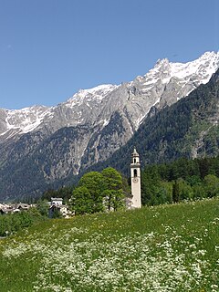
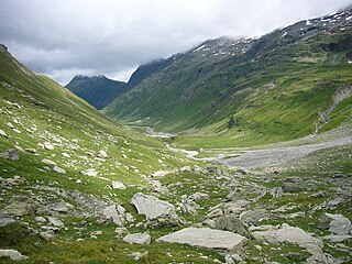
The Val Viola Pass (Italian : Passo di Val Viola, Romansh : Pass da Val Viola) is a high mountain pass in the Alps on the border between Switzerland and Italy. It connects Poschiavo in the Swiss canton of Graubünden with Valdidentro in the Italian region of Lombardy. The pass lies at a height of 2,468 metres above sea level between Piz Val Nera and Corno di Dosdè.

Italian language Romance language

Italian is a Romance language of the Indo-European language family. Italian, together with Sardinian, is by most measures the closest language to Vulgar Latin of the Romance languages. Italian is an official language in Italy, Switzerland, San Marino and Vatican City. It has an official minority status in western Istria. It formerly had official status in Albania, Malta, Monaco, Montenegro (Kotor) and Greece, and is generally understood in Corsica and Savoie. It also used to be an official language in the former Italian East Africa and Italian North Africa, where it plays a significant role in various sectors. Italian is also spoken by large expatriate communities in the Americas and Australia. In spite of not existing any Italian community in their respective national territories and of not being spoken at any level, Italian is included de jure, but not de facto, between the recognized minority languages of Bosnia-Herzegovina and Romania. Many speakers of Italian are native bilinguals of both standardized Italian and other regional languages.

Romansh language Romance language spoken predominantly in the southeastern Swiss canton of Grisons (Graubünden)

Romansh (also spelled Romansch, Rumantsch, or Romanche; Romansh: rumantsch, rumàntsch, romauntsch or romontsch) is a Romance language spoken predominantly in the southeastern Swiss canton of Grisons (Graubünden), where it has official status alongside German and Italian. It is used as the medium of instruction in schools in Romansh-speaking areas. Romansh has also been recognized as a national language of Switzerland since 1938, and as an official language since 1996, along with German, French and Italian. It is sometimes grouped by linguists with Ladin and Friulian as a Rhaeto-Romance language, though this is disputed.

Mountain pass Route through a mountain range or over a ridge

A mountain pass is a navigable route through a mountain range or over a ridge. Since many of the world's mountain ranges have presented formidable barriers to travel, passes have played a key role in trade, war, and both human and animal migration throughout Earth's history. At lower elevations it may be called a hill pass. The highest vehicle-accessible pass in the world appears to be Mana Pass, located in the Himalayas on the border between India and Tibet, China.

The pass is traversed by a trail.

Related Research Articles

Ticino (river) river in Switzerland and Italy

The river Ticino is the most important perennial left-bank tributary of the Po. It has given its name to the Swiss canton through which its upper portion flows.

Engadin long valley in the Swiss Alps

The Engadin or Engadine is a long high Alpine valley region in the eastern Swiss Alps located in the canton of Graubünden in most southeastern Switzerland with about 25,000 inhabitants. It follows the route of the Inn from its headwaters at Maloja Pass in the southwest running roughly northeast until the Inn flows into Austria, one hundred kilometers downstream. The En/Inn subsequently flows at Passau into the Danube, as the only Swiss river to drain into the Black Sea. The Engadine is protected by high mountain ranges on all sides and is famous for its sunny climate, beautiful landscapes and outdoor activities.

Adige river in Northern Italy

The Adige is the second longest river in Italy after the Po, rising in the Alps in the province of South Tyrol near the Italian border with Austria and Switzerland, flowing 410 kilometres (250 mi) through most of North-East Italy to the Adriatic Sea.

Trepalle is a village in the Italian Alps, a frazione of Livigno, Lombardy. It is considered to be the village located at the highest altitude in Europe. Some argue instead that the village of Juf in Switzerland is Europe's highest with permanent population.

Geography of the Alps

The Alps cover a large area. This article describes the delimitation of the Alps as a whole and of subdivisions of the range, follows the course of the main chain of the Alps and discusses the lakes and glaciers found in the region.

Poschiavo Place in Grisons, Switzerland

Poschiavo is a municipality in the Bernina Region in the canton of Grisons in Switzerland.

Val Rezzo Comune in Lombardy, Italy

Val Rezzo is a comune (municipality) in the Province of Como in the Italian region Lombardy, located about 70 kilometres (43 mi) north of Milan and about 30 kilometres (19 mi) north of Como, on the border with Switzerland. As of 31 December 2004, it had a population of 202 and an area of 6.6 square kilometres (2.5 sq mi).

Chiavenna Comune in Lombardy, Italy

Chiavenna is a comune (municipality) in the Province of Sondrio in the Italian region of Lombardy. It is the centre of the Alpine Valchiavenna region. The historic town is a member of the Cittaslow movement.

Valdidentro Comune in Lombardy, Italy

Valdidentro is a comune (municipality) in the Province of Sondrio in the Italian region Lombardy, located about 140 kilometres (87 mi) northeast of Milan and about 50 kilometres (31 mi) northeast of Sondrio, in the upper Alta Valtellina on the border with Switzerland.

Toce river in Italy

The Toce is a river in Piedmont, Italy, which stretches the length of the Val d'Ossola from the Swiss border to Lake Maggiore into which it debouches near Fondotoce in the commune of Verbania. The river is 83.6 kilometres (51.9 mi) long and is formed in the upper Val Formazza by the confluence of a number of torrents in the plain of Riale.

Val Bregaglia valley

The Val Bregaglia is an alpine valley of Switzerland and Italy at the base of which runs the river Mera. The valley begins at the Maloja Pass which connects it to the Engadin. There the Orlegna river extends westwards and joins the Mera river to Chiavenna shortly after which the Mera joins with the Liro and turns south towards Lake Como. From Chiavenna to Maloja, a distance of 32 km, the valley rises 1482 m. Most of the valley falls within the Swiss district of Maloja in the canton of the Grisons, the lower part within the Italian province of Sondrio. A 10,800 ha tract of the valley has been identified as an Important Bird Area by BirdLife International.

Lago di Val Viola lake in the Grisons, Switzerland, near Lago di Saoseo, in the Poschiavo region

Lago di Val Viola is a lake in the Grisons, Switzerland. The lake is located near Lago di Saoseo, in the Poschiavo region.

Lägh da Cavloc lake near Maloja Pass in the Val Forno, Grisons, Switzerland

Lägh da Cavloc is a lake near Maloja Pass in the Val Forno, Grisons, Switzerland.

Val Poschiavo valley in the canton of Graubünden, Switzerland

Val Poschiavo is a valley in the southern, Italian-speaking part of the Swiss canton of Graubünden (Grisons). The main town is Poschiavo.

Piz la Stretta

Piz la Stretta is a mountain of the Livigno Alps, located on the border between Italy and Switzerland. Its 3,104-metre (10,184 ft) high summit overlooks the pass of La Stretta

Val Ferret valley

Val Ferret is the name of the two separate valleys, departing from the Col Ferret on the border between Italy and Switzerland, on the southern and eastern sides of the Mont Blanc Massif. The Swiss valley drains northeastwards towards Orsières and on into the Rhône basin; whereas the Italian valley drains southwestwards towards Courmayeur and on into the Po basin.

Rheinwald

The Rheinwald is a valley in the Canton of Graubünden in Switzerland. The river Hinterrhein flows through three valleys in Graubünden; the Rheinwald is the highest of the three.

Rein da Medel river in Switzerland

The Rein da Medel is the longest headwater of the Rhine. It is located in the Swiss cantons of Ticino and Graubünden and flows through the valleys Val Cadlimo and Val Medel. Rein da Medel is the local Sursilvan, name in Graubünden, which is commonly used to denote the Ticino part as well.

Val Curciusa valley

The Val Curciusa is an alpine valley in Graubünden, Switzerland. In the region of the San Bernardino Pass, it provides a connection between the Rheinwald valley and the Misox valley.

Italy–Switzerland border international border

The border between the modern states of Switzerland and Italy extends to 744 kilometres (462 mi), from the French-Swiss-Italian tripoint at Mont Dolent in the west to the Austrian-Swiss-Italian tripoint near Piz Lad in the east. Much of the border runs across the High Alps, rising above 4,600 metres (15,100 ft) as it passes east of Dufourspitze, but it also descends to the lowest point in Switzerland as it passes Lago Maggiore below 200 metres (660 ft).

References

  1. Retrieved from the Swisstopo topographic maps.

See also