
Dolj County is a county (județ) of Romania on the border with Bulgaria, in Oltenia, with the capital city at Craiova.

Urlați is a town in Prahova county, Muntenia, Romania. In 2011, it had a population of 10,064. Sixteen villages are administered by the town: Arioneștii Noi, Arioneștii Vechi, Cherba, Jercălăi, Mărunțiș, Orzoaia de Jos, Orzoaia de Sus, Schiau, Ulmi, Valea Bobului, Valea Crângului, Valea Mieilor, Valea Nucetului, Valea Pietrei, Valea Seman and Valea Urloii.

The Mureș is a 789-kilometre-long (490 mi) river in Eastern Europe. Its drainage basin covers an area of 30,332 km2 (11,711 sq mi). It originates in the Hășmașu Mare Range in the Eastern Carpathian Mountains, Romania, rising close to the headwaters of the river Olt, and joins the Tisza at Szeged in southeastern Hungary. In Romania, its length is 761 km (473 mi) and its basin size is 27,890 km2 (10,770 sq mi).

The Siret or Sireth is a river that rises from the Carpathians in the Northern Bukovina region of Ukraine, and flows southward into Romania before it joins the Danube. It is 647 km (402 mi) long, of which 559 km (347 mi) in Romania, and its basin area is 44,811 km2 (17,302 sq mi), of which 42,890 km2 (16,560 sq mi) in Romania. Its average discharge is 250 m3/s (8,800 cu ft/s). In ancient times, it was named Hierasus.

The Olt is a river in Romania. It is 615 km (382 mi) long, and its basin area is 24,050 km2 (9,290 sq mi). It is the longest river flowing exclusively through Romania. Its source is in the Hășmaș Mountains of the eastern Carpathian Mountains, near Bălan, rising close to the headwaters of the river Mureș. It flows through the Romanian counties Harghita, Covasna, Brașov, Sibiu, Vâlcea and Olt. The river was known as Alutus or Aluta in Roman antiquity. Olt County and the historical province of Oltenia are named after the river.
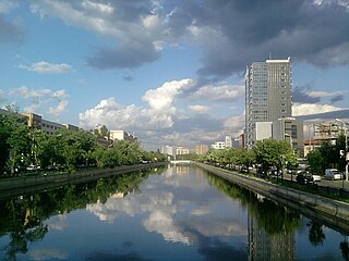
The Dâmbovița is a river in Romania. It has its sources on the Curmătura Oticului, a mountain pass that separates the Iezer Mountains from the Făgăraș Mountains proper. It passes through Bucharest and flows into the river Argeș near Budești, in Călărași County. Its length is 286 km (178 mi) and its basin size is 2,824 km2 (1,090 sq mi). Dâmbovița County is named after the river.

The Ialomița is a river of Southern Romania. It rises from the Bucegi Mountains in the Carpathians. It discharges into the Borcea branch of the Danube in Giurgeni. It is 417 km (259 mi) long, and its basin area is 10,350 km2 (4,000 sq mi). Ialomița County takes its name from this river.
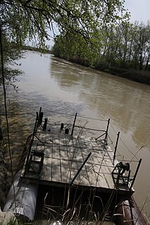
The Prahova is a river of Southern Romania, which rises from the Bucegi Mountains, in the Southern Carpathians. It flows into the Ialomița near Adâncata. The upper reach of the river, upstream of the confluence with the river Azuga is sometimes called the Prahovița.

The Arieș is a left tributary of the river Mureș in Transylvania, Romania. It discharges into the Mureș in Gura Arieșului, 11 km southwest of Luduș. Its total length is 166 km (103 mi), and its drainage basin area is 3,005 km2 (1,160 sq mi).

The Crișul Alb (Romanian), is a river in western Romania in the historical region of Transylvania and south-eastern Hungary. Its source is in the southern Apuseni Mountains. It flows through the towns Brad, Ineu, Chișineu-Criș in Romania, and Gyula in Hungary. Crossing the border of Hungary, the river, now called Fehér-Körös, joins the Fekete-Körös a few kilometres north from Gyula to form the river Körös (Criș). In Romania, its length is 234 km (145 mi) and its basin size is 4,240 km2 (1,640 sq mi).

Bistra is a commune in Maramureș County, Romania. The Ukrainian border is located to the north of the commune. The first documentary mention of the settlement dates to 1411.
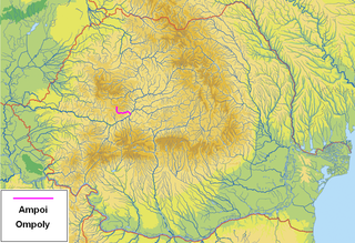
The Ampoi is a river in the Apuseni Mountains, Alba County, western Romania. It is a right tributary of the river Mureș. It flows through the town Zlatna, and joins the Mureș near Alba Iulia. Its length is 43 km (27 mi) and its basin size is 250 km2 (97 sq mi).

The Someșul Mare is a river in north-western Romania, originating in the Bistrița-Năsăud County in the Rodna Mountains at the confluence of two headwaters — the Preluci and the Zmeu. The Someșul Mare flows west through Rodna, Năsăud and Beclean, until it meets the Someșul Mic upstream of Dej. Its length is 130 km (81 mi) and its basin size is 5,033 km2 (1,943 sq mi). Downstream from its confluence with the Someșul Mic, the river is called Someș.
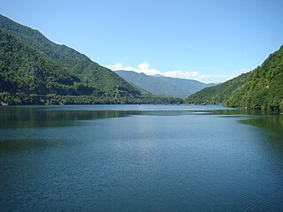
The Lotru is a right tributary of the river Olt in Romania. Its source is in the Parâng Mountains. It feeds the reservoirs Vidra, Malaia and Brădișor. It flows into the Olt near the town Brezoi. It passes through the communes Voineasa, Malaia, and Brezoi. Its length is 83 km (52 mi) and its basin size is 990 km2 (380 sq mi).
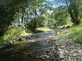
The Săcuieu is a left tributary of the river Crișul Repede in Romania. Its source is in the Apuseni Mountains. It discharges into the Crișul Repede near Bologa. Its length is 31 km (19 mi) and its basin size is 226 km2 (87 sq mi).
The Jiul de Vest is a headwater of the river Jiu in Romania. At its confluence with the Jiul de Est in Iscroni, the Jiu is formed. Its length is 54 km (34 mi) and its basin size is 496 km2 (192 sq mi). The upper course of the river is also known locally as Câmpușelu.
The Valea Cerbului is a right tributary of the river Prahova in Romania. It source is in the Bucegi Mountains. It flows into the Prahova in Bușteni. Its length is 7 km (4.3 mi) and its basin size is 26 km2 (10 sq mi).
The Valea Stanciului is a left tributary of the river Săcuieu in Romania. It flows into the Săcuieu in Răchițele. Its length is 15 km (9.3 mi) and its basin size is 31 km2 (12 sq mi). The river valley is known for its gorge Cheile Văii Stanciului and the Vălul Miresei waterfalls.

The Strei is a left tributary of the river Mureș in Transylvania, Romania. The upper reach of the river, upstream of the village of Baru, is also known as Râul Petros. It flows through the town Călan and the villages Petros, Baru, Livadia, Pui, Galați, Băiești, Ohaba de sub Piatră, Ciopeia, Subcetate, Covragiu, Bretea Română, Bretea Streiului, Ruși, Strei, Streisângeorgiu, Batiz, Băcia and Simeria Veche. It discharges into the Mureș near Simeria. Its length is 93 km (58 mi) and its basin size is 1,983 km2 (766 sq mi).

The Sadu is a right tributary of the river Cibin in Romania. It discharges into the Cibin in Tălmaciu. The Negovanu and Sadu II dams are located on the Sadu. Its length is 60 km (37 mi) and its basin size is 278 km2 (107 sq mi).


