The Appian Way is one of the earliest and strategically most important Roman roads of the ancient republic. It connected Rome to Brindisi, in southeast Italy. Its importance is indicated by its common name, recorded by Statius, of Appia longarum... regina viarum . The road is named after Appius Claudius Caecus, the Roman censor who began and completed the first section as a military road to the south in 312 BC during the Samnite Wars.

Veii was an important ancient Etruscan city situated on the southern limits of Etruria and 16 km (9.9 mi) north-northwest of Rome, Italy. It now lies in Isola Farnese, in the comune of Rome. Many other sites associated with and in the city-state of Veii are in Formello, immediately to the north. Formello is named after the drainage channels that were first created by the Veians.

Lanuvium, modern Lanuvio, is an ancient city of Latium vetus, some 32 kilometres (20 mi) southeast of Rome, a little southwest of the Via Appia.
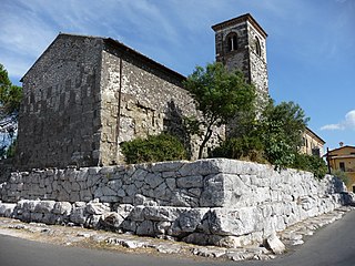
Segni is an Italian town and comune located in Lazio. The city is situated on a hilltop in the Lepini Mountains, and overlooks the valley of the Sacco River.

Paestum was a major ancient Greek city on the coast of the Tyrrhenian Sea in Magna Graecia. The ruins of Paestum are famous for their three ancient Greek temples in the Doric order dating from about 550 to 450 BC that are in an excellent state of preservation. The city walls and amphitheatre are largely intact, and the bottom of the walls of many other structures remain, as well as paved roads. The site is open to the public, and there is a modern national museum within it, which also contains the finds from the associated Greek site of Foce del Sele.

Arpino is a comune (municipality) in the province of Frosinone, in the Latin Valley, region of Lazio in central Italy, about 100 km SE of Rome. Its Roman name was Arpinum. The town produced two consuls of the Roman republic: Gaius Marius and Marcus Tullius Cicero.
Cerveteri is a town and comune of northern Lazio in the region of the Metropolitan City of Rome. Known by the ancient Romans as Caere, and previously by the Etruscans as Caisra or Cisra, and as Agylla by the Greeks, its modern name derives from Caere Vetus used in the 13th century to distinguish it from Caere Novum.

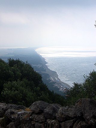
Norba, an ancient town of Latium (Adjectum), Italy. It is situated 1 mile northwest of the modern town of Norma, on the western edge of the Volscian Mountains or Monti Lepini. The town is perched above a precipitous cliff with a splendid view over the Pomptine Marshes below; the highest point stands to ca. 460 meters above sea level.
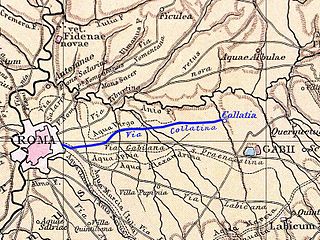
Collatia was an ancient town of central Italy, c. 15 km northeast of Rome by the Via Collatina.
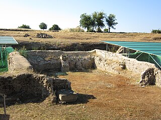
Gabii was an ancient city of Latium, located 18 km (11 mi) due east of Rome along the Via Praenestina, which was in early times known as the Via Gabina. It was on the south-eastern perimeter of an extinct volcanic crater lake, approximately circular in shape, named the Lacus Gabinus, and then during later times called the Lago di Castiglione, "lake of the fortification", after Castiglione, a mediaeval tower erected on the site of the ancient acropolis, or arx, of Gabii. A necropolis is adjacent on that side of the lake. At present, the former lake is entirely agricultural land. The ruins of the ancient city project from the fields next to the cliffs overlooking it, on both sides of the via. A municipium in Roman times, Gabii is currently located in the frazione of Osteria dell'Osa 10 km (6.2 mi) from the comune of Monte Compatri, of which it is a part, in the Province of Rome, Region of Lazio. The site is under new seasonal archaeological excavation.

Lucus Feroniae was an ancient sanctuary or, literally sacred grove ("lucus"), dedicated to the Sabine goddess Feronia, protector of freedmen, ex-slaves. It was located near to the ancient town of Feronia in Etruria on the ancient Via Tiberina, in what is now the territory of the modern commune of Capena, Lazio.
Crustumerium was an ancient town of Latium, on the edge of the Sabine territory, near the headwaters of the Allia, not far from the Tiber.

Satricum, an ancient town of Latium vetus, lay on the right bank of the Astura river some 60 kilometres (37 mi) SE of Rome in a low-lying region south of the Alban Hills, at the NW border of the Pontine Marshes. It was directly accessible from Rome via a road running roughly parallel to the Via Appia.
A Roman colonia was originally a Roman outpost established in conquered territory to secure it. Eventually, however, the term came to denote the highest status of a Roman city. It is also the origin of the modern term colony.
The prehistory of Italy began in the Paleolithic period, when species of Homo colonized the Italian territory for the first time, and ended in the Iron Age, when the first written records appeared in Italy.

Saxa Rubra was a village and station on the Roman Flaminian Way, 9 miles (14 km) from Rome, Italy.

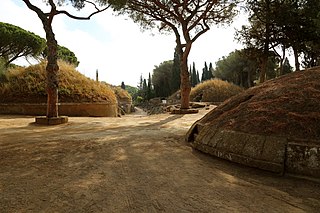
Casal Rotondo is the largest tomb on the Appian Way, to the southeast of Rome, Italy. A small farmhouse has been constructed on the top.

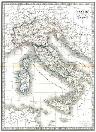
Old Latium is a region of the Italian peninsula bounded to the north by the river Tiber, to the east by the central Apennine mountains, to the west by the Mediterranean Sea and to the south by Monte Circeo. It was the territory of the Latins, an Italic tribe which included the early inhabitants of the city of Rome. Later it was also settled by various Italic tribes such as the Rutulians, Volscians, Aequi, and Hernici. The region was referred to as "old" to distinguish it from the expanded region, Latium, that included the region to the south of Old Latium, between Monte Circeo and the river Garigliano – the so-called Latium adiectum. It corresponded to the central part of the modern administrative region of Lazio, Italy, and it covered an area measuring of roughly 50 Roman miles. It was calculated by Mommsen that the region's area was about 1860 square kilometres.

A tholos, , in Latin tholus, is a form of building that was widely used in the classical world. It is a round structure with a circular wall and a roof, usually built upon a couple of steps, and often with a ring of columns supporting a conical or domed roof.