Related Research Articles
For thousands of years the area that is today known as Steveston was home to the Halq’eméylem speaking peoples. Specifically, the area is said to be home to at least two Musqueam villages. One known as qʷeyaʔχʷ was located East of what is today known as Garry Point Park. This community was forced out of their homes due to pressure from the canneries who would replace their homes with fishing camps. The second village, qʷɬeyəm, is believed to have been located North of Moncton Street near Railway Avenue. Today, Musqueam's presence in the history of what is today known as Steveston is heavily underrepresented. As Musqueam Councillor Howard Grant explains, there is "almost nothing with respect to Musqueam people... or First Nations in general." Richmond is currently working to change this as, "recently, city council voted to rebuild the historic First Nations Bunkhouse in Britannia Heritage Shipyards--believed to be the only structure of its kind remaining along B.C.'s coast."
Rivers Inlet is a fjord in the Central Coast region of the Canadian province of British Columbia, its entrance off Fitz Hugh Sound, about 125 km (78 mi) southwest of the community of Bella Coola and about 65 km (40 mi) north of the northern tip of Vancouver Island and the western entrance of the Queen Charlotte Strait.
Kingcome Inlet is one of the lesser principal fjords of the British Columbia Coast, north and east of Broughton Island. It is sixth in sequence of the major saltwater fjords north from the 49th parallel near Vancouver and similar in width, on average 2.5 km (1.6 mi), to longer inlets such as Knight Inlet and Bute Inlet, but it is only 35 km (22 mi) in length from the mouth of the Kingcome River to Sutlej Channel, which ultimately connects around Broughton Island to the main regional waterway of the Queen Charlotte Strait. Kingcome Inlet has a short side inlet, Wakeman Sound, fed by the Wakeman River.
Loughborough Inlet is one of the lesser principal inlets of the British Columbia Coast. It penetrates the Coast Mountains on the north side of the Discovery Islands archipelago, running about 35 km (22 mi) from its head at the mouth of the Stafford River to Chancellor Channel and Cordero Channel, which are on the north side of West Thurlow Island. A further 14 km (8.7 mi) west along Chancellor Channel is Johnstone Strait.
Loveland Bay Provincial Park is a provincial park on Vancouver Island, British Columbia, Canada, located on the north side of Campbell Lake, just west of the city of Campbell River.
Morton Lake Provincial Park is a provincial park in British Columbia, Canada, located on Vancouver Island northwest of the city of Campbell River.
Rock Bay Marine Provincial Park is a provincial park in British Columbia, Canada, located on the Inside Passage at the junction of Johnstone Strait and Discovery Passage. The park contains approximately 525 ha. Rock Bay is located on the shore of Vancouver Island, immediately south of East Thurlow Island.
Thurston Bay Marine Provincial Park is a provincial park on the northwest side of Sonora Island in British Columbia, Canada.
Kingcome, also known as Okwunalis or Ukwana'lis is an unincorporated settlement in the Kingcome Inlet area of the Central Coast of British Columbia, Canada, located a few miles up the Kingcome River from the head of the inlet. Quaee Indian Reserve No. 7 is the Indian reserve containing the village.
Roy was a cannery town on the South Coast of British Columbia, Canada, located on Loughborough Inlet north of the town of Campbell River and the Discovery Islands.
St. Vincent Bay was a cannery town on the South Coast of British Columbia, Canada, located on the northwest bank of Jervis Inlet near Hotham Sound, and just northeast of the Saltery Bay ferry terminal on the upper Sunshine Coast, and opposite the mouth of Sechelt Inlet. It was utilized as a log sort and booming ground. It has now been transformed into a quarry for aggregate.
Vancouver River is located in the Sunshine Coast region of the South Coast of British Columbia, Canada, emptying into Prince of Wales Reach of lower Jervis Inlet at the former cannery town of Vancouver Bay and the bay of the same name. The river is approximately 21 km in length.
Shoal Bay was a cannery town in the Discovery Islands region of the South Coast of British Columbia in Canada, located on the northeast side of East Thurlow Island, at the bay of the same name.
Forward Harbour was a cannery town in the Johnstone Strait region of the Central Coast of British Columbia, Canada, located on the inlet of the same name, which is on the mainland side of Wellbore Channel, to the east of Hardwicke Island. Nearby on the same vicinity on the Mainland, though fronting on other bodies of water, are Jackson Bay to the immediate north, off Sunderland Channel, and Heydon Bay, British Columbia to the east on Loughborough Inlet.
The K'ómoks First Nation, is the Indigenous band government of the Island Comox or K'ómoks people of Vancouver Island, British Columbia, Canada. Closely allied to the Cape Mudge and Campbell River First Nations, historically they were a Coast Salish people since integrated into Kwakwaka'wakw society. Originally part of the Laich-kwil-tach Council of Chiefs, which is a treaty society, they are now negotiating independently in the BC Treaty Process. They remain a member government of the Kwakiutl District Council.
Heriot Bay is the principal settlement on Quadra Island in British Columbia, Canada.
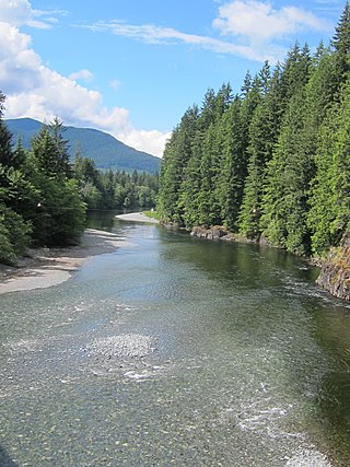
The Salmon River is a river in the north of Vancouver Island in British Columbia, Canada. Its headwaters lie in Strathcona Park. It flows northwest, through the Sayward Valley into Kelsey Bay next to the village of Sayward before finally entering Johnstone Strait. The river supports steelhead and several species of Pacific salmon.

Port Neville is a bay, port and locality on the north side of Johnstone Strait, south of Call Inlet, in the Central Coast region of British Columbia, Canada.
Dorman Island is an island in the Johnstone Strait region of the Central Coast of British Columbia, Canada, between West and East Cracroft Islands on the north side of the isthmus that joins them at low tide. Until 1940, with Farquharson Island, it was one of a group called the Double Islands; they were renamed to avoid duplication of the name elsewhere.
Kildonan is an unincorporated community in the Alberni Inlet-Barkley Sound region of the west coast of southern Vancouver Island, British Columbia. The former steamboat landing and ferry dock is on the east shore of Uchuchklesit Inlet, which branches northwest of the lower reaches of Alberni Inlet. Adjacent to Pacific Rim National Park Reserve, the locality is by road and ferry about 120 kilometres (75 mi) southwest of Port Alberni.
References
| | This article about a location in British Columbia, Canada is a stub. You can help Wikipedia by expanding it. |
| | This Canadian ghost town-related article is a stub. You can help Wikipedia by expanding it. |