Vittalur is a village in the Kumbakonam taluk of Thanjavur district, Tamil Nadu.
Villiyavarambal is a village in the Kumbakonam taluk of Thanjavur district, Tamil Nadu.
Vilandakandam is a village in the Kumbakonam taluk of Thanjavur district, Tamil Nadu.
Kudalur is a village in the Thanjavur taluk of Thanjavur district, Tamil Nadu, India.
Papanasam taluk is a taluk of Thanjavur district of the Indian state of Tamil Nadu. The headquarters of the taluk is the town of Papanasam.
Kakkarai is a village in the Orathanadu taluk of Thanjavur district, Tamil Nadu, India.
Pallipattu taluk is a taluk of Tiruvallur district of the Indian state of Tamil Nadu. The headquarters of the taluk is the town of Pallipattu.
Viluppuram taluk is a taluk of Viluppuram district of the Indian state of Tamil Nadu. The headquarters of the taluk is the town of Viluppuram.
Sennivanam is a village in the Ariyalur taluk of Ariyalur district, Tamil Nadu, India.
Varanavasi is a village in the Ariyalur taluk of Ariyalur district, Tamil Nadu, India.
Vanjinapuram is a village in the Sendurai taluk of Ariyalur district, Tamil Nadu, India.
Variyankaval is a village in the Andimadam taluk of Ariyalur district, Tamil Nadu, India. It has a government primary school and government higher secondary school. It also has a primary health centre and a bank. Agriculture and weaving are major activities. This village is surrounded by lakes in all directions. There are four old well-planned streets with tiled houses and four newly made streets on the western side and two planned streets on the eastern side of the village. Gangaikonda Cholapuram, a UNESCO heritage site, capital of Chola dynasty is located 15 km east of this village. It is widely believed that this village belongs to Chola Period and is more than 1000 years old. There are unconfirmed reports that ancient burial urns, called Muthumakkal Thazhi, were unearthed in some fields around this village.
Palliyur is a village in the Papanasam taluk of Thanjavur district, Tamil Nadu, India.
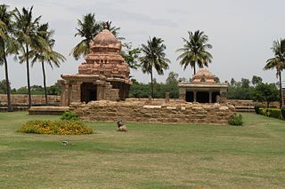
Thiruvaikavur is a village in the Papanasam taluk of Thanjavur district, Tamil Nadu, India. The village is famous for the Tiruvaikavur temple.
Chokkanavur is a village in the Pattukkottai taluk of Thanjavur district, Tamil Nadu, India.
Kondikulam is a village in the Pattukkottai taluk of Thanjavur district, Tamil Nadu, India.
Pannaivayal is a village in the Pattukkottai taluk of Thanjavur district, Tamil Nadu, India.
Pukkarambai is a village in the Pattukkottai taluk of Thanjavur district, Tamil Nadu, India.
Uthiramerur Taluk is a taluk in Kanchipuram district of the Indian state of Tamil Nadu. The headquarters of the taluk is the town of Uthiramerur.
Walajabad taluk is a taluk in the Kanchipuram district of Tamil Nadu, India. At the 2011 Census of India, the taluk covered an area of 339.03 square kilometres (130.90 sq mi) with a population of 125,868. The headquarters of the taluk is the town of Walajabad.