
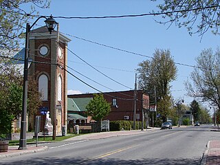
Prescott is a town on the north shore of the Saint Lawrence River in province of Ontario, Canada. The town is a part of the United Counties of Leeds and Grenville. In 2021, it had a population of 4,078. The Ogdensburg–Prescott International Bridge, 5 kilometres (3.1 mi) east of Prescott at Johnstown, crosses the Canada–United States border and connects the town with the city of Ogdensburg, New York.
Riverview is a neighbourhood in Ottawa, Ontario, Canada. It is southeast of the downtown adjacent to the Rideau River, its location on which is its namesake. The 2021 Census population of Riverview is 13,113.
Westboro is an area in the west end of Ottawa, Ontario, Canada. Located along the Ottawa River, Island Park Drive defines Westboro's eastern border, while the Ottawa River defines its northern border. Under this definition, the population of the area is 22,725.
Carlsbad Springs is a rural community on Bear Brook in Cumberland Ward in Ottawa, Ontario, Canada; Prior to amalgamation in 2001, the community was on the border between Gloucester and Cumberland. According to the Canada 2011 Census, the population of the surrounding area is 916.

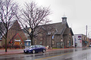
Tillsonburg is a town in Oxford County, Ontario, Canada with a population of 18,615 located about 50 kilometres southeast of London, on Highway 3 at the junction of Highway 19.

The United Counties of Prescott and Russell is a county located in the Canadian province of Ontario. Its county seat is L'Orignal. It is located in Eastern Ontario, in the wedge-shaped area between the Ottawa River and St. Lawrence River, approximately 55 kilometres (34 mi) east of the City of Ottawa.
Cumberland is a former municipality and now geographic township in eastern Ontario, Canada. It was an incorporated township from 1800 to 1999, when it was incorporated as the City of Cumberland, then ceased to be a separate municipality in 2001, when it was amalgamated into the city of Ottawa. It now exists only as a geographic township.
Russell Road is an arterial road in Eastern Ontario, Canada. It begins in Ottawa in the Riverview neighbourhood and runs eastward through the rural communities of Ramsayville, Carlsbad Springs and Bearbrook in Ottawa and through the Municipality of Clarence-Rockland, connecting the communities of Cheney and Bourget, ending at Boundary Road on the eastern border of Clarence Rockland. In Ottawa it is officially Ottawa Road #26, and in Clarence-Rockland as United Counties of Prescott and Russell County Road #2.

Embrun, is a community in the Canadian province of Ontario in the Eastern Ontario region. Embrun is also part of the National Capital Region. Embrun is part of the larger Russell Township in Prescott and Russell United Counties. In 2011, the urban area of Embrun had a total population of 6,380, but if surrounding agricultural areas closely tied to the community are included, the population figure rises to 8,669. This makes Embrun the largest community in the Township of Russell.
Alta Vista is a neighbourhood in Alta Vista Ward in Ottawa, Ontario, Canada. Its boundaries according to the Alta Vista Community Association are that part of Alta Vista Ward south of Smyth Road in the north, north of Walkley Road and east of the Rideau River, and west of the "greenspace underneath Haig Drive". However, the name is ambiguous, as there are several sub-neighbourhoods in this area,, as the neighbourhood could refer to the ward as a whole, down to the core Alta Vista area,, centred on Alta Vista Drive.

Bells Corners is a suburban neighbourhood in Ottawa, Ontario, Canada. It is located along Robertson Road west of downtown, within Ottawa's western Greenbelt, in College Ward. As of the 2021 Canadian census, the community had a population of 9,385.

Minaki is an unincorporated area and community in Unorganized Kenora District in northwestern Ontario, Canada. It is located at the point where the Canadian National Railways transcontinental main line crosses the Winnipeg River, between Wade to the west and Ena Lake at the east, and was accessible only by rail until about 1960. It was a fuelling and watering point in the days of steam locomotives; now few trains stop in Minaki, though the thrice-weekly Via Rail transcontinental Canadian passenger trains will stop on request at the Minaki railway station.
Bear Brook is a small stream in the municipalities of Clarence-Rockland and The Nation, United Counties of Prescott and Russell, and the city of Ottawa in eastern Ontario, Canada. It forms in the fields and forests just north of Edwards, and flows in a mostly eastern direction to its mouth as a left tributary of the South Nation River.

Carlington is a neighbourhood located in River Ward in the west-end of Ottawa, Ontario, Canada.

Orléans South-Navan Ward is a city ward in Ottawa, Ontario represented on Ottawa City Council. It is located in the east end of the city, encompassing the southern portion of the Orleans subdivision and surrounding rural areas.
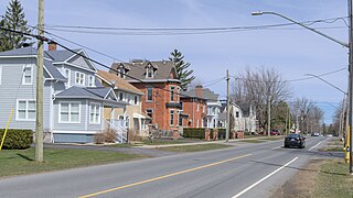
Morrisburg is an unincorporated community in the Municipality of South Dundas, located in Eastern Ontario, Canada. The population was 2,398 at the 2021 census.
Bayshore is a neighbourhood in Bay Ward in the west end of Ottawa, Ontario, Canada. Prior to amalgamation in 2001, the neighbourhood was in the City of Nepean. It is bounded east by row houses off Bayshore Drive, to the north Carling Avenue, to the west Holly Acres Drive and the Lakeview neighbourhood, and to the south Ontario Highway 417. The main street in Bayshore is Woodridge Crescent, while the Bayshore Station is the major bus transit station.

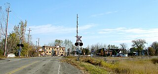
Bearbrook is a dispersed rural community in Cumberland Ward in the city of Ottawa, Ontario, Canada. It is named after the nearby small creek Bear Brook, a tributary of the South Nation River.


