
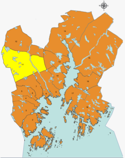
Kristiansand Region is a statistical metropolitan region in the counties of Vest-Agder and Aust-Agder in southern Norway. It is centered on the city of Kristiansand. The region consist of 6 municipalities in the centre of Southern Norway. Vennesla, Songdalen, and Birkenes are inland municipalities while Kristiansand, Søgne, and Lillesand are coastal municipalities. Kristiansand is the largest municipality in population in the region and Birkeland is the largest in area.

Southern Norway is the geographical region (landsdel) along the Skagerrak coast of southern Norway. The region is an informal description since it does not have any governmental function. It roughly corresponds to the old petty kingdom of Agder as well as the two present-day counties of Vest-Agder and Aust-Agder. The total combined area of Vest-Agder and Aust-Agder counties is 16,493 square kilometres (6,368 sq mi). The name is relatively new, having first been used in Norway around 1900.

The Otra is the largest river in the Sørlandet region of Norway. It begins in Setesdalsheiene mountains at the lake Breidvatnet in Bykle municipality in Aust-Agder county, just south of the border with Vinje municipality in Telemark county. The river then flows south through Bykle, Valle, Bygland, Evje og Hornnes, and Iveland municipalities in Aust-Agder before passing into Vest-Agder county and flowing through Vennesla and Kristiansand municipalities. The river empties into the Skagerrak in the center of the city of Kristiansand on the southern coast of Norway.
Strai is a village and a district in the municipality of Kristiansand in Vest-Agder, Norway. It is located in the borough of Grim. Its population (2014) is about 1,000. The district of Mosby lies to the north, the districts of Lund, Kvadraturen, and Grim are located to the south, and the municipality of Songdalen lies to the west.

Mosby is a village and district in the Torridal valley in Kristiansand municipality in Vest-Agder county, Norway. The village lies along the river Otra, between the villages of Aukland and Strai and the municipal border with Vennesla to the north.

Norwegian National Road 41 is a Norwegian national road that runs through Telemark, Aust-Agder, and Vest-Agder counties in Norway. The road runs between the village of Brunkeberg in Kviteseid municipality in Telemark county in the north and Timenes in Hånes in the city of Kristiansand in Vest-Agder county in the south. The 172.9-kilometre (107.4 mi) long road connects to the European route E134 highway in the north and to the European route E18 highway in the south. The road runs for 12.5 kilometres (7.8 mi) in Vest-Agder county, 89 kilometres (55 mi) in Aust-Agder county, and 71.4 kilometres (44.4 mi) in Telemark county. The southern half of the road runs along the river Tovdalselva and the lake Herefossfjorden, and it is located in a fault zone called the Kristiansand-Porsgrunn grabenen.

Vollevannet is a freshwater is a lake in the municipality of Kristiansand in Vest-Agder county, Norway. The 0.15-square-kilometre (37-acre) lies in the district of Gimlekollen in the borough of Lund, and the surrounding residential area is also called Vollevannet. The lake lies along the European route E18 highway at the exit for the Vest-Agder Museum Kristiansand and Ålefjær. Historically, the lake was used as a reservoir for the city's drinking water. The lake is held back by two dams, and there is a small, sandy beach at the northeast end of the lake. The lake has perch in it.

Torridal is a V-shaped valley in the municipalities of Kristiansand and Vennesla in Vest-Agder county, Norway. The area was historically a part of the former Oddernes municipality and today it includes areas north of the city center of Kristiansand on both riverbanks of the river Otra. The local name Torridalselva is commonly used for the river's lower course from Mosby to the sea.

Lund is a borough and district in the city of Kristiansand in Vest-Agder county, Norway. It is the second largest borough in the city after Vågsbygd. In 2015, the population was about 30,000. Lund is divided into 4 districts: Lund (centrum), Gimlekollen, Justvik, and Ålefjær.

Møvik or Møvig is a neighbourhood in the city of Kristiansand in Vest-Agder county, Norway. The neighborhood is located in the borough of Vågsbygd and in the district of Voiebyen. It's located in the southeast part of the borough along the shore. It lies north of Spinneren and Krooden, southwest of Ternevig, and south of Voie.
Voie is a neighbourhood in the city of Kristiansand in Vest-Agder county, Norway. The neighborhood is located in the borough of Vågsbygd and in the district of Voiebyen. Voie lies along Norwegian County Road 456 and County Road 457. The only road to the island of Andøya goes past the neighborhood of Voie. It lies northwest of Møvik and northeast of Steindalen.

Kjøita or Kjøita Park is a neighbourhood in the city of Kristiansand in Vest-Agder county, Norway. It's located along the eastern shore of the Otra river in the borough of Lund. The neighborhood of Oddemarka lies to the east, Gimle lies to the north, and the centre of Lund lies to the southeast. Kjøita Park is an industrial park.

Gimle is a neighbourhood in the city of Kristiansand in Vest-Agder county, Norway. It's located in the borough of Lund. It is located near the neighborhoods of Oddemarka and Presteheia. The neighborhood of Kjøita lies to the southwest and the neighborhood of Marvika lies to the southeast.

Gillsvannet or Gjelsvannet is a freshwater lake in the municipality of Kristiansand in Vest-Agder county, Norway. The 1.05-square-kilometre (260-acre) lake is located about 5 kilometres (3.1 mi) northeast of downtown Kristiansand, along to County Road 452. The lake lies about 300 metres (980 ft) west of the Topdalsfjorden, at an elevation of about 1 metre above sea level. There is a practice range for kayaking on the lake as well as many areas used for swimming during the summer season. The Gimlekollen district lies on the southern shore of the lake and the village of Justvik lies just north of the lake.

Mandal is the administrative centre of Mandal municipality in Vest-Agder county, Norway. It is the second largest town by population in Vest-Agder county after Kristiansand and the fourth largest town in the Sørlandet/Agder region. The town is located at the mouth of the river Mandalselva at the southern end of the Mandalen valley. The 6.32-square-kilometre (1,560-acre) town has a population (2015) of 10,725 which gives the town a population density of 1,697 inhabitants per square kilometre (4,400/sq mi).
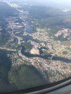
Vennesla is the administrative centre of Vennesla municipality in Vest-Agder county, Norway. The village is located in the upper Torridal valley along the river Otra, about 15 kilometres (9.3 mi) north of the city of Kristiansand. The village itself extends for about 10 kilometres (6.2 mi) along both sides of the river. The Norwegian National Road 9 passes through Mosby, about 6 kilometres (3.7 mi) south of Vennesla. The Sørlandsbanen railway line passes through Vennesla, stopping at Vennesla Station. The lake Venneslafjorden is located on the river Otra in the northern part of the village of Vennesla.

Torridal Church is a parish church in Kristiansand municipality in Vest-Agder county, Norway. It is located in the village of Aukland, just south of the village of Mosby and just north of the village of Strai, on the west shore of the river Otra. The church is part of the Torridal parish in the Kristiansand arch-deanery in the Diocese of Agder og Telemark. The white church was built in 1978 using expanded clay aggregate. It seats about 215 people.


