Ararat is a province (marz) of Armenia. Its capital and largest city is the town of Artashat.

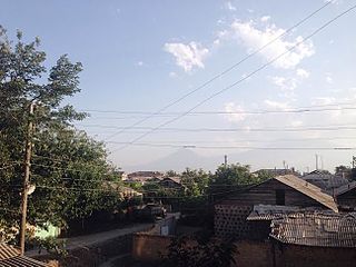
Vedi is a town and urban municipal community in the Vedi Municipality of the Ararat Province of Armenia, located along the Vedi River, 35 kilometres south of the capital Yerevan, and 18 kilometres southeast of the provincial centre Artashat. According to the 2011 census, the population of the town was 11,384. As per the 2016 official estimate, Vedi has a population of around 10,600. According to the 2022 census, the population of the town was 11,066.
Aralez is a village in the Vedi Municipality of the Ararat Province of Armenia.
Pokr Vedi is a village in the Vedi Municipality of the Ararat Province of Armenia.
Taperakan is a village in the Vedi Municipality of the Ararat Province of Armenia. The village used to be named for Sergey Kirov, an early Bolshevik leader.
Urtsadzor is a village in the Vedi Municipality of the Ararat Province of Armenia containing the former village of Chimankend. The village was previously the administrative capital of the Gharabaghlar District which existed in 1937–1951 in Soviet Armenia before being reattached to the Ararat Province.

Vanashen is a village in the Vedi Municipality of the Ararat Province of Armenia. Before 1978, it was known as Taytan.

Vosketap is a village in the Vedi Municipality of the Ararat Province of Armenia. The town's local Azerbaijanis moved following the outbreak of the Nagorno-Karabakh conflict. In 1988-1989 Armenian refugees from Azerbaijan settled in the village.

Dashtakar is a village in the Vedi Municipality of the Ararat Province of Armenia.

Lanjanist is a village in the Vedi Municipality of the Ararat Province of Armenia.
Lusashogh is a village in the Vedi Municipality of the Ararat Province of Armenia.
Nor Kyank is a village in the Vedi Municipality of the Ararat Province of Armenia.

Shaghap is a village in the Vedi Municipality of the Ararat Province of Armenia.
Sisavan is a village in the Vedi Municipality of the Ararat Province of Armenia.
Yeghegnavan is a village in the Vedi Municipality of the Ararat Province of Armenia, near the Armenia–Turkey border. The village was populated by Azerbaijanis before the exodus of Azerbaijanis from Armenia after the outbreak of the Nagorno-Karabakh conflict.
Goravan, is a village in the Vedi Municipality of the Ararat Province of Armenia, just south of the Vedi river, which separates the town of Vedi from Goravan.
Nor Ughi is a village in the Vedi Municipality of the Ararat Province of Armenia. It literally means new way in Armenian. It was developed around the Vedi Wine Factory operating since 1956.
Ginevet is a village in the Vedi Municipality of the Ararat Province of Armenia.

Kirwin Reservoir is a reservoir in Phillips County, Kansas, United States. It is located next to the city of Kirwin in northern Kansas. The U.S. Bureau of Reclamation built it and continues to operate it for the purposes of flood control and area irrigation. The Kirwin National Wildlife Refuge lies on its shores.
Vedi Alco, is one of the leading producers of alcoholic drinks in Armenia, located in the village of Ginevet of Ararat Province. It was founded in 1956 as the Vedi Wine Factory by the government of the Armenian SSR, named after the Vedi raion of Soviet Armenia. The grapes processed by Vedi Alco are mainly from the Ararat plain as well as the Areni and Getap region of Vayots Dzor.
