
Porur is a neighbourhood of Chennai, India. It is situated in the Maduravoyal taluk of Chennai district in the southern part of the city. Since 2011, it has been a part of the Chennai Corporation and included in zone number 11.
Alanthurai is a Town in Coimbatore district in the state of Tamil Nadu, India. It falls under Perur taluk. It is a western suburb of Coimbatore, which comes under the Coimbatore South Revenue Division.located between Madavarayapuram and Pooluvapatti.
Chettipalayam is a suburb of Coimbatore city in Tamil Nadu, India. The place and its vicinity is also home to Kari Motor Speedway, the LOTUS and the Coimbatore Golf Club. It is located 17 km away from Coimbatore Junction. There is also a railway station in Podanur nearby. It is a Town Panchayat and not within the Coimbatore Corporation limits.

Desur is a Town panchayat in Tiruvanamalai district in the Indian state of Tamil Nadu.
Dhaliyur is a panchayat town in Coimbatore district in the state of Tamil Nadu, India. Dhaliyur is a western suburb of Coimbatore city. It lies close to Kerala State border. It is located near the Western Ghats.
Kannampalayam is a suburb of Coimbatore, in the Indian state of Tamil Nadu. Kannampalayam is a Town Panchayat.
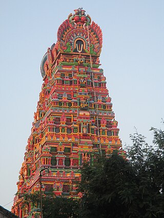
Karamadai is a town located near Mettupalayam, in the Indian state of Tamil Nadu. It is located on Coimbatore - Ooty NH 67. Nearby places are Teachers colony, Press Colony, Jodhipuram and Periyanaickenpalayam. The Ranganathaswamy temple and Nanjundeswarar temple are the most prominent landmarks in the town. The place of Karamadai came into limelight due to the presence of ex-steel giant Sri Ramakrishna Steel Industries.
Kinathukadavu, meaning Pass of the Well, is a town panchayat suburb of Coimbatore city and taluk in Coimbatore district in the Indian state of Tamil Nadu. It is along the National Highway 209 and is 23 kilometres (14 mi) from Gandhipuram heart of Coimbatore city and 20.5 kilometres (13 mi) from Pollachi town.

Madukkarai is a suburb of Coimbatore city in the Indian state of Tamil Nadu. It is the gateway to Coimbatore city from Kerala State and is located around 12 km from the Kerala border. The Coimbatore International Airport is about 27 km from here. It is the administrative centre for Madukkarai taluk.
Mopperipalayam is a panchayat town in Coimbatore district in the Indian state of Tamil Nadu.
Nallur (Nalloor) is a panchayat town in Kanniyakumari district in the Indian state of Tamil Nadu.
Odayakulam is a panchayat town in Coimbatore district in the Indian state of Tamil Nadu.
Pooluvapatti is a panchayat town in Coimbatore district in the Indian state of Tamil Nadu. It is a western suburb of Coimbatore and lies close to Kerala border. Pooluvapatti comes under Coimbatore Municipal Corporation.
Thirumalayampalayam is a panchayat town in Coimbatore district in the Indian state of Tamil Nadu. It is an important suburb of Coimbatore.
Thondamuthur is a suburb of Coimbatore city in the Indian state of Tamil Nadu. It comes under the Coimbatore Corporation. Thondamuthur is located 15 km west from the District headquarters Coimbatore, there are three routes available to reach Thondamuthur, through Vadavalli (15 km), through Perur (15 km), through Gandhi park, Vedapatti (14 km). Thondamuthur is the residential area. There is very high rise in population due to the development of many residential plots, apartments and many people reside here because the place is well connected with city centre through many routes and they can easily commute daily from Thondamuthur. The climate of Thondamuthur is very pleasant, low pollution, and many tourist spots like kovai Kutralam, Velliangiri hills, Isha Foundation, Siruvani hills, Vaidehi falls are situated near Thondamuthur. People can taste World's second tastiest water Siruvani here.
Vedapatti is a suburb of Coimbatore in the Indian state of Tamil Nadu. It is the western suburb of Coimbatore, which was included with the Coimbatore Corporation limits in 2011.
Veerakeralam is within the corporation limits of Coimbatore city in the Indian state of Tamil Nadu. It lies on extreme part of westside of the city.
Keeranur is a panchayat town in Pudukkottai District in the Indian state of Tamil Nadu. It is located 225 km South-East of Coimbatore. The Uthama Nathaswami Sivan Temple is of a Mutharaya edifice and contains epigraphs of Cholas and Vijayanagar Empires.

Veerapandi is a panchayat gram in Theni district in the Indian state of Tamil Nadu.
Vellakinar is one of the localities of the Coimbatore city in Tamil Nadu, India. Vellakinar is located on the stretch of Mettupalayam road in Coimbatore. Neighbouring places of Vellakinar are Thudiyalur, Goundampalayam, GN Mills(Gnanambikai Mills). Tamil Nadu Housing Board colony, Sreevatsa Gardens, Samathuvapuram and Meenakshi Gardens, Coimbatore are main residential areas in Vellakinar panchayat. Vellakinar was added to the Coimbatore municipal corporation.
