The Hardangerfjord is the fourth longest fjord in the world, and the second longest fjord in Norway. It is located in Hordaland county in the Hardanger region. The fjord stretches 179 kilometres (111 mi) from the Atlantic Ocean into the mountainous interior of Norway along the Hardangervidda plateau. The innermost point of the fjord reaches the town of Odda.
Utne is a village in Ullensvang municipality in the Hardanger region of Hordaland county, Norway. The village is located on the northern end of the Folgefonn Peninsula, at the confluence of the Sørfjorden and Hardangerfjorden. The village is the site of Utne Church. The village of Alsåker lies about 10 kilometres (6.2 mi) to the west on the northern shore of the peninsula and the village of Vikebygd lies about 20 kilometres (12 mi) to the south along the eastern shore of the peninsula.

The Ranfjorden is a fjord in the Helgeland district of Nordland county, Norway. The largest part of the fjord is in the municipality of Rana, but the fjord also passes through the municipalities of Hemnes, Vefsn, Leirfjord, Nesna, and Dønna. The river Ranelva meets the Ranfjord in at the town of Mo i Rana at the innermost part of the fjord. It then flows to the west for about 68 kilometres (42 mi) to where it meets the sea along the border of Dønna and Nesna municipalities.
Osterfjorden is a fjord in Hordaland county, Norway. The fjord is one of three fjords surrounding the island of Osterøy. The fjord runs along the municipal border of Lindås and Osterøy municipalities. The fjord begins at the Romarheimsfjorden and flows to the west for 27 kilometres (17 mi) before ending near the village of Knarvik at the confluence of four fjords: Osterfjorden, Radfjorden, Sørfjorden, and Salhusfjorden. The Osterfjorden is generally about 1 to 3 kilometres wide and the deepest point in the fjord reaches a depth of 639 metres (2,096 ft) below sea level.
Sørfjorden is a 30-kilometre (19 mi) long fjord in Hordaland county, Norway. The fjord flows around the west and south sides of the island of Osterøy, going through the municipalities of Osterøy, Bergen, and Vaksdal. The fjord begins at the village of Vaksdal where the Veafjorden flows into the Sørfjorden, it then heads west and then north before emptying into the Osterfjorden. The fjord flows past the following villages: Bruvik, Vaksdal, Hausvik, Garnes, Ytre Arna, Hylkje, Breistein, Valestrandfossen, Steinstø and Hamre.
Sørfjorden or Sørfjord is the name of several fjords on the coast of Norway.
Osterøy is an island situated northeast of the city of Bergen in Hordaland county, Norway. With a total area of 328 square kilometres (127 sq mi), it is the largest Norwegian island not located directly adjacent to the ocean, and the second largest such island in Northern Europe. Osterøy is covered by two municipalities: the majority by Osterøy municipality, and the rest by Vaksdal municipality. The vast majority of the island's population lives in Osterøy municipality.

Sørfjorden is a fjord on the island of Stjernøya in Hasvik Municipality in Finnmark county, Norway. The 4.5-kilometre (2.8 mi) long fjord begins between Roren in the west and Nordnes in the east. The fjord goes directly southeast to the Nerdalen valley at the end of the fjord. Sørfjorden is the westernmost of the fjords on Stjernøya. There are several isolated farms along the fjord. The fjord flows out into the Sørøysundet strait.

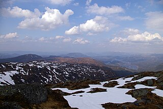
Sørfjorden is a 38-kilometre (24 mi) long fjord that is one of the innermost branches of the main Hardangerfjorden in Hordaland county, Norway. It is the longest arm that branches off of the Hardangerfjord. Sørfjorden stretches from just north of the village of Kinsarvik straight south to the industrial town of Odda. The Folgefonna glacier and Folgefonna National Park are located just to the west of the fjord and the Hardangervidda mountain plateau lies to its east.

Austfjorden is a fjord in Hordaland county, Norway. The 20-kilometre (12 mi) long fjord runs along the border between the municipalities of Lindås and Masfjorden. It starts in Lindås and extends to the northwest. The Masfjorden joins the Austfjorden from the north, and then the Austfjorden empties into the Fensfjorden before reaching the open sea near Fedje. The Austfjorden is the innermost arm of the Fensfjorden. The village of Knarrviki and the Mongstad industrial area lie on the western shore of the Austfjorden. The village of Myking lies on the western shore of the fjord, near the innermost part of the fjord.

The Hemnfjorden is a fjord in Trøndelag county in Norway. The 25-kilometre (16 mi) long fjord forms the boundary between the municipalities of Hemne and Snillfjord. The fjord begins at the village of Kyrksæterøra at the mouths of the rivers Søo and Haugaelva. The fjord flows northwards until it joins the Trondheimsleia. The Åstfjorden and Snillfjorden are smaller fjords which branch off the main Hemnfjorden to the east into Snillfjord municipality. The deepest point in the fjord reaches 410 metres (1,350 ft) below sea level.
Salhusfjorden is a 4-kilometer (2.5 mi) long fjord and sound between the municipalities of Bergen and Meland in Hordaland county, Norway. To the west, it starts between Salhus and Frekhaug, where the Byfjorden meets the Herdlefjorden. To the east, the fjord ends between Knarvik and Hordvikneset, where the Osterfjorden runs northeast, the Sørfjorden runs southeast, and the Radfjorden runs north. The fjord is up to 500 meters (1,600 ft) deep. It acts as one of the borders between the districts of Midhordland to the south and Nordhordland to the north. The islands of Holsnøy and Flatøy lie along the northern side of the fjord.
Bindalsfjorden is a fjord in the southern part of Nordland county, Norway. The fjord is mostly located in the municipality of Bindal with a small part in neighboring Sømna municipality. The 71-kilometre (44 mi) long fjord begins near the villages of Terråk and Vassås where the Sørfjorden and Tosenfjorden join together. It then flows northwest past Bindalseidet and then southwest past the village of Holm before the mouth of the fjord by the island of Austra.

Melfjorden is a fjord in the municipality of Rødøy in Nordland county, Norway. It is located on the Arctic Circle. The 33-kilometre (21 mi) long fjord goes from the village of Melfjordbotn in the east to its mouth in the Rødøyfjorden near the island of Rangsundøya. There are two fjord arms that branch off the main fjord: Nordfjorden flows to the north into the Saltfjellet–Svartisen National Park and Sørfjorden to the south past the villages of Sørfjorden and Kilboghavn.

Ullsfjorden (Norwegian) or Moskavuotna (Northern Sami) is a fjord in Troms county, Norway. The fjord runs through the municipalities of Tromsø, Karlsøy, and Lyngen. The 75-kilometre (47 mi) fjord flows from the village of Sjøvassbotn northwards along the west side of the Lyngen Peninsula. The Kjosen fjord branches off to the east side and the Grøtsundet strait branches off to the west. The islands of Reinøya and Karlsøya lie along the western side of the fjord. The southern part of the Ullsfjorden is also known as Sørfjorden. The area surrounding the Ullsfjorden was part of the municipality of Ullsfjord for about 60 years during the 20th century.

Lyngen is a fjord in Troms county, Norway. The 82-kilometre (51 mi) long fjord is the longest fjord in Troms county and it is often used as the dividing line between "northern Troms" and "southern Troms". The fjord is located within the municipalities of Skjervøy, Nordreisa, Lyngen, Gáivuotna–Kåfjord, and Storfjord. It stretches from the village of Hatteng in Storfjord Municipality in the south all the way north to the islands of Skjervøy Municipality. The Lyngen Alps lie along the western shore of the fjord and the European route E06 highway runs along the eastern shore. The Kåfjorden branches off of the main fjord on the east side, and the southernmost part of the fjord is also known as the Storfjorden.

Bruvik is a village in Osterøy municipality in Hordaland county, Norway. The village is located on the southern shore of the island of Osterøy, along the Sørfjorden. It sits about 13 kilometres (8.1 mi) east of the village of Hausvik and about 3 kilometres (1.9 mi) across the fjord from the village of Vaksdal.

Vikebygd is a village area in the municipality of Ullensvang in Hordaland county, Norway. The village area is actually made up of the conurbation of the smaller villages of Bleie and Nå. The village area lies on the western shore of the Sørfjorden, across from the village of Sekse. The village is built on the steep mountainsides that line the sides of the fjord. The Folgefonna National Park and the Folgefonna glacier both lie just to the southwest of the village. The village area is dominated by fruit farms and orchards.

Søndeledfjorden is a fjord in Risør municipality in Aust-Agder county, Norway. The 15-kilometre (9.3 mi) long fjord begins at the village of Søndeled and flows east into the Skaggerak. The large island of Barmen sits in the middle of the fjord, effectively separating it into two fjords known as the Nordfjorden in the north and the Sørfjorden in the south. At the western end of Barmen, the Nordfjorden and Sørfjorden reconnect in an area known as the Rødsfjorden. There are many islands at the mouth of the fjord as well as in the fjord itself.

The Eid Fjord is the innermost part of the Hardanger Fjord in Norway. It extends 29 kilometers (18 mi) eastwards from the Utne Fjord and Sørfjorden. The Eid Fjord lies in the municipalities of Ullensvang, Ulvik, and Eidfjord in Hordaland county.