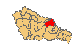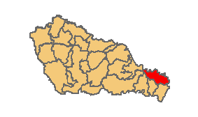
Novi Marof is a town in north-western Croatia, located south of Varaždin and east of Ivanec, in Varaždin County. It lies on the intersection of state roads D3 and D24 and is also connected with highway A4, state road D22 and R201 railway.

Ivanić-Grad or Ivanić Grad is a town in Zagreb County, Croatia. It is on the border of Moslavina and Posavina.

Cestica is a village and municipality in Croatia in Varaždin County.
Visoko is a village and municipality in Croatia in Varaždin County. In the 2011 census, the total population of the municipality was 1,518, in the following settlements:
Koprivnički Bregi is a municipality in the Koprivnica-Križevci County in Croatia. According to the 2011 census, there are 2,381 inhabitants in the area, with Croats forming an absolute majority.

Domašinec is a village and municipality in Međimurje County, Croatia. It is located around 14 kilometres east of Čakovec, the seat and largest city of Međimurje County, and close to the Mura River and border with Hungary.

Donji Kraljevec is a village and municipality in Međimurje County, Croatia.

Goričan is a municipality in Međimurje County, Croatia.

Kotoriba is a village and municipality in Međimurje County, in northern Croatia.

Podturen is a village and a municipality in Međimurje County, Croatia. The population of the municipality in the 2011 census was 3,873. The majority of the population are Croats.

Orehovica is a village and municipality in Međimurje County, Croatia. There are three villages in the municipality – Orehovica, Podbrest and Vularija.

Konjščina is a village and municipality in Krapina-Zagorje County in Croatia. The city is about 30 km northeast of Zagreb. According to the 2011 census, there are 3,790 inhabitants in the area, absolute majority which are Croats. It is connected by the D24 highway and R201 railway.
Bojnikovec is a village in Croatia. It is connected by the D41 highway.
Valentinovo is a village in Croatia. It is connected by the D206 highway.
Gornje Orešje is a settlement (naselje) in the Sveti Ivan Zelina administrative territory of Zagreb County, Croatia. As of 2011 it had a population of 251 people.
Radoišće is a settlement (naselje) in the Sveti Ivan Zelina administrative territory of Zagreb County, Croatia. As of 2011 it had a population of 250 people.
Tomaševec is a settlement (naselje) in the Sveti Ivan Zelina administrative territory of Zagreb County, Croatia. As of 2011 it had a population of 198 people.
Zadrkovec is a settlement (naselje) in the Sveti Ivan Zelina administrative territory of Zagreb County, Croatia. As of 2011 it had a population of 214 people.
Zrinšćina is a settlement (naselje) in the Sveti Ivan Zelina administrative territory of Zagreb County, Croatia. As of 2011 it had a population of 126 people.


