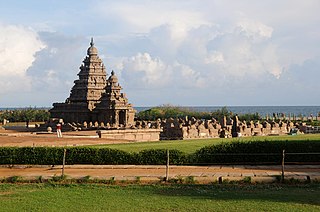
Tamil Nadu is the southernmost state of India. The tenth largest Indian state by area and the sixth largest by population, Tamil Nadu is the home of the Tamil people, who speak the Tamil language—the state's official language and one of the longest surviving classical languages of the world. The capital and largest city is Chennai.

Madurai formerly known as Madura, is a major city in the Indian state of Tamil Nadu. It is the cultural capital of Tamil Nadu and the administrative headquarters of Madurai District, which is governed by the Madurai Municipal Corporation established on 1 November 1866. As of the 2011 census, it is the third largest metropolis in Tamil Nadu after Chennai and Coimbatore in terms of population and 27th largest urban agglomeration in India. Located on the banks of River Vaigai, Madurai has been a major settlement for two millennia and has a documented history of more than 2500 years. It is often referred to as "Thoongatha Nagaram", meaning "the city that never sleeps".

Coimbatore, also known as Kovai, is one of the major metropolitan cities in the Indian state of Tamil Nadu. It is located on the banks of the Noyyal River and surrounded by the Western Ghats. Coimbatore is the second largest city in Tamil Nadu after Chennai in terms of population and the 16th largest urban agglomeration in India as per the census 2011. It is the administrative capital of Coimbatore District and is administered by the Coimbatore Municipal Corporation which was established in 1981.

Salem, natively spelt as Selam, is a major city in Salem district, located on the banks of the Thirumanimutharu river in the Indian state of Tamil Nadu surrounded by mountains. Salem is the fifth largest urban agglomeration in the state, exceeded by Chennai, Coimbatore, Madurai, Tiruchirappalli, and Third largest metropolitan region in the state only after to Chennai and Coimbatore metropolitan regions. The city is 124 km2 (48 sq mi) large.

Erode District is one of the 38 districts in the south Indian state of Tamil Nadu. It was the largest district by area in the state before the formation of Tirupur district in 2009 and is the third largest by area, as of 2024. The headquarters of the district is Erode. The district is divided into two revenue divisions, Erode and Gobichettipalayam, and is further subdivided into 10 taluks.

Erode, is a city in the Indian state of Tamil Nadu. It is located on the banks of the Kaveri river and is surrounded by the Western Ghats. Erode is the seventh largest urban agglomeration in Tamil Nadu. It is the administrative capital of Erode district and is administered by the Erode Municipal Corporation which was established in 2008.
Thuvakudi is a Municipality in Tiruchirapalli district in the Indian state of Tamil Nadu. It is an industrial town housing more than 250 industries and is located in the National Highway NH 65 between Tiruchirapalli and Thanjavur. The town has a dry weather, making it suitable for dry crops like cotton, chillies and millets..

Vellore district is one of the 38 districts in the Tamil Nadu state of India. It is one of the eleven districts that form the north region of Tamil Nadu. Vellore city is the headquarters of this district. As of 2011, the district had a population of 1,614,242 with a sex ratio of 1,007 females for every 1,000 males. In 2017 Vellore district ranked eleventh in list of districts in Tamil Nadu by Human Development Index.
Thoothukudi District is one of the 38 districts of Tamil Nadu state in southern India. The district was formed by bifurcation of Tirunelveli district on 20 October 1986. Thoothukudi is the district headquarters and largest city of the district. The district is known for fishing as well as pearl cultivation, with an abundance of pearls being found in the seas offshore. Thoothukudi district has many historical sites such as Adichanallur and the ancient trade port of Korkai.

Kulithalai is a municipality in Karur district & Sub-urb of Tiruchirapalli City in the Indian state of Tamil Nadu. The recorded history of Kulithalai is known from Cheras, followed by medieval Chola period of the 9th century and has been ruled, at different times, by the Medieval Cholas, Later Cholas, Later Pandyas, Vijayanagar Empire and the British.

Sirkazhi, also spelled as Sirkali and Siyali, is a municipal town in Mayiladuthurai district in Tamil Nadu, India. It is located 13 km (8.1 mi) from the coast of the Bay of Bengal, and 250 km (160 mi) from the state capital Chennai. Sirkazhi was a part of Thanjavur district until 1991 and has later been part of Nagapattinam district. The town covers an area of 13.21 km2 (5.10 sq mi) and in 2011 had a population of 34,927. It is administered by a second grade municipality. Sirkazhi is part of the Cauvery delta region and agriculture is the major occupation. Roads are the main means of transportation; the town has 51.47 km (31.98 mi) of district roads, including a national highway.

At the 2011 Census of India, the population of the state of Tamil Nadu was 72,147,039, increasing from 62.4 million in 2001. There were 36,137,975 males and 36,009,064 females, with a sex ratio of 996 females per 1000 males. Its literacy rate was 80.09%. 10.51% of the population was below seven years old, and it had a population density of 555.
Kulamangalam is a village in the Madurai-North taluk of Madurai district, Tamil Nadu, India.
Sangagiri taluk is a taluk of Salem district of the Indian state of Tamil Nadu. The headquarters of the taluk is the town of Sangagiri. Sangagiri Fort is one of the tourist spots of this taluk
Musiri taluk is a taluk of Tiruchirapalli district of the Indian state of Tamil Nadu. The headquarters of the taluk is the town of Musiri.
Devanur is a village in the Andimadam taluk of Ariyalur district, Tamil Nadu, India.
Koollu is a village in the Hosur taluk of Krishnagiri district, Tamil Nadu, India.
Kurubarapalli is a village in the Hosur taluk of Krishnagiri district, Tamil Nadu, India. A census of 2011, it had a population of 5,354 residents.

Tiruppur or Tirupur ( ), is a city in the Indian state of Tamil Nadu. It is located on the banks of the Noyyal river and is the fifth largest urban agglomeration in Tamil Nadu. It is the administrative capital of Tiruppur district and is administered by the Tiruppur Municipal Corporation which was established in 2008.

Tiruvannamalai is a city, a spiritual, cultural, economic hub and also the administrative headquarters of Tiruvannamalai District in the Indian state of Tamil Nadu. The city is home to the renowned Annamalaiyar temple, Annamalai hill, Girivalam and the Karthigai Deepam festival and a prominent pilgrimage destination.
