
The Financial District of Lower Manhattan, also known as FiDi, is a neighborhood located on the southern tip of Manhattan island in New York City. It is bounded by the West Side Highway on the west, Chambers Street and City Hall Park on the north, Brooklyn Bridge on the northeast, the East River to the southeast, and South Ferry and the Battery on the south.

The National Register of Historic Places in the United States is a register including buildings, sites, structures, districts, and objects. The Register automatically includes all National Historic Landmarks as well as all historic areas administered by the U.S. National Park Service. Since its introduction in 1966, more than 90,000 separate listings have been added to the register.
This is a list of properties and districts in the District of Columbia on the National Register of Historic Places. There are more than 600 listings, including 74 National Historic Landmarks of the United States and another 13 places otherwise designated as historic sites of national importance by Congress or the President.

This is a list of the properties and historic districts in each of the 46 counties of South Carolina that are designated National Register of Historic Places.

Ohio Drive is a street in Southwest Washington, D.C., located in East and West Potomac Parks and bordering the Tidal Basin, Washington Channel, and the Potomac River. It is a central organizing feature of East Potomac Park, providing the only major vehicular route to and through the area. Unlike most roadways named after states in the District of Columbia, Ohio Drive is not an avenue, nor it is heavily used like Wisconsin or Rhode Island Avenues. However, the segment from Independence Avenue to the Rock Creek and Potomac Parkway is an important commuter route.

The Downtown Miami Historic District is a U.S. historic district located in the Central Business District of Downtown Miami, Florida.
The Twin Mounds Archeological District, also known as Wekiva 7 (8Or457) & Wekiva 8 (8Or459), is a U.S. historic district east of Sorrento, Florida.
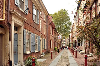
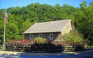
Historic districts in the United States are designated historic districts recognizing a group of buildings, properties, or sites by one of several entities on different levels as historically or architecturally significant. Buildings, structures, objects and sites within a historic district are normally divided into two categories, contributing and non-contributing. Districts greatly vary in size: some have hundreds of structures, while others have just a few.

In the law regulating historic districts in the United States, a contributing property or contributing resource is any building, object, or structure which adds to the historical integrity or architectural qualities that make the historic district significant. Government agencies, at the state, national, and local level in the United States, have differing definitions of what constitutes a contributing property but there are common characteristics. Local laws often regulate the changes that can be made to contributing structures within designated historic districts. The first local ordinances dealing with the alteration of buildings within historic districts was passed in Charleston, South Carolina in 1931.
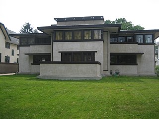
The Frank Lloyd Wright/Prairie School of Architecture Historic District is a residential neighborhood in the Cook County, Illinois village of Oak Park, United States. The Frank Lloyd Wright Historic District is both a federally designated historic district listed on the U.S. National Register of Historic Places and a local historic district within the village of Oak Park. The districts have differing boundaries and contributing properties, over 20 of which were designed by Frank Lloyd Wright, widely regarded as the greatest American architect.

Evergreen Historic District is one of the oldest neighborhoods in Memphis, Tennessee.

The Virginia Park Historic District is located on the north side of New Center, an area in Detroit, Michigan, along both sides of Virginia Park Street from Woodward Avenue to the John C. Lodge Freeway access road. The district was listed on the National Register of Historic Places in 1982.

The U.S. Capitol Gatehouses and Gateposts — designed circa 1827 by celebrated architect Charles Bulfinch — originally stood on the grounds of the United States Capitol in Washington, D.C. Two of the gatehouses are listed on the National Register of Historic Places in their new locations.

There are 73 properties listed on the National Register of Historic Places in Albany, New York, United States. Six are additionally designated as National Historic Landmarks (NHLs), the most of any city in the state after New York City. Another 14 are historic districts, for which 20 of the listings are also contributing properties. Two properties, both buildings, that had been listed in the past but have since been demolished have been delisted; one building that is also no longer extant remains listed.

This is a list of the National Register of Historic Places listings in Davenport, Iowa. This is intended to be a complete list of the properties and districts on the National Register of Historic Places in Davenport, Iowa, United States. Latitude and longitude coordinates are provided for many National Register properties and districts; these locations may be seen together in an online map.

The West Line Historic District is a residential community in central Austin, Texas, United States. The district encompasses an approximately 90-block tract of land located west of downtown. Bounded by Baylor Street to the east, Fifth Street to the south, Thirteenth Street to the north and Texas State Highway Loop 1 to the west. It is located south of the Old West Austin Historic District and southeast of the Clarksville Historic District.

Carl L. Linde was an American architect based in the Pacific Northwest of the United States, particularly in Portland, Oregon. Several of his works are listed on the National Register of Historic Places.

Castleton is the primary village and a census-designated place (CDP) in the town of Castleton, Rutland County, Vermont, United States. As of the 2020 census, it had a population of 1,337, out of 4,458 in the entire town. A large portion of the village is part of the Castleton Village Historic District, listed on the National Register of Historic Places in 1979. It is also home to Castleton University, founded in 1787, and now part of the Vermont State Colleges system.

Broad Street is a major thoroughfare in Central Ohio, predominantly in Franklin County and Columbus. It stretches east from West Jefferson at Little Darby Creek to Pataskala. The street is considered one of Columbus's two main roads, along with High Street.

High Street is a major thoroughfare in Central Ohio, predominantly in Franklin County and Columbus. It stretches from the northern border of Columbus in Delaware County south to the southern boundary of Franklin County just past Columbus's municipal boundaries. The street is considered one of Columbus's two main roads, along with Broad Street.


