Erode District is a district in the Kongu Nadu region of the state of Tamil Nadu, India. It was the largest district by area in the state before the formation of Tirupur District. The headquarters of the district is Erode. It is divided into two revenue divisions, Erode and Gobichettipalayam, and is further subdivided into 10 taluks. Periyar district was a part of Coimbatore District before its division into two on September 17, 1979 and was renamed as Erode District in 1996.It is consider to be a largest city by area in Tamilnadu covering above 8000 sq.km. As of 2011, the district had a population of 2,251,744 with a sex-ratio of 993 females for every 1,000 males, much above the national average of 929.

The Amaravati River is the longest tributary of Kaveri River in fertile the districts of Karur and Tirupur, Tamil Nadu state, South India.
Velagoundampatti is a place in Tamil Nadu, India. It is located on the state highway connecting the district headquarters, Namakkal with the other major town of this area, Thiruchengode. It is located along the State Highways SH-94 stretch, connecting Namakkal with Erode, Tirupur, Coimbatore. Velagoundampatti have two panjayath Aniyar and Marukalampatti.

Karur District is a district located very centrally along the Kaveri and Amaravathi rivers in the Indian state of Tamil Nadu. The main town in Karur District is the city of Karur, which is also the district headquarters. The district had a population of 1,064,493 with a sex-ratio of 1,015 females for every 1,000 males.

Aravakurichi is a panchayat town and a Taluk headquarters in Karur district in the state of Tamil Nadu, India. Aravakurichi is also a taluk. Aravakurichi is well known in Tamil Nadu as a major market for Moringa oleifera vegetable.

Dharapuram is a town in Tirupur district in the Indian state of Tamil Nadu. Dharapuram is one of the oldest towns in Tamil Nadu and was the capital of Kongu Nadu under the Cheras, Western Ganga Dynasty and later Kongu Cholas, at which time it was known as Vanchipuri. Amaravathi River flows through the town. As of 2011, the town had a population of 67,007.Dharapuram Municipality is promoted 1st grade municipality on May 6, 1983. Dharapuram Town is situated along the bank of River Amaravathi, located in between 10 degree 45 minutes northern latitude and 77 degree 31 minutes eastern latitude with an extent of 7.02 km2. It is a small agricultural marketing centre for a large rural hinterland in the Tirupur District. The town is at a distance of 47 km towards of the District Headquarters Tirupur,75 km towards the Erode and at a distance of 75 km towards the industrial town Coimbatore.
Mohanur is a new Taluk in the Namakkal district of the Indian state Tamil Nadu. The Mohanur Panchyat Union includes Mohanur Town, Pettapalayam, Manappalli, Rasipalayam, Kumaripalayam, Sengappalli, Ediyar, Perumandam Palayam, Ariyur, Aniyapuram, and Valayapatti. It is linked to Tiruchirappalli, Salem, Erode, and Karur districts by road.
Mulanur is a panchayat town under in Dharapuram taluk in Tirupur District in the Indian state of Tamil Nadu.
Paramathi is a panchayat town in Namakkal district in the Indian state of Tamil Nadu.
TNPL Kagithapuram is a panchayat town in Karur district in the Indian state of Tamil Nadu.
Moolimangalam is a small urban area located in Karur district in the Indian state of Tamil Nadu. It is situated in the 3rd and 4th wards of Tamil Nadu Kagitha Alai Town Panchayat.
Velayuthampalayam is a village located in Karur District in the Indian state of Tamil Nadu. It comes under the jurisdiction of Punjai Pugalur Town Panchayat. This town is situated on the footsteps of Pugali Malai Arunattan Malai, which houses Lord Murugan. The river Cauvery is 3 kilometers away from the town.It is very close to TNPL Kagithapuram. The adjacent places are TNPL Kagithapuram, Thottakuritchi and Karappalayam.
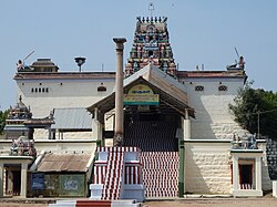
Natadreeswarar Temple is one of the devoted Hindu temples dedidated to Lord Shiva, located on hillock island inside the River Kaveri, near the city of Erode, on Erode-Karur Highways.
Erode city being the headquarters of Erode district, in India, has an extensive road, rail and water transport network, as it lies on the Kaveri (Cauvery) River.
Thirukkattuthurai is a small village located in Karur District in the Indian state of Tamil Nadu. It is the first of the three wards of the Thirukkattuthurai village Panchayat. The village is situated on the bank of the river Cauvery. The village Co-operative water pumping station is the first of its kind in Tamil Nadu planned by O.K.Ramaswamy Gounder and inaugurated by K.Kamarajar, Chief Minister of Tamil Nadu in that period. It is about 4.5 km from TNPL Pugalur. The adjacent towns and villages are Aalamarathumeydu, Karapalayam, Nadayanur, Velayuthampalayam, Kattipalayam and Thavittupalayam. The adjacent town Velayuthampalayam have the hill named Pugali Malai/Arunattan Malai, which houses Lord Murugan.

Thanjavur has a well-developed transport infrastructure. Thanjavur is well connected by Road, and Rail with most cities and towns in India
Vangal is a village in the Karur district of the Indian state of Tamil Nadu. It is situated 80 km (50 mi) from Tiruchirappalli and 7 miles from Karur town. Vangal is also known as Vangal-Kuppuchipalayam and Vangal Palayur.

The Noyyal Orathuppalayam Dam and Reservoir, also called Orathuppalayam Dam, is located on the Noyyal River between Chennimalai and Kangayam in Tirupur District, Tamil Nadu, South India. The dam is situated 16 km (9.9 mi) north of Kangayam and 26 km (16 mi) east of Tirupur.