Province of Verapaz Provincia de la Verapaz(Spanish) | |
---|---|
Province of Kingdom of Guatemala | |
1544–1821 | |
Capital | Cobán |
Population | |
• ca 1550 | ca 52,000 |
• 1577 | ca 3,000 |
History | |
Government | |
• Type | Monarchy |
Sovereign | |
• 1544-1556 | Charles I / first |
• 1813-1821 | Ferdinand VII / last |
Provincial head | |
• 1544-1550 | Bartolomé de las Casas / first |
Legislature | Audiencia of Guatemala / 1544-1564; 1570-1821 Audiencia of Mexico / 1564-1570 |
Historical era | Spanish colonisation to Latin American independence |
• Established | 1544 |
• Disestablished | 1821 |
Today part of | Belize / de jure Guatemala |
Native name per Luján Muñoz 2005a, p. 693 and de la Puente Brunke & Guevara Gil 2008, p. 587. Start date per Luján Muñoz 2005a, p. 695. Capital per Luján Muñoz 2005a, p. 695. Population per Luján Muñoz 2005b, pp. 292, 322. Provincial leaders per xx. Legislature per de la Puente Brunke & Guevara Gil 2008, pp. 556–557, 561 and Luján Muñoz 2005b, pp. 99–100. |
Verapaz, formerly Tezulutlan, was a second order subdivision of the former Kingdom of Guatemala, itself a constituent part of New Spain. [n 1]
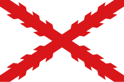
The northern limits of Tezulutlan and later Verapaz were the subject of heated debates between competing authorities of Santiago de Guatemala and Mérida de Yucatán. [1] Particularly questioned were the lowlands now comprising northern and eastern Alta Verapaz, southern Belize, and all of Izabal and Petén. [1] [n 2] Commonly accepted as unquestionably part of the province, on the other hand, were the highlands now comprising southwestern Alta Verapaz, and all of Baja Verapaz. [1]
In the early 16th century, Tezulutlan is said to have housed Q’eqchi’ and Poqomchi’ speakers, whose polities were reportedly wedged ‘between the uninhabited sierras de Chuacús and de las Minas, to the south, and the jungles of Petén, to the north.’ [2] [n 3] They therefore bordered the quiché–achí state (on the Carchelá River, between Tactic and Tzalamá) to the southwest, and choles, manchés, acalaes, lacandones polities to the north and east. [3] The Q’eqchi’ state lay in ‘the sierras which stretch between the Polochic River, to the south, and the Cahabón River, to the north,’ and thus bordered the Poqomchi’ polity to the west, said border falling somewhere between modern Cobán (then a Q’eqchi’ city) and Santa Cruz Munchú (then a Poqomchi’ city). [4] The Q’eqchi’ heartland is thought to have been among the colonial towns Carchá, Chamelco, and Cobán. [2] The Poqomchi’ state lay in ‘a narrow strip from west to east, from the middle Chixoy River to Panzós, in the lower Polochic valley,’ and thereby formed a western and southern buffer, from Chamá to Panzós, for the Q’eqchi’ state from the southwesterly K’iche’ one. [5] The western Poqomchi’ heartland was probably near San Cristóbal Cagcoh, and the eastern one amidst Tactic, Tamahú, and Tucurú. [6]
Juan Rodríguez Cabrillo and Sancho de Barahona reportedly lead a military campaign against the Q’eqchi’ city of Cobán, in Tezulutlan, in mid 1528, but details remain muddled. [7] Nonetheless, the expedition is now deemed to have probably founded no Spanish settlement in the region. [7] Similarly, Diego de Alvarado is thought to have lead a military campaign against the Poqomchi’ polity in Tezulutlan in 1530 or 1531, with details likewise remaining confused. [7] The expedition reportedly returned within the year as the captain had ‘forgotten about this corner when Peru rang,’ or returned in April 1531 as troops were ‘devastated [...] asking for shelter and ministrations.’ [7] A further campaign or entrada founded Nueva Sevilla in 1543 on the Río Polochic; it grew to 60 vecinos but the Dominicans protested the settlement, such that in 1548 the Audiencia ordered its desertion, effected in 1549. [8] A similar attempt was later made by Núñez de Landecho, who founded Monguía or Munguía about 1568 on Lake Izabal, but it likewise failed. [8] Frustrated too was the attempt by Martín Alfonso Tovilla, then alcalde mayor of the province, who founded Toro de Acuña in the former Manche on 13 May 1631; the villa was abandoned within the year. [9] [n 4]
The asiento or capitulación of Tezulutlan was secretely signed on 2 May 1537 in Santiago de Guatemala by Alonso Maldonado, interim governor of the province, and Bartolomé de las Casas, episcopal vicar of the diocese. [10] [n 5] Said asiento would bind the Crown to not subject to encomiendas those native Indians whom the Dominicans converted to Roman Catholicism. [11] It was ‘declared generally compliant’ by a real provisión of the viceroy, Antonio de Mendoza, and Audiencia of Mexico, dated 6 February 1539; the same was then ‘confirmed’ by a real cédula of Charles I of Spain, dated Madrid, 17 October 1540. [12] [n 6]
Dominican friars are thought to have entered the province in 1544 to Chamelco and Tucurú, as by mid 1545 ‘the few pueblos already reducidos (from the local population) lay near Chamelco and Tucurú, which confirms that this was not only the area of greatest population density, but also seat of the K’ekchi’ and Poqomchi’ authorities.’ [1]
Of the pre-Hispanic polities north of Verapaz, the first to be contacted was the Manche Chol Territory in the 1590s via Cahabón. [13] [n 7] By 1606 the inhabitants of some six pueblos ‘had been discovered and baptised.’ [13] Meanwhile, Alonso Criado de Castilla had in 1604 ‘discovered and inaugurated’ the port of Santo Tomás de Aquino in the Amatique Bay, within the former Toquegua territory. [13] [n 8] Nonetheless, by 1633, ‘on the heels of a general rebellion came the loss of all those Indians, of whom had been reducidos over 6,000 souls to the Faith, spread across nine pueblos.’ [14] [n 9]
Dominican reducciones having proved fruitless, by the mid 17th century it was thought more expedient to undertake an ‘entrada’ northwards, capture native Indians, and relocate them south, closer to Spanish dominion. [15] The earliest of these is thought to have occurred in circa 1654, when over 30 Ch’olan speakers north of Verapaz were relocated to Atiquipaque, in the Guazacapán province. [15] The new policy, however, was not assiduously pursued until the 1674–1676 entrada by Francisco Gallegos. [16] By 1680, the Dominicans reported over 3,000 reducidos from the Lacandon and Manche Chol polities. [17] [n 10]
The conquest of Petén, for which Verapaz served as a southern entry point, began in earnest by 1690 and was completed within five or six years. [17] The conquered lands and their pueblos de indios were placed under the political administration of Santiago de Guatemala, and the ecclesiastic oversight of Mérida de Yucatán. [18]
Lutheran pirates were first sighted near Amatique Bay in 154xx. The local port of call, Bodegas del Golfo, established 154xx, came under xx.
In 1548–1555, Verapaz was constituted an alcaldía mayor, with jurisdiction over the province's pueblos de indios. [19] Said pueblos de indios were in turn the jurisidction of principales, that is, native Indian members of the pre-Hispanic elite, who served as members of their local cabildos and parishes. [20] In the particular case of Verapaz, additionally, the clergy held outsized authority in temporal matters. [21] Thomas Gage, for instance, noted that local principales ‘did nothing without the approval of their vicar.’ [21]
The earliest description in print of the ‘peaceful conquest of Verapaz’ is thought to have appeared in Antonio de Remesal's 1619 Historia de la provincia de San Vicente de Chiapa y Guatemala. [22] [n 11]
—J. Luján Muñoz in the 1994 Historia General de Guatemala. [23]
Cobán, fully Santo Domingo de Cobán, is the capital of the department of Alta Verapaz in central Guatemala. It also serves as the administrative center for the surrounding Cobán municipality. It is located 219 km from Guatemala City.
Livingston is a town, with a population of 17,923, in Izabal Department, eastern Guatemala, at the mouth of the Río Dulce at the Gulf of Honduras. The town serves as the municipal seat of the municipality of the same name. It was Guatemala's main port on the Caribbean Sea before the construction of nearby Puerto Barrios.
In a protracted conflict during the Spanish colonization of the Americas, Spanish colonisers gradually incorporated the territory that became the modern country of Guatemala into the colonial Viceroyalty of New Spain. Before the conquest, this territory contained a number of competing Mesoamerican kingdoms, the majority of which were Maya. Many conquistadors viewed the Maya as "infidels" who needed to be forcefully converted and pacified, disregarding the achievements of their civilization. The first contact between the Maya and European explorers came in the early 16th century when a Spanish ship sailing from Panama to Santo Domingo was wrecked on the east coast of the Yucatán Peninsula in 1511. Several Spanish expeditions followed in 1517 and 1519, making landfall on various parts of the Yucatán coast. The Spanish conquest of the Maya was a prolonged affair; the Maya kingdoms resisted integration into the Spanish Empire with such tenacity that their defeat took almost two centuries.
Chisec is a town and municipality in the north of the Guatemalan department of Alta Verapaz that was founded in 1813. It is situated at 230 metres (755 ft) above sea level. The municipality covers a territory of 1244 km2. Approximately 95% of the municipality's inhabitants are Mayan, spread over the town of Chisec and approximately 140 communities. The Q'eqchi' language is widely spoken there alongside Spanish.
San Agustín Lanquín, often referred to simply as Lanquín, is a municipality in the Guatemalan department of Alta Verapaz. It is situated at 380 m above sea level. It has a population of about 16,500 people, many of Q'eqchi' Maya descent. It covers an area of 208 km².
Panzós is a town with a population of 22,068 and a municipality in the Guatemalan department of Alta Verapaz.
San Cristóbal Verapaz is a town, with a population of 20,961, and a municipality in the Guatemalan department of Alta Verapaz. It is located approximately 29 km from Cobán, the capital of Alta Verapaz and about 210 km from Guatemala City. San Cristóbal belongs to the Pokimchi' linguistic area. Its main income source is the «Cobán» shoe factory, which specializes in industrial rubber boots, which are sold both locally and internationally.
Tactic is a town, with a population of 15,213, and a municipality in the Guatemalan department of Alta Verapaz. It is situated at 1,465 m above sea level. The municipality has a population of 38,052 and covers an area of 102 km². The languages spoken in Tactic are predominantly Spanish, Poqomchiʼ, and Q'eqchi'.
San Jerónimo is a town and municipality in the Baja Verapaz department of Guatemala. The municipality is situated at 940 metres above sea level and has a population of 25,459. It covers an area of 275 km². The annual festival is September 28-September 30.
El Estor is a town, with a population of 20,489, and a municipality in the Izabal department of Guatemala. The population of El Estor consists largely of Qʼeqchiʼ speaking indigenous people.
Qʼeqchiʼ are a Maya people of Guatemala and Belize. Their indigenous language is the Qʼeqchiʼ language.
Chahal is a municipality in the Guatemalan department of Alta Verapaz. The name originates from the Mayans.
The Spanish conquest of the Maya was a protracted conflict during the Spanish colonisation of the Americas, in which the Spanish conquistadores and their allies gradually incorporated the territory of the Late Postclassic Maya states and polities into the colonial Viceroyalty of New Spain. The Maya occupied the Maya Region, an area that is now part of the modern countries of Mexico, Guatemala, Belize, Honduras and El Salvador; the conquest began in the early 16th century and is generally considered to have ended in 1697.
Virgilio Rodríguez Macal was a Guatemalan writer, journalist, and diplomat who won various international and national prizes. As a novelist he is noted for integrating his deep knowledge of Mesoamerican and Guatemalan history and geography into his stories, often setting his novels in colorful Guatemalan jungle settings including its biologically rich flora and fauna.
The Spanish conquest of Petén was the last stage of the conquest of Guatemala, a prolonged conflict during the Spanish colonisation of the Americas. A wide lowland plain covered with dense rainforest, Petén contains a central drainage basin with a series of lakes and areas of savannah. It is crossed by several ranges of low karstic hills and rises to the south as it nears the Guatemalan Highlands. The conquest of Petén, a region now incorporated into the modern republic of Guatemala, climaxed in 1697 with the capture of Nojpetén, the island capital of the Itza kingdom, by Martín de Ursúa y Arizmendi. With the defeat of the Itza, the last independent and unconquered native kingdom in the Americas fell to European colonisers.
The Lakandon Chʼol were a former Chʼol-speaking Maya people inhabiting the Lacandon Jungle in what is now Chiapas in Mexico and the bordering regions of northwestern Guatemala, along the tributaries of the upper Usumacinta River and the foothills of the Sierra de los Cuchumatanes.
The Manche Chʼol were a Maya people who constituted the former Manche Chʼol Territory, a Postclassic polity of the southern Maya Lowlands, within the extreme south of what is now Petén and the area around Lake Izabal in northern Guatemala, and southern Belize. The Manche Chʼol took the name Manche from the name of their main settlement. They were the last of a set of Ch'olan-speaking groups in the eastern Maya Lowlands to remain independent and ethnically distinct. It is likely that they were descended from the inhabitants of Classic period Maya cities in the southeastern Maya Lowlands, such as Nim Li Punit, Copán and Quiriguá.
The Acala Chʼol were a former Chʼol-speaking Maya people who occupied a territory to the west of the Manche Chʼol and east of the Chixoy River in what is now the Alta Verapaz Department of Guatemala. The Acala should not be confused with the people of the former Maya territory of Acalan, near the Laguna de Terminos in Mexico.
The Franja Transversal del Norte is a region in Guatemala delimited to the north by an imaginary line between Vértice de Santiago in Huehuetenango and Modesto Méndez Port in Izabal and in the south by La Mesilla in Huehuetenango and Izabal lake. It is composed, from west to east, of part of the Guatemalan departments of Huehuetenango, Quiché, Alta Verapaz and the entire department of Izabal. It extends roughly 15750 km2. During the Guatemalan Civil War, most of the massacres took place there due to the oil, mineral and precious wood reserves in the region. In the 21st century, there are projects to work in the region and a modern highway was built in 2010.
The Mopan Territory, historically also known as Aycal, was a Postclassic polity of the former Maya Lowlands, in present-day Belize and Guatemala.