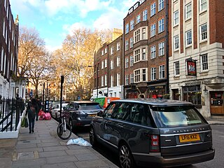
Drury Lane is a street on the eastern boundary of the Covent Garden area of London, running between Aldwych and High Holborn. The northern part is in the borough of Camden and the southern part in the City of Westminster. Drury Lane is part of London's West End Theatreland.

Oxford Street is a major road in the City of Westminster in the West End of London, running from Tottenham Court Road to Marble Arch via Oxford Circus. It marks the notional boundary between the areas of Fitzrovia and Marylebone to the north, with Soho and Mayfair to its immediate south. It is Europe's busiest shopping street, with around half a million daily visitors, and as of 2012 had approximately 300 shops. It is designated as part of the A40, a major road between London and Fishguard, though it is not signed as such, and traffic is regularly restricted to buses and taxis.

The Metropolitan Borough of St Marylebone was a metropolitan borough of the County of London from 1900 to 1965. It was based directly on the previously existing civil parish of St Marylebone, Middlesex, which was incorporated into the Metropolitan Board of Works area in 1855, retaining a parish vestry, and then became part of the County of London in 1889.
Peter Jones & Partners is a large department store in central London. It is owned by John Lewis & Partners and located in Sloane Square, Chelsea. The store holds two royal warrants granted by Charles, then Prince of Wales, and Prince Philip, Duke of Edinburgh.
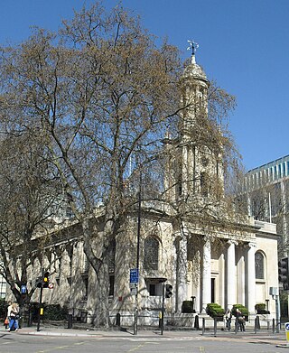
Holy Trinity Church, in Marylebone, Westminster, London, is a Grade I listed former Anglican church, built in 1828 and designed by John Soane. In 1818 Parliament passed an act setting aside one million pounds to celebrate the defeat of Napoleon. This is one of the so-called "Waterloo churches" that were built with the money. The building has an entrance off-set with four large Ionic columns. There is a lantern steeple, similar to St Pancras New Church, which is also on Euston Road to the east.

Welbeck Street is a street in the West End, central London. It has historically been associated with the medical profession. Former resident Andrew Berry was one of the men to have successfully deployed a parachute at altitude less than 3000 ft
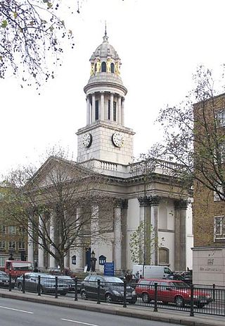
St Marylebone Parish Church is an Anglican church on the Marylebone Road in London. It was built to the designs of Thomas Hardwick in 1813–17. The present site is the third used by the parish for its church. The first was further south, near Oxford Street. The church there was demolished in 1400 and a new one erected further north. This was completely rebuilt in 1740–42, and converted into a chapel-of-ease when Hardwick's church was constructed. The Marylebone area takes its name from the church. Located behind the church is St Marylebone School, a Church of England school for girls.

St Peter, Vere Street, known until 1832 as the Oxford Chapel after its founder Edward Harley, 2nd Earl of Oxford and Earl Mortimer, is a former Anglican church off Oxford Street, London. It has sometimes been referred to as the Marybone Chapel or Marylebone Chapel.
Duke Street is a street crossing the western half of Oxford Street, London and connecting Wigmore Street and Grosvenor Square. It is best known as the setting for the TV series The Duchess of Duke Street and has been the headquarters of the Artists' Rifles, a regiment of the British Army Reserve, since 1880.
Marylebone is an area in London, England and is located in the City of Westminster. It is in Central London and part of the West End. Oxford Street forms its southern boundary.

Marshall & Snelgrove was a department store on the north side of Oxford Street, London, on the corner with Vere Street founded by James Marshall. The company became part of the Debenhams group.
The Howard de Walden Estate is a property estate in Marylebone, London, owned by the Howard de Walden family. As of 2020 the estate was reported to be worth £4.7 billion.

Thayer Street is a street in the Marylebone district of the City of Westminster, London, that contains four listed buildings.

Hinde Street Methodist Church in Hinde Street, Marylebone, London, is Grade II listed with Historic England. It was built 1807-10 and rebuilt in the 1880s.

Swallow Street is a small street in the West End of London, running north from Piccadilly. It is about 341 feet (104 m) long.

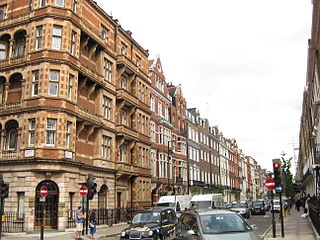
Marylebone Lane is one of the original streets of the Marylebone district of the City of Westminster, London. It runs from Oxford Street in the south to Marylebone High Street in the north, its winding shape following the course of the River Tyburn that it once ran alongside and pre-dating the grid pattern of the other streets in the area. Today the lane is largely composed of small shops, cafes and restaurants with some small apartment blocks. There are some larger commercial buildings at the southern end near Oxford Street.

Henrietta Place, originally known as Henrietta Street, is a street in Marylebone in the City of Westminster in central London that runs from Marylebone Lane in the east to Cavendish Square in the west. It is joined on the north side by Welbeck Street and Wimpole Street, and on the south side by Vere Street, Chapel Place, and Old Cavendish Street.
Old Cavendish Street, originally Cavendish Street, is a street in Marylebone in the City of Westminster in central London that runs from Henrietta Place in the north to Oxford Street in the south.

Holles Street is a street in Marylebone in the City of Westminster in central London that runs from the south side of Cavendish Square to Oxford Street.

South Audley Street is a major shopping street in Mayfair, London. It runs north to south from the southwest corner of Grosvenor Square to Curzon Street.


