
Nordaustlandet is the second-largest island in the archipelago of Svalbard, Norway, with an area of 14,443 square kilometres (5,576 sq mi). It lies north east of Spitsbergen, separated by Hinlopen Strait. Much of Nordaustlandet lies under large ice caps, mainly Austfonna and Vestfonna, the remaining parts of the north being tundra inhabited by reindeer and walruses. The island is uninhabited and lies entirely within Nordaust-Svalbard Nature Reserve.

In glaciology, an ice cap is a mass of ice that covers less than 50,000 km2 (19,000 sq mi) of land area. Larger ice masses covering more than 50,000 km2 (19,000 sq mi) are termed ice sheets.

Edgeøya, anglicised as Edge Island, is a Norwegian island located in southeast of the Svalbard archipelago; with an area of 5,073 square kilometres (1,960 sq mi), it is the third-largest island in this archipelago. An Arctic island, it forms part of the Søraust-Svalbard Nature Reserve, home to polar bears and reindeer. An ice field covers its eastern side. The island takes its name from Thomas Edge, an English merchant and whaler. It is seldom visited today and development of tourist facilities is forbidden by law because of its nature reserve status.
Svartisen is a collective term for two glaciers located in Nordland county in northern Norway. It is part of Saltfjellet-Svartisen National Park, located in the Saltfjell mountain range. The glaciers are located in the municipalities of Beiarn, Meløy, Rana, and Rødøy. Svartisen consists of two separate glaciers that are separated by the 1-kilometre (0.62 mi) long Vesterdalen valley. The two glaciers are:
Glacial surges are short-lived events where a glacier can advance substantially, moving at velocities up to 100 times faster than normal. Surging glaciers cluster around a few areas. High concentrations of surging glaciers occur in the Karakoram, Pamir Mountains, Svalbard, the Canadian Arctic islands, Alaska and Iceland, although overall it is estimated that only one percent of all the world's glaciers ever surge. In some glaciers, surges can occur in fairly regular cycles, with 15 to 100 or more surge events per year. In other glaciers, surging remains unpredictable. In some glaciers, however, the period of stagnation and build-up between two surges typically lasts 10 to 200 years and is called the quiescent phase. During this period the velocities of the glacier are significantly lower, and the glaciers can retreat substantially.
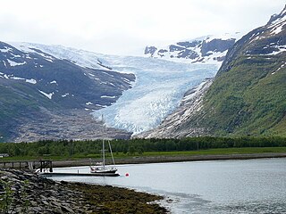
Austfonna is an ice cap located on Nordaustlandet in the Svalbard archipelago in Norway. Covering an area of 7,800 km2, it is Europe's third-largest glacier by area and volume, after the Severny Island ice cap of Novaya Zemlya, Russia, and Vatnajökull in Iceland. The combined area of Austfonna and the Vegafonna ice cap is 8,492 km2.

Olav V Land is a peninsula in eastern Spitsbergen Island, Svalbard named after Olav V of Norway. It is covered by the Olav V Icefield, measuring about 4,150 square kilometres (1,600 sq mi).
Sjuøyane is the northernmost part of the Svalbard archipelago north of mainland Norway, and some 20 km north of the eastern major island Nordaustlandet. The islands are the northernmost landmass reachable by normal means, being 1024.3 kilometers south of the North Pole. In comparison, Robert Falcon Scott started his ill-fated Terra Nova Expedition 1374 km from the South Pole. Many of the islands are named after English explorers, most notably Captain Nelson.

Nordaust-Svalbard Nature Reserve is located in the north-eastern part of the Svalbard archipelago in Norway. The nature reserve covers all of Nordaustlandet, Kong Karls Land, Kvitøya, Sjuøyane, Storøya, Lågøya, Wilhelm Island, Wahlbergøya and a small section of the north-east corner of Spitsbergen. The reserve is 55,354 square kilometres (21,372 sq mi), of which 18,663 square kilometres (7,206 sq mi) is on land and 36,691 square kilometres (14,166 sq mi) is on water—making it the largest preserved area in Norway. It includes the largest glacier in Norway, Austfonna, as well as Vestfonna and parts of Olav V Land. The reserve has been protected since 1 July 1973 and borders in the south to Søraust-Svalbard Nature Reserve.
Holtedahlfonna is a glacier at Haakon VII Land on Spitsbergen, Svalbard, between Wijdefjorden and Kongsfjorden. The glacier covers an area of about 1,375 km2 (531 sq mi), and is the second largest ice cap on Spitsbergen. It is named after Norwegian geologist and polar explorer Olaf Holtedahl.
Vegafonna is an ice cap in Gustav Adolf Land on Nordaustlandet in the Svalbard archipelago. It is located on the peninsula Scaniahalvøya, between the bay Palanderbukta to the north and Torellneset to the south. The glacier is named after the vessel SS Vega. Further west on the peninsula is the ice cap Glitnefonna.
Glitnefonna is an ice cap in Gustav Adolf Land on Nordaustlandet in the Svalbard archipelago. It is located on the peninsula Scaniahalvøya, west of the glacier Vegafonna, between the bay Palanderbukta to the northeast and Hinlopen Strait to the southwest. The glacier is named after the god hall Glitnir from Norse mythology.
Longstaffbreen is a glacier in Ny-Friesland at Spitsbergen, Svalbard. It is a branch from the ice areas of Åsgardfonna and Valhallfonna, and the glacier debouches into the lake of Femmilsjøen. The glacier is named after Arctic explorer and mountaineer Tom George Longstaff.
Valhallfonna is an ice cap in Ny-Friesland at Spitsbergen, Svalbard. It is located west of Hinlopen Strait and northeast of Åsgardfonna. The glacier covers an area of about 1,000 km2.
Gimlebreen is a glacier in Gustav V Land at Nordaustlandet, Svalbard. It is located north of the headland of Brageneset. Gimlebreen is a glacier stream from the large icecap Vestfonna.
Norddomen is an ice dome of Austfonna at Nordaustlandet, Svalbard. The glacier cap of Austfonna has two significant ice domes, Norddomen and Sørdomen further south. Norddomen is the highest point of Nordaustlandet, with a height of about 700 m.a.s.l.
Sørdomen is an ice dome of Austfonna at Nordaustlandet, Svalbard. The glacier cap of Austfonna has two significant ice domes, Sørdomen and Norddomen further north. The part of Austfonna west of Sørdomen is called Palanderisen.
Rijpdalen is a valley in the central part of Nordaustlandet, Svalbard, separating Gustav V Land from Prins Oscars Land. The valley extends between the head of Wahlenbergfjorden and the head of Rijpfjorden. The valley is named after Dutch explorer Jan Rijp. At the watershed in Rijpdalen is the plain of Helvetesflya. The ice caps of Vestfonna and Austfonna are separated by Rijpdalen and Helvetesflya.

Tinayrebreen is a glacier in Haakon VII Land at Spitsbergen, Svalbard. It has a length of about ten kilometers, and extends from the glacier cap of Isachsenfonna to Möllerfjorden, where it debouches into the bay of Tinayrebukta. The glacier is named after French painter Louis Tinayre.
