Via Tiberina

Last updated
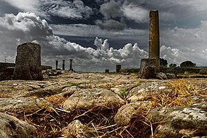
Remains of paved road at Lucus Feroniae. Basolato.jpg
Remains of paved road at Lucus Feroniae.

The via Tiberina was an ancient Roman road, which from the north of Rome, going up the right bank of the Tiber river, crossed the ancient center of Veio, Capena and Falerii Veteres countryside to Tiber Valley and continued towards Ocriculum, today in Umbria. Today, in the metropolitan city of Rome Capital, its route coincides with the provincial road 15 / A Tiberina.

Contents

History

The via Tiberina, which owes its name to its path that follows that of the Tiber river, is one of the oldest roads in the area north of Rome: although there are references to it only in documents from the Constantinian era, [1] its use is testified since prehistoric times, as a set of sheep tracks that connected the archaic centers located along the river, thus playing the role of a way of great communication, similarly to what happened on the other side with the Via Salaria. [2]

It is also hypothesized that the Tiberina coincided in the area with the ancient Via Campana, a road used by the Etruscans since the 7th century BC to transport inland the salt extracted to the salt-field at the mouth of the Tiber. [3]

During the 4th century BC Rome, having definitively defeated the city of Veii and its Faliscan and Capenate allies, moved to the permanent and systematic conquest and occupation of the territory of the defeated: the Tiberina was readapted to the new Roman needs, [4] also modifying the ancient layout that in fact, it took the path it has maintained until the modern era. The Roman restructuring work in many points exceeded the limits due to the orography of the territory in favor of direct connections between the centers of greater importance, [1] as evidenced for example by the straight section between the locality of Scorano and the current city of Fiano Romano, [5] completely coinciding with that of the Roman era. 

Although it lost part of its importance as a connection with Umbria and the upper Sabina with the construction of the Via Flaminia, around 220 BC, [6] the Tiberina nevertheless remained, both in the republican and in the imperial age, a rapid and safe to transport the products of the surrounding fertile territory to the Roman market, [7] as well as a necessary support for river navigation [8] and with a local viability function.

And this function of connection between the area of the western side of the lower Tiber valley and Rome remained unchanged for the following centuries, thus representing the Tiberina one of the main roads for all the centers of the area up to the modern age.

Route

In the Republican era, the Tiberina departed from the Pons Sublicius which allowed the passage on the right bank of the Tiber, downstream of the Tiber Island. [9]  

Later, with the construction of the Flaminia, the route of the two roads was common from Ponte Milvio to Prima Porta (ad gallinas albas): here, immediately after the bridge over the ditch of Prima Porta, the Tiberina branched off continuing to follow the course of the river and crossing the ancient ager capenate arriving at the sanctuary of Lucus Feroniae. From here it continued, always along the Tiber, towards the area of the current Ponzano Romano until it crosses the Treja  [ it ] river near Falerii Veteres (Civita Castellana). Here it was divided in two: one branch joined directly with the via Flaminia near Borghetto, probably while another crossed the Tiber reaching the ancient center of Poggio Sommavilla and Foglia, [10] continuing on the left bank, rejoined the Flaminia just south of Ocriculum. [6]

Along the route of the Tiberina there are many and very significant archaeological sites, [11] [12] [13] [14] [15] such as the sanctuary of Lucus Feroniae and a lot of villas rustica among which the Villa dei Volusii stands out in Fiano Romano, which testify how it connected important centers of primary importance for the history of the area.

Related Research Articles

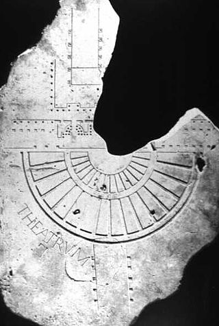
<i>Forma Urbis Romae</i> Marble map of ancient Rome (c.205-208)

The Forma Urbis Romae or Severan Marble Plan is a massive marble map of ancient Rome, created under the emperor Septimius Severus between 203 and 211 CE. Matteo Cadario gives specific years of 205–208, noting that the map was based on property records.
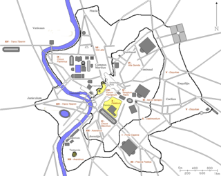
<span class="mw-page-title-main">14 regions of Augustan Rome</span> Administrative subdivisions of ancient Rome

In 7 BC, Augustus divided the city of Rome into 14 administrative regions. These replaced the four regiones—or "quarters"—traditionally attributed to Servius Tullius, sixth king of Rome. They were further divided into official neighborhoods.

<span class="mw-page-title-main">Capena</span> Comune in Lazio, Italy

Capena is a town and comune in the Metropolitan City of Rome, Lazio region. The town has borrowed its modern name from a pre-Roman and Roman settlement that was 3 kilometres (1.9 mi) to its north.

<span class="mw-page-title-main">Lucus Feroniae</span> Archaeological site in Capena, Italy

Lucus Feroniae was an ancient sanctuary or, literally sacred grove ("lucus"), dedicated to the Sabine goddess Feronia, protector of freedmen, ex-slaves. It was located near to the ancient town of Feronia in Etruria on the ancient Via Tiberina, in what is now the territory of the modern commune of Capena, Lazio.

<span class="mw-page-title-main">Cremera</span> Italian stream connecting to the Tiber

The Cremera is a 36.7-kilometre (22.8 mi) Italian stream in Lazio which runs past Sacrofano, Formello, and Campagnano di Roma before falling into the Tiber about 10 kilometres (6 mi) north of Rome. It connects to the Tiber just as the Via Flaminia intersects the Grande Raccordo Anulare highway, on the proximity of the Labaro Roma Nord railway station, where there is an ancient Roman bridge. The identification with the Fosso della Valchetta is fixed as correct by the account in Livy ii. 49, which shows that the Saxa Rubra were not far off, and this we know to be the Roman name of the post station of Prima Porta, about 12 kilometres (7 mi) from Rome on the Via Flaminia. It is famous for the defeat of the three hundred Fabii, who had established a fortified post on its banks.

<span class="mw-page-title-main">Lucos Cozza</span> Italian archaeologist (1921–2011)

Lucos Cozza was an Italian Roman archaeologist.

<span class="mw-page-title-main">Pietro Rosa</span> Italian archaeologist (1810–1891)

Pietro Rosa was an Italian architect and topographer. He studied the settlements of the ancient Roman countryside and carried out a systematic series of excavations on the Palatine Hill in Rome.

<span class="mw-page-title-main">Fiano Romano</span> Comune in Lazio, Italy

Fiano Romano is a town and comune (municipality) in the Metropolitan City of Rome, Italy, approximately 40 kilometres (25 mi) north of the city.

<span class="mw-page-title-main">Prima Porta</span> Zona of Rome in Lazio, Italy

Prima Porta is the 58th zona of Rome, identified by the initials Z. LVIII. The name Prima Porta came from an arch of the aqueduct that brought water to the Villa of Livia, which formed over Via Flaminia a sort of gateway which travellers saw as the first indication of having reached Rome (Piperno).

<span class="mw-page-title-main">Feronia (Etruria)</span> Ancient city in Etruria

Feronia or Lucus Feroniae was an ancient roman municipium border the present Via Tiberina and Autostrada A1, current Comune of Capena near the present town of Fiano Romano. It is located in the plain along the Tiber Valley, at the foot of Mount Soracte, and was within the ancient territory of Capena. It began as a sanctuary called Lucus Feroniae in the time of Tullus Hostilius when it was located in Etruria.

<span class="mw-page-title-main">Villa of Livia</span> Ancient Roman house near Rome, Italy

The Villa of Livia is an ancient Roman villa at Prima Porta, 12 kilometres (7.5 mi) north of Rome, Italy, along the Via Flaminia. It may have been part of Livia Drusilla's dowry that she brought when she married Octavian, her second husband, in 39 BC. However, it may also have been a gift given to her by Octavian upon their betrothal. The ancient sources tell us that Livia returned to this villa following the marriage. It was her sumptuous country residence complementing her house on the Palatine Hill in Rome.

<span class="mw-page-title-main">Baths of Constantine (Rome)</span>

Baths of Constantine was a public bathing complex built on Rome's Quirinal Hill, beside the Tiber River, by Constantine I, probably before 315.

The temple of Minerva Medica was a temple in ancient Rome, built on the Esquiline Hill in the Republican era, though no remains of it have been found. Since the 17th century, it has been wrongly identified with the ruins of a nymphaeum on a nearby site, on account of the erroneous impression that the Athena Giustiniani had been found in its ruins.

The Murus Terreus Carinarum is an obscure earthwork fortification of the ancient city of Rome known from a passage in the works of Varro. The Murus Terreus may have been a part of Rome's earliest fortifications, often referred to as the Servian Wall. While the location of the Murus Terreus remains unknown and debated, it is thought likely that it belonged to the fortifications of the Oppian Hill, thus placing it between the Carinae and the Subura. Pinza suggested that the works were located on the summit of the Oppian.

<span class="mw-page-title-main">Alda Levi</span> Italian archaeologist (1890–1950)

Alda Levi Spinazzola was an Italian archaeologist and art historian.

<span class="mw-page-title-main">Crepereia Tryphaena</span>

Crepereia Tryphaena was a young Roman woman, presumably about 20 years old, whose sarcophagus was found during the excavation works started in 1889 for the foundations of the Palace of Justice and for the construction of the Umberto I bridge over the Tiber in Rome. Among the items found in her sarcophagus were pieces of a funeral outfit, including a sculpted doll.
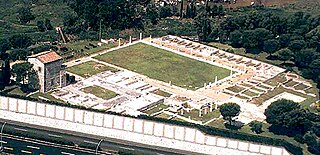
<span class="mw-page-title-main">Villa dei Volusii</span>

The ancient Roman Villa dei Volusii or Villa dei Volusii-Saturnini is an archaeological site located in the municipality of Fiano Romano, next to the ancient Roman town and sanctuary of Lucus Feroniae, along the route of ancient Via Tiberina.
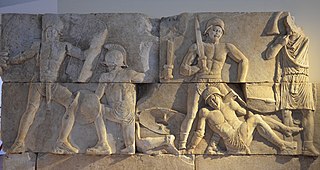
<span class="mw-page-title-main">Mausoleum of Fiano Romano</span> Roman Empire funerary art in Rome

The Mausoleum of Fiano Romano is a set of thirteen large blocks of Carrara marble decorated in relief of the 1st century BC, approximately 0.60 metres (2.0 ft) x 1.00 metre (3.28 ft) x 0.30 metres (0.98 ft), with scenes of Gladiator fights that originally decorated three sides of an imposing funerary monument tower.

<span class="mw-page-title-main">Bust of Augustus with Gemmed Crown</span> A bust of Augustus at the Capitoline Museums

The Bust of Augustus with Gemmed Crown is a Roman Bust depicting the first emperor of the Roman Empire, Augustus.

<span class="mw-page-title-main">Archaeological area of Poggio Sommavilla</span> Archaeological site in Lazio, Italy

The archaeological area of ​​Poggio Sommavilla is an archaeological site located in Poggio Sommavilla, a Frazione of the Comune of Collevecchio in the Tiber valley.
References

  1. 1 2 Radke, p. 112
  2. Gamurrini et al., p. 324
  3. Stanco, Enrico Angelo; Fontana, Sergio; Blanchi, Fulvia; Felici, Fabrizio (2004). "Fiano Romano: un'area funeraria della prima età impériale in località Palombaro". Bullettino della Commissione Archeologica Comunale di Roma (in Italian). 105: 227.
  4. Jones, p. 128
  5. Jones, p. 100
  6. 1 2 Ashby, T.; Fell, R. A. L. (1921). "The Via Flaminia". The Journal of Roman Studies. 11. Society for the Promotion of Roman Studies: 126. doi:10.2307/295901. JSTOR   295901.
  7. Pani, p. 108
  8. Pani, p. 110
  9. Romani et al., p. 1051
  10. Foglia municipality of Magliano Sabina
  11. Mancinelli, Maria Carla. "Relazione su scavi, trovamenti e restauri - Via Tiberina". Bullettino della Commissione Archeologica Comunale di Roma (in Italian). 94, 1 (1991-1992): 197–209.
  12. Carbonara, Andrea; Messineo, Gaetano; Vittori, Maria Cristina (1996). "Relazioni su scavi, trovamenti, restauri - Via Tiberina". Bullettino della Commissione Archeologica Comunale di Roma (in Italian). 97: 285–302.
  13. Quaranta, Paola; Messineo, Gaetano; Vittori, Maria Cristina; Zaccagnini, Rossella; Lazzeretti, Alessandra; Maresca, Claudia (1998). "Relazioni su scavi, trovamenti, restauri - Via Tiberina". Bullettino della Commissione Archeologica Comunale di Roma (in Italian). 99: 328–368.
  14. Stanco, Enrico Angelo (2000). "Relazioni su scavi, trovamenti, restauri - Via Tiberina". Bullettino della Commissione Archeologica Comunale di Roma (in Italian). 101: 353–364.
  15. Mancini, Davide (2006). "Relazioni su scavi, trovamenti, restauri - Via Tiberina". Bullettino della Commissione Archeologica Comunale di Roma (in Italian). 107: 378–386.

Bibliography