Victoria Park, Swinton

Last updated • 1 min readFrom Wikipedia, The Free Encyclopedia
Victoria Park
Victoria Park, Swinton (8179908674).jpg
Type Municipal park
Location Swinton, Greater Manchester, England
Coordinates 53°30′32″N2°19′39″W / 53.5090°N 2.3275°W / 53.5090; -2.3275 Coordinates: 53°30′32″N2°19′39″W / 53.5090°N 2.3275°W / 53.5090; -2.3275
Created 1897 (1897)
Operated by City of Salford

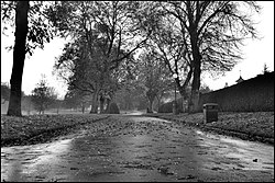
Victoria Park is a park in Swinton, Greater Manchester. Situated on Manchester Road (A6), Swinton, it opened as a public park in 1897.

View of the tennis courts Victoria Park, Swinton (8179909042).jpg
View of the tennis courts

Victoria Park is made up of the grounds of Swinton Old Hall; the hall itself being demolished in 1993. [1] Having tennis courts and two bowling greens, Victoria Park is home to a Grade II listed Victorian bandstand built to commemorate the 60th year of the reign of Queen Victoria; the bandstand being built around 1897. [1] [2]

Swinton and Pendlebury received its Charter of Incorporation as a municipal borough from Edward Stanley, 18th Earl of Derby at a ceremony in Victoria Park on 29 September 1934. [3] [4]

Victoria Park has been awarded three Green Flag Awards. [2] The Green Flag Scheme is a national standard for public parks and green spaces that aims to raise standards across the UK. [5] This award puts Victoria Park alongside Brighton Pier, London Zoo, Alton Towers and the Norfolk Broads. [6]

Related Research Articles

Salford city in Greater Manchester, England, UK

Salford is a part of Greater Manchester, England, approximately 1 mile west of Manchester city centre, in a meander of the River Irwell, which forms part of its boundary with the city of Manchester to the east.

Rusholme area of Manchester, England

Rusholme is an inner-city area of Manchester, England, about two miles south of the city centre. The population of Rusholme ward at the 2011 census was 13,643. Rusholme is bounded by the neighbourhoods of Chorlton-on-Medlock to the north, Victoria Park and Longsight to the east, Fallowfield to the south and Moss Side to the west. It has a large student population, with several student halls and many students renting terraced houses, and suburban houses towards the Victoria Park area.

City of Salford Metropolitan borough and city in England

The City of Salford, commonly known as Salford, is a city and metropolitan borough of Greater Manchester, England, extending west to include the towns of Eccles, Worsley, Swinton, Walkden, Little Hulton, and Irlam. The city has a population of 245,600, and is administered from the Salford Civic Centre in Swinton.

Worsley town in United Kingdom

Worsley is a town in Greater Manchester, England, which in 2014 had a population of 10,090. It lies along Worsley Brook, 5.75 miles (9.25 km) west of Manchester. The M60 motorway bisects the area.

Prestwich town in Greater Manchester, England

Prestwich is a surburban town in the Metropolitan Borough of Bury, Greater Manchester, England, 3.3 miles (5.3 km) north of Manchester city centre, 3.1 miles (5 km) north of Salford and 4.7 miles (7.6 km) south of Bury.

Eccles, Greater Manchester town in the City of Salford in Greater Manchester, England

Eccles is a town in the City of Salford Greater Manchester, England, 2.7 miles (4.3 km) west of Salford and 3.7 miles (6.0 km) west of Manchester city centre, between the M602 motorway to the north and the Manchester Ship Canal to the south.

Salford Crescent railway station

Salford Crescent railway station is a railway station in Salford, Greater Manchester, England, opened by British Rail in 1987.

Salford Central railway station

Salford Central railway station in Salford, Greater Manchester, England, close to Spinningfields and Deansgate. It is served by trains to and from Manchester Victoria, towards Rochdale and Wigan Wallgate.

Broughton, Salford suburb of Salford, Greater Manchester, England

Broughton is a suburb of Salford, England, on the east bank of the River Irwell 1.3 miles (2.1 km) northwest of Manchester city centre and 2.1 miles (3.4 km) south of Prestwich, which includes Broughton Park, Higher Broughton and Lower Broughton.

Pendleton, Greater Manchester inner city area of Salford, Greater Manchester, England

Pendleton is an inner city suburb of Salford, Greater Manchester, England, 2 miles (3.2 km) from Manchester city centre. The A6 dual carriageway skirts the east of the district.

Swinton railway station (Greater Manchester)

Swinton railway station serves the town of Swinton and Pendlebury in the City of Salford, Greater Manchester, England.

Walkden suburban town in the City of Salford, Greater Manchester, England

Walkden is a suburban town in the City of Salford, Greater Manchester, England, 6 miles (9.7 km) northwest of Salford, and 7 miles (11.3 km) of Manchester.

Little Hulton area of the City of Salford, Greater Manchester, England

Little Hulton is an area within the City of Salford, Greater Manchester, England, 3.4 miles (5.5 km) south of Bolton, 7 miles (11.3 km) west-northwest of Salford, and 9 miles (14.5 km) west-northwest of Manchester. Little Hulton is bordered by Farnworth to the north and Walkden to the east.

Eccles Interchange

Eccles Interchange is a transport hub in Eccles, Greater Manchester, England. It is composed of a bus station, and a single-platform Metrolink light rail station, the latter of which is the terminus of the system's Eccles Line. It opened on 21 July 2000. It is roughly 310 metres (340 yd) away from Eccles railway station.

Peel Park, Salford

Peel Park is a public urban park in Salford, Greater Manchester, England, located on the flood plain of the River Irwell below Salford Crescent and adjacent to the University of Salford. It was the first of three public parks to be opened on 22 August 1846, for the people of Manchester and Salford, paid for by public subscription. The park was the main public venue for the 1851 royal visit of Queen Victoria to Manchester and Salford and has been the subject of a number of paintings by the Salford artist, L.S. Lowry.

Moss Bank Park, Bolton

Moss Bank Park is a 34.25 hectares park in Bolton, Greater Manchester, England. It consists of open space, woodland, gardens and other facilities. Moss Bank Park has been awarded the Green Flag Standard in 2008 and 2009. The Green Flag Scheme is a national standard for public parks and green spaces that aims to raise standards across the UK. This award puts Moss Bank Park alongside Brighton Pier, London Zoo, Alton Towers and the Norfolk Broads.

Salford Civic Centre

Salford Civic Centre is located in Swinton in the City of Salford, Greater Manchester, England. It is the location of the council chamber and committee rooms, as well as being the administrative headquarters of Salford City Council.

Leigh-Salford-Manchester Bus Rapid Transit

The Leigh-Salford-Manchester Bus Rapid Transit scheme in Greater Manchester, England provides transport connections between Leigh, Atherton, Tyldesley, Ellenbrook and Manchester city centre via Salford. The guided busway and bus rapid transit (BRT) scheme promoted by Transport for Greater Manchester (TfGM) opened on 3 April 2016. Built by Balfour Beatty at a total cost of £122 million to improve links from former coalfield towns into Manchester city centre, the busway proposal encountered much opposition and a public enquiry in 2002 before construction finally started in 2013. A branch route from Atherton, and an extension to the Manchester Royal Infirmary have been added to the planned original scheme.

References

  1. 1 2 "Salford City Council Website" . Retrieved 2 February 2010.
  2. 1 2 "Green Flag Award Sites" . Retrieved 2 February 2010.
  3. "Greater Manchester Gazetteer". Greater Manchester County Record Office. Place Names - S. Archived from the original on 18 July 2011. Retrieved 8 October 2007.
  4. "Magazine of Salford Museums & Heritage Service" (PDF). Retrieved 23 March 2008.
  5. "Green Flag Award Scheme" (PDF). Retrieved 24 January 2010.
  6. "Bolton News archive" . Retrieved 24 January 2010.