This article concerns the systems of transportation in Laos. Laos is a country in Asia, which possesses a number of modern transportation systems, including several highways and a number of airports. As a landlocked country, Laos possesses no ports or harbours on the sea, and the difficulty of navigation on the Mekong means that this is also not a significant transport route.

Luang Phabang, or Louangphabang, commonly transliterated into Western languages from the pre-1975 Lao spelling ຫຼວງພຣະບາງ as Luang Prabang, literally meaning "Royal Buddha Image", is a city in north central Laos, consisting of 58 adjacent villages, of which 33 comprise the UNESCO Town of Luang Prabang World Heritage Site. It was listed in 1995 for unique and "remarkably" well preserved architectural, religious and cultural heritage, a blend of the rural and urban developments over several centuries, including the French colonial influences during the 19th and 20th centuries.

Vang Vieng is a town in the Vientiane Province in Laos. It is popular with tourists, specifically backpackers, seeking adventure sports as well as its karst topography. It is on the Nam Song River, 130km north of Vientiane.

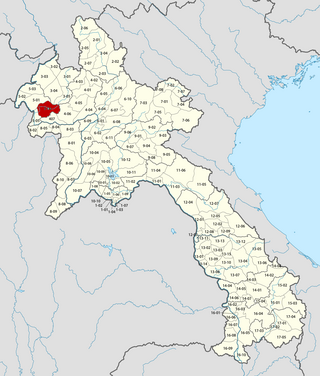
Sainyabuli, is the capital of Sainyabuli Province, Laos. It lies on Route 4 which along with Route 13 connects it to Luang Prabang, roughly 80 kilometres northeast by road and to the Thai border across the Luang Prabang Range in the southwest. A passport control point is in the area. Sainyabuli Airport lies southwest of the town.
Lahu is a Tibeto-Burman language spoken by the Lahu people of China, Thailand, Myanmar, Vietnam and Laos. It is widely used in China, both by Lahu people, and by other ethnic minorities in Yunnan, who use it as a lingua franca. However, the language is not widely used nor taught in any schools in Thailand, where many Lahu are in fact refugees and illegal immigrants, having crossed into Thailand from Myanmar.

Pha Oudom is a district (muang) of Bokeo province in northwestern Laos. The district, along with Pak Tha district, was part of Oudomxay province until 1992.

Vientiane is the capital and largest city of Laos. Comprising the five urban districts of Vientiane Prefecture, the city is located on the banks of the Mekong, right at the border with Thailand. Vientiane was the administrative capital during French rule and, due to economic growth in recent times, is now the economic center of Laos. The city had a population of 1,001,477 as of the 2023 Census.

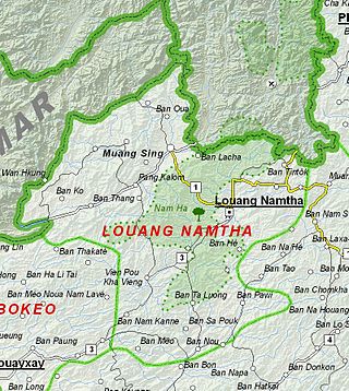
Muang Sing is a small town and district (muang) in Luang Namtha Province, northwestern Laos, about 60 kilometres northwest of the town of Luang Namtha and 360 kilometres northwest of Vientiane. It lies very close to the border with Yunnan, China, surrounded by mountains and rivers. Historically, Muang Sing has been a major producer of opium and still has problems with drugs and smuggling, due to its proximity to China and Myanmar.

Ban Nam Di is a village in Luang Namtha Province, Laos, located about 6 kilometres (3.7 mi) northeast of Luang Namtha. It has a population of about 500. The Nam Di River flows nearby and the Nam Di waterfall is about a 1 kilometre (0.62 mi) from the village. The village is famous for its bamboo paper making by the Lanten peoples. The locals are adept at turning bamboo into pulp on the river banks and making paper by spreading it thinly over square cotton screens. The paper is usually primarily for Taoist religious purposes, but in recent years the villagers have been producing it as souvenirs for tourists. The houses in the village are mainly made with bamboo roofs.

Bokèo is a northern province of Laos. It is the smallest and least populous province in the country. Bokeo province covers an area of 6,196 square kilometres (2,392 sq mi). Bokeo province borders Luang Namtha province to the northeast, Oudomxai province to the east, Xaignabouli province to the south, and Thailand to the southwest and Burma to the west and northwest. The province has five districts: and The provinnce has Golden Triangle Special Economic Zone in Ton Pheung district. It is rich in deposits of precious and semiprecious stones. Bokeo's provincial capital is Houayxay on the Mekong River. The province is in the Golden Triangle, at the border of Myanmar and Thailand. There are 34 ethnic groups in the province. Houay Xay is the border town with Thailand and regional economic centre.

Vientiane province is a province of Laos in the country's northwest. As of 2015 the province had a population of 419,090. Vientiane province covers an area of 15,610 square kilometres (6,030 sq mi) composed of 11 districts. The principal towns are Vang Vieng and Muang Phôn-Hông.

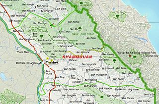
Khammouane province (Khammouan) is a province in the center of Laos. Its capital lies at Thakhek.

Luang Namtha is a province of Laos in the country's north. From 1966 to 1976 it formed, together with Bokeo, the province of Houakhong. Luang Namtha province covers an area of 9,325 square kilometres (3,600 sq mi). Its provincial capital is Luang Namtha. The province borders Yunnan, China to the north, Oudomxai province to the east and southeast, Bokeo province to the southwest, and Shan State, Myanmar to the northwest.

Saiyabuli province is a province in northwest Laos. Saiyabuli town is the capital of the province. Saiyabuli is the only Lao province that is completely west of the Mekong River.

Luang Prabang is a province in northern Laos. Its capital of the same name, Luang Prabang, was the capital of the Lan Xang Kingdom during the 13th to 16th centuries. It is listed since 1995 by UNESCO as a World Heritage Site for unique architectural, religious and cultural heritage, a blend of the rural and urban developments over several centuries, including the French colonial influences during the 19th and 20th centuries. The province has 12 districts. The Royal Palace, the national museum in the capital city, and the Phou Loei Protected Reserve are important sites. Notable temples in the province are the Wat Xieng Thong, Wat Wisunarat, Wat Sen, Wat Xieng Muan, and Wat Manorom. The Lao New Year is celebrated in April as The Bun Pi Mai.

Oudomxay is a province of Laos, located in the northwest of the country. Its capital is Muang Xai.
The Yang people, also known as the Nhang or Nyang, are a Tai-speaking ethnic group of Phongsaly Province, northwestern Laos. Chazee (1998) reports that they number 5,843 people as of 2015. The Yang are heavily influenced by Tai Lue culture, although the Yang of Namo Nua village, Oudomxay province are more heavily influenced by Tai Dam people culture.
The Battle of Luang Namtha, fought between January 1962 and May 1963, was a series of clashes in the Laotian Civil War. It came about as a result of the turmoil following Laotian independence as a result of the First Indochina War with France. The Kingdom of Laos had foreign soldiers on its soil, and a political struggle in progress concerning those outside troops. Following a coup and counter-coup that left General Phoumi Nosavan in charge, the general decided on military action to settle the political issue of interlopers in Laos.

Khokmanh or Ban Khokmanh is a village in Mueang Luang Prabang, Khoueng Luang Prabang in Laos.


