A National Biodiversity Conservation Area (NBCA) is an environmentally protected area in Laos. There are all together 21 different NBCAs in Laos, protecting 29,775 square kilometers. Another 10 NBCAs have been proposed, many of them being treated by authorities as though they were already officially protected.

The spotted linsang is a linsang, a tree-dwelling carnivorous mammal, native to much of Southeast Asia. It is widely, though usually sparsely, recorded, and listed as Least Concern on the IUCN Red List.

Xam Neua, is the capital of Houaphanh Province, Laos, in northeast Laos.
Viengxay is a district (muang) of Houaphanh province in northeastern Laos. It is home to the Viengxay caves, the Nam Et National Biodiversity Conservation Area, and Phou Pha Thi mountain, site of the Secret War Battle of Lima Site 85 (LS-85) 11 March 1968.
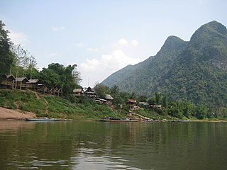
Muang Ngoi Neua is a Lao town along the Nam Ou in Louangphrabang Province. It is part of Ngoi district 170 kilometres North-East of Luang Prabang.
Nam Et-Phou Louey National Park is a protected area in northern Laos, covering 4,107.1 km2 (1,585.8 sq mi) in three provinces: Houaphan, Luang Prabang, and Xieng Khouang. It was designated a national park in 2019, and was previously designated a national protected area. The protected area included a 3,000 km2 (1,200 sq mi) core area where human access and wildlife harvest is prohibited and a 2,950 km2 buffer area where pre-existing villages are allocated land for subsistence living.

Bolikhamsai is a province of Laos. Pakxan, Thaphabat, Pakkading, Borikhane, Viengthong, and Khamkeut are its districts and Pakxan is its capital city. The province is the site of the Nam Theun 2 Dam, the country's largest hydroelectric project.

Vientiane province is a province of Laos in the country's northwest. As of 2015 the province had a population of 419,090. Vientiane province covers an area of 15,610 square kilometres (6,030 sq mi) composed of 11 districts. The principal towns are Vang Vieng and Muang Phôn-Hông.
Xiangkhouang is a province of Laos on the Xiangkhoang Plateau, in the nation's northeast. The province has the distinction of being the most heavily bombed place on Earth.

Houaphanh province is a province in eastern Laos. Its capital is Xam Neua.

Phongsaly province, also spelled Phôngsali, is a province of Laos in the extreme north of the country. The capital of the province is the city of Phôngsali. Phongsaly is between Yunnan (China), and Điện Biên province in Vietnam. Its culture has thus been historically heavily influenced by China.

Vientiane is a prefecture of Laos, in the northwest Laos. The national capital, Vientiane, is in the prefecture. The prefecture was created in 1989, when it was split off from Vientiane province.

Luang Prabang is a province in northern Laos. Its capital of the same name, Luang Prabang, was the capital of the Lan Xang Kingdom during the 13th to 16th centuries. It is listed since 1995 by UNESCO as a World Heritage Site for unique architectural, religious and cultural heritage, a blend of the rural and urban developments over several centuries, including the French colonial influences during the 19th and 20th centuries. The province has 12 districts. The Royal Palace, the national museum in the capital city, and the Phou Loei Protected Reserve are important sites. Notable temples in the province are the Wat Xieng Thong, Wat Wisunarat, Wat Sen, Wat Xieng Muan, and Wat Manorom. The Lao New Year is celebrated in April as The Bun Pi Mai.

Oudomxay is a province of Laos, located in the northwest of the country. Its capital is Muang Xai.
Operation Triangle was a military operation of the Laotian Civil War staged from 19—29 July 1964. Although planned by the General Staff of the Royal Lao Army, it was subject to American approval because the RLA depended on the Americans for finances, supplies, and munitions. Operation Triangle was an ambitious undertaking dependent on martial skills unfamiliar to the Lao. It not only called for coordination of infantry, artillery, and tactical air strikes among forces of three different nationalities; as a covert operation, it also had to have plausible deniability.

Protected areas in Laos include:

Muang Soui(In Lao: ເມືອງສຸຍ) is a small town in Xiangkhouang Province Laos. It is located on Route 7 of Laos, so east of Phoukhoune district, northwest of Phonsavan, and Ban Phou Pheung Noi, but north of Sam Thong, and Long Tieng.

Ban Phou Pheung Noi is a Laotian village located at the peak of Phou Pheung mountain in the Xieng Khouang province of Laos. Phou Pheung mountain is approximately 916 m (3,005 ft). During the Vietnam War, combat between the American allies, the Hmong, and the Pathet Lao, The Laos Marxist government, and the Communist North Vietnamese People's Army took place on the mountain. Phou Pheung mountain runs from east to west and is rocky, and is covered in tropical forests. It is south of Muang Soui - Nongtang-Nato, and west of Phou Douk, Muang Phuan, Phonsavan and Plain of Jars. To the east, about 10 miles from Ban Phou Pheung Noi, is the Num Ngum 4 hydroelectric dam.

Route 7 of Laos, ເສັ້ນ ທາງ ເລກ 7 ຂອງປະເທດລາວ (ທ. 7) is a provincial road served from east to west in Xiangkhouang province, Laos. It runs from Nong Het in the east to Phoukhoune District in the west. This is where people change connections to go to Luang prabang or Vientiane.