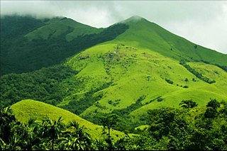
Madikeri is city and headquarters of Kodagu district in the Karnataka state of India. It is recognised as one of the world's eight "hottest hotspots" of biological diversity and also one of UNESCO World Heritage Sites. The city is ranked 1st in India for having cleanest air and best AQI in 2024.
Bagalkote, is a city in the state of Karnataka, India, which is also the headquarters of Bagalkot district. It is situated on branch of River Ghataprabha, The population of the urban agglomeration was 111,933 according to the provisional results of 2011 national census of India, the city is spread over an area of 49.06 square kilometres (18.94 sq mi) with an average elevation of 532 m (1,745 ft) above MSL.

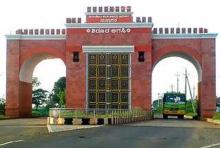
Chamarajanagara is a city and headquarter of eponymous Chamarajanagar district in the Karnataka state of India. It is named after Chamaraja Wodeyar IX, the erstwhile Raja of Mysore, Chamarajanagara was previously known as 'Arikottara'.
Shrigonda is a municipal council in Ahilyanagar - Ahmednagar district in the Indian state of Maharashtra. Shrigonda is located at 18.616°N 74.698°E. It has an average elevation of 561 metres (1840 feet). As of the 2001 Indian census, Shrigonda had a population of 26,331. Males constitute 52% of the population and females 48%. Shrigonda has an average literacy rate of 71%, higher than the national average of 59.5%: male literacy is 77%, and female literacy is 64%. In Shrigonda, 12% of the population is under 6 years of age.
Akot is a city in the Vidarbha Region that lies in the Akola district in the Indian state of Maharashtra.
Kiraoli is a town and a nagar panchayat in Agra district in the Indian state of Uttar Pradesh.
Kodigenahalli is a census town in Tumkur district in the Indian state of Karnataka.
Kumbhraj is a town in Guna district in the Indian state of Madhya Pradesh. Kumbhraj is one of the largest producer of coriander seeds in the world. Many multinational companies like Tata procure coriander seeds from Kumbhraj. Kumbhraj name is given by Rana Kumbha.
Lasalgaon is a census town in Nashik District in the Indian state of Maharashtra.
Mohanpur is a census town in Haridwar district in the Indian state of Uttarakhand.
Nangavalli is a panchayat town in Salem district in the Indian state of Tamil Nadu.
Peraiyur is a panchayat town in Madurai district in the Indian state of Tamil Nadu. It is one of the Revenue blocks of Madurai District. Peraiyur is the headquarters of the Peraiyur taluk.
Pratitnagar is a census town in Dehradun district in the Indian state of Uttarakhand.
Rohru is a town and a municipal committee in Shimla district in the Indian state of Himachal Pradesh. It is at the banks of the Pabbar River, and it is about 115 km from Shimla city. Rohru is at 31.202°N 77.7519°E. It has an average elevation of 1,525 metres (5,003 feet).
Veerakkalpudur is a panchayat town in Salem district in the Indian state of Tamil Nadu.

Nelli-marla is a census town in Vizianagaram district of the Indian state of Andhra Pradesh. It is in Nellimarla mandal of Vizianagaram revenue division.
Shahpura or Shahpura Bhitoni is a town and a nagar panchayat in Jabalpur district in the Indian state of Madhya Pradesh.
Pipariya is a census town in Jabalpur district in the Indian state of Madhya Pradesh.
Tarasadi is a city and municipality in Surat district in the Indian state of Gujarat. The town is located 45 km North-East of Surat on Surat-Mumbai highway near Kosamba.
Talikoti also Talikot is a taluq in Vijaypur district in the northern part of the Indian state of Karnataka, about 85 kilometres to the southeast of Vijayapura city. It lies on the river called Doni. It is famous for the Battle of Talikota in 1565.

