Villa Frontera | |
|---|---|
Village | |
| Country | |
| Region | |
| Province | Arica |
Villa Frontera, also identified as Chacalluta, is a village within the Arica Province of the Arica and Parinacota Region, Chile. [1] [2]
Villa Frontera | |
|---|---|
Village | |
| Country | |
| Region | |
| Province | Arica |
Villa Frontera, also identified as Chacalluta, is a village within the Arica Province of the Arica and Parinacota Region, Chile. [1] [2]
Villa Frontera is on the Pacific Ocean coast and on the northern bank of the Lluta River. It is the northernmost settlement along the Chilean coast before the border with Peru (the name Villa Frontera means frontier town in English). The Playa Las Machas beach stretches south from the village to the town of Arica.
Between the 2002 and 2017 census, the population grew from 370 to 870. [2] As a location close to the border control with good road links to the rest of Chile, a substantial warehousing area has developed to the east of the village.
The village is at the junction of Chile Route 5, part of the Pan-American highway, and the western terminus of Chile Route 11. Chacalluta International Airport sits between the village and the Peruvian border. Arica, 6km to the south, is the nearest ocean harbour. The Tacna-Arica Railway passes through the village however there is no station and in 2012 the line ceased operation.
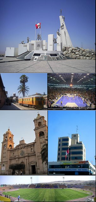
Tacna, officially known as San Pedro de Tacna, is a city in southern Peru and the regional capital of the Tacna Region. A very commercially active city, it is located only 35 km (22 mi) north of the border with Arica y Parinacota Region from Chile, inland from the Pacific Ocean and in the valley of the Caplina River. It is Peru's tenth most populous city.

Tacna is the southernmost department and region in Peru. The Chilean Army occupied the present-day Tacna Department during the War of the Pacific from 1885 until 1929 when it was reincorporated into Peru.

Arica Province is one of two provinces of Chile's northernmost region, Arica y Parinacota. The province is bordered on the north by the Tacna Province of Peru, on the south by the Tamarugal Province in the Tarapacá Region, on the east the Parinacota Province and on the west by the Pacific Ocean. Its capital is the port city of Arica.

Arica is a commune and a port city with a population of 222,619 in the Arica Province of northern Chile's Arica y Parinacota Region. It is Chile's northernmost city, being located only 18 km (11 mi) south of the border with Peru. The city is the capital of both the Arica Province and the Arica and Parinacota Region. Arica is located at the bend of South America's western coast known as the Arica Bend or Arica Elbow. At the location of the city are two valleys that dissect the Atacama Desert converge: Azapa and Lluta. These valleys provide citrus and olives for export.

Putre is a Chilean town and commune, capital of the Parinacota Province in the Arica-Parinacota Region. It is located 130 km (81 mi) east of Arica, at an altitude of 3,500 m (11,483 ft). The town is backdropped by Taapaca volcanic complex.

The Tarapacá Region is one of Chile's 16 first-order administrative divisions. It comprises two provinces, Iquique and Tamarugal. It borders the Chilean Arica y Parinacota Region to the north, Bolivia's Oruro Department and Potosí Department on the east, Chile's Antofagasta Region to the south and the Pacific Ocean to the west. The port city of Iquique is the region's capital.
Azapa Valley is a fertile and narrow oasis in Arica y Parinacota Region, Chile. It is framed between two arid hills and divided by the San Jose River that runs during the summer season. It is located three kilometres (1.9 mi) from the city of Arica. This jewel of the north has a unique climate that permits the farming of a great variety of fruits and vegetables throughout the year. This is in addition to the unique Azapa olives, renowned for their violet color and bitter flavor that also yield a hearty oil.

The Arica y Parinacota Region is one of Chile's 16 first order administrative divisions. It comprises two provinces, Arica and Parinacota. It borders Peru's Department of Tacna to the north, Bolivia's La Paz and Oruro departments to the east and Chile's Tarapacá Region to the south. Arica y Parinacota is the 5th smallest, the 3rd least populous and the 6th least densely populated of the regions of Chile. Arica is the region's capital and largest city.

Tacora is a stratovolcano located in the Andes of the Arica y Parinacota Region of Chile. Near the border with Peru, it is one of the northernmost volcanoes of Chile. It is part of the Central Volcanic Zone in Chile, one of the four volcanic belts of the Andes. The Central Volcanic Zone has several of the highest volcanoes in the world. Tacora itself is a stratovolcano with a caldera and a crater. The youngest radiometric age is 50,000 years ago and it is heavily eroded by glacial activity.

The Lluta River is a river located in the northern portion of the Arica y Parinacota Region of Chile. Its headwaters are on the western flanks of the Andes of the Parinacota Province, just a few kilometers south of the border with Peru, and empties into the Pacific Ocean at the village of Villa Frontera, about 4 km north of the city of Arica.

Chacalluta International Airport is an airport serving the city of Arica, capital of the Arica Province in the northern Arica y Parinacota Region of Chile. It is 18.5 kilometres (11.5 mi) northwest of the city and 1 kilometre (0.62 mi) south of the border with Peru, adjacent to the village of Villa Frontera.

Afro-Chileans are Chilean people of African descent. They may be descendants of slaves who were brought to Chile via the trans-Atlantic slave trade, or recent migrants from other parts of Latin America, the Caribbean or Africa.
Molinos is a village in the Arica and Parinacota Region, Chile. It is located south of the border with Peru, and just south of the Lluta River. The Lluta flooded in 2019 and temporarily cut off access to the village. As of the census in 2002, the village had a population of 39, most of whom were men.
The 1877 Iquique earthquake occurred at 21:16 local time on 9 May. It had a magnitude of 8.5 on the surface wave magnitude scale. Other estimates of its magnitude have been as high as 8.9 Mw and 9.0 Mt. It had a maximum intensity of XI (Extreme) on the Mercalli intensity scale and triggered a devastating tsunami. A total of 2,385 people died, mainly in Fiji from the tsunami.
The Chilean Inca trail is a local and popular term among local tourism initiatives and Chilean anthropologists and archaeologists for the various branches of the Qhapak Ñan in Chile and its associated Inca archaeological sites.

Kunturiri is a volcano in the Andes on the border of Bolivia and Chile which rises up to 5,762 metres (18,904 ft). On the Chilean side it is located in the Arica and Parinacota Region and on the Bolivian side in the Oruro Department, Sajama Province, Curahuara de Carangas Municipality, Sajama Canton as well as in the La Paz Department, Pacajes Province, Calacoto Municipality, Ulloma Canton.

The Chile–Peru border is an international border of South America. It separates Chile from Peru along a line that runs about 10 km north of the Arica–La Paz railway. The border runs from the bend of coast known as the "Arica-Elbow" at the Pacific Ocean inland in northeast direction into the Andes and the Altiplano Plateau. The border was established in 1929 with the Treaty of Lima. Venezuelan migrants seeking to enter Chile avoid the Chile–Peru border as it better guarded than the Bolivia–Chile border.

The Chilean–Peruvian territorial dispute is a territorial dispute between Chile and Peru that started in the aftermath of the War of the Pacific and ended significantly in 1929 with the signing of the Treaty of Lima and in 2014 with a ruling by the International Court of Justice. The dispute applies since 2014 to a 37,610 km2 territory in the Chile–Peru border, as a result of the maritime dispute between both states.
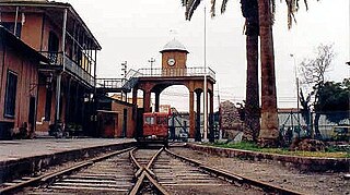
The Tacna–Arica railway is a transnational railway that connects the cities of Tacna and Arica, located in Peru and Chile, respectively. Agreed upon as part of the 1929 Treaty of Lima, it has a length of 62 km (39 mi) and a track gauge of 1,435 mm (4.708 ft). It is currently administered by the Regional Government of Tacna and operates since May 28, 2016, after being suspended since March 12, 2012.