Visviri

Last updated
Visviri
Chile location map.svg
Red pog.svg
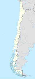
Visviri
Location in Chile
Coordinates: 17°35′41″S69°28′54″W / 17.59472°S 69.48167°W / -17.59472; -69.48167
Country Flag of Chile.svg Chile
Admin. divisionFlag of Arica y Parinacota, Chile.svg  Arica y Parinacota
Province Parinacota Province
Commune General Lagos
Population
 (2002)
  Total265 [1]

Visviri is a Chilean hamlet at the northern end of the country and the capital of the General Lagos commune in Parinacota Province, Arica and Parinacota Region. It is notable for being Chile's northernmost populated area, and for being near border of three countries of Bolivia, Peru and Chile. The Bolivian settlement of Charaña is located to the east and Tripartito, Peru lies to the north. [2]

Related Research Articles

<span class="mw-page-title-main">Andean music</span> Style of music

Andean music is a group of styles of music from the Andes region in South America.

<span class="mw-page-title-main">Tacna</span> Place in Peru

Tacna, officially known as San Pedro de Tacna, is a city in southern Peru and the regional capital of the Tacna Region. A very commercially active city, it is located only 35 km (22 mi) north of the border with Arica y Parinacota Region from Chile, inland from the Pacific Ocean and in the valley of the Caplina River. It is Peru's tenth most populous city.

<span class="mw-page-title-main">Altiplano</span> Large plateau in west-central South America

The Altiplano, Collao or Andean Plateau, in west-central South America, is the most extensive high plateau on Earth outside Tibet. The plateau is located at the latitude of the widest part of the north–south-trending Andes. The bulk of the Altiplano lies in Bolivia, but its northern parts lie in Peru, and its southwestern fringes lie in Chile.

<span class="mw-page-title-main">Arica</span> City in Arica y Parinacota, Chile

Arica is a commune and a port city with a population of 222,619 in the Arica Province of northern Chile's Arica y Parinacota Region. It is Chile's northernmost city, being located only 18 km (11 mi) south of the border with Peru. The city is the capital of both the Arica Province and the Arica and Parinacota Region. Arica is located at the bend of South America's western coast known as the Arica Bend or Arica Elbow. At the location of the city are two valleys that dissect the Atacama Desert converge: Azapa and Lluta. These valleys provide citrus and olives for export.

<span class="mw-page-title-main">Parinacota (volcano)</span> Volcano on the border of Chile and Bolivia

Parinacota, Parina Quta or Parinaquta is a dormant stratovolcano on the border of Bolivia and Chile. Together with Pomerape it forms the Nevados de Payachata volcanic chain. Part of the Central Volcanic Zone of the Andes, its summit reaches an elevation of 6,380 metres (20,930 ft) above sea level. The symmetrical cone is capped by a summit crater with widths of 1 kilometre (0.62 mi) or 1,000 metres (3,300 ft). Farther down on the southern slopes lie three parasitic centres known as the Ajata cones. These cones have generated lava flows. The volcano overlies a platform formed by lava domes and andesitic lava flows.

<span class="mw-page-title-main">Pomerape</span> Mountain in Chile

Pomerape is a stratovolcano lying on the border of northern Chile and Bolivia. It is part of the Payachata complex of volcanoes, together with Parinacota Volcano to the south. The name "Payachata" means "twins" and refers to their appearance. It hosts glaciers down to elevations of 5,300–5,800 metres (17,400–19,000 ft), lower on the northern slope.

<span class="mw-page-title-main">Payachata</span>

Payachata or Paya Chata is a north–south trending complex of potentially active volcanos on the border of Bolivia and Chile, directly north of Chungará Lake. The complex contains two peaks, Pomerape to the north and Parinacota to the south. On the Bolivian side the volcanoes are located in the Oruro Department, Sajama Province, Curahuara de Carangas Municipality, and on the Chilean side they lie in the Arica y Parinacota Region, Parinacota Province.

<span class="mw-page-title-main">Tarapacá Region</span> Region of Chile

The Tarapacá Region is one of Chile's 16 first-order administrative divisions. It comprises two provinces, Iquique and Tamarugal. It borders the Chilean Arica y Parinacota Region to the north, Bolivia's Oruro Department and Potosí Department on the east, Chile's Antofagasta Region to the south and the Pacific Ocean to the west. The port city of Iquique is the region's capital.

<span class="mw-page-title-main">Arica y Parinacota Region</span> Region of Chile

The Arica y Parinacota Region is one of Chile's 16 first order administrative divisions. It comprises two provinces, Arica and Parinacota. It borders Peru's Department of Tacna to the north, Bolivia's La Paz and Oruro departments to the east and Chile's Tarapacá Region to the south. Arica y Parinacota is the 5th smallest, the 3rd least populous and the 6th least densely populated of the regions of Chile. Arica is the region's capital and largest city.

<span class="mw-page-title-main">Lauca National Park</span> Wildlife park in northern Chile

Lauca National Park is in Chile's far north, in the Andean range. It encompasses an area of 1,379 km2 of altiplano and mountains, the latter consisting mainly of enormous volcanoes. Las Vicuñas National Reserve is its neighbour to the south. Both protected areas, along with Salar de Surire Natural Monument, form Lauca Biosphere Reserve. The park borders Sajama National Park in Bolivia.

<span class="mw-page-title-main">Lauca River</span> River in Bolivia and Chile

The Lauca River is a binational river. It originates in the Chilean Altiplano of the Arica and Parinacota Region, crosses the Andes and empties into Coipasa Lake in Bolivia.

<span class="mw-page-title-main">Lluta River</span> River in Chile

The Lluta River is a river located in the northern portion of the Arica y Parinacota Region of Chile. Its headwaters are on the western flanks of the Andes of the Parinacota Province, just a few kilometers south of the border with Peru, and empties into the Pacific Ocean at the village of Villa Frontera, about 4 km north of the city of Arica.

Parinacota, Parina Quta or Parinaquta may refer to:

Molinos is a village in the Arica and Parinacota Region, Chile. It is located south of the border with Peru, and just south of the Lluta River. The Lluta flooded in 2019 and temporarily cut off access to the village. As of the census in 2002, the village had a population of 39, most of whom were men.

<span class="mw-page-title-main">Canal Lauca</span>

The Canal Lauca is an artificial channel to divert the waters of the Lauca River westward through a canal and tunnel into the Azapa Valley for purposes of irrigation in the valley and hydroelectric-power generation. Its construction began 1948 and water diversion began 14 years later from a dam located about 16 miles southwest of Lago Cotacotani Lake.

<span class="mw-page-title-main">Kunturiri (Bolivia and Chile)</span>

Kunturiri is a volcano in the Andes on the border of Bolivia and Chile which rises up to 5,762 metres (18,904 ft). On the Chilean side it is located in the Arica and Parinacota Region and on the Bolivian side in the Oruro Department, Sajama Province, Curahuara de Carangas Municipality, Sajama Canton as well as in the La Paz Department, Pacajes Province, Calacoto Municipality, Ulloma Canton.

<span class="mw-page-title-main">Pedro José de Guerra</span>

Pedro José Domingo de Guerra was a Bolivian jurist who served as the acting President of Bolivia in 1879 in the absence of Hilarión Daza who was personally commanding the Bolivian Army in the War of the Pacific between Chile, and an allied Bolivia and Peru. His grandson, José Gutiérrez Guerra, was also president of Bolivia between 1917 and 1920.

Lauca is a 5,140 metres (16,860 ft) high andesitic stratovolcano in the Central Volcanic Zone of the Andes on the Altiplano in northern Chile. Administratively it is located in Putre, Arica y Parinacota Region. The volcano was active during the Late Miocene from 10.5 million years ago onwards. A major ignimbrite collapsed the volcano in the Late Pliocene.

<span class="mw-page-title-main">Chilean–Peruvian territorial dispute</span>

The Chilean–Peruvian territorial dispute is a territorial dispute between Chile and Peru that started in the aftermath of the War of the Pacific and ended significantly in 1929 with the signing of the Treaty of Lima and in 2014 with a ruling by the International Court of Justice. The dispute applies since 2014 to a 37,610 km2 territory in the Chile–Peru border, as a result of the maritime dispute between both states.

References

  1. "Censo INE 1999". National Institute of Statistics (in Spanish). Archived from the original on 2012-04-17.
  2. "Primer Poblamiento Humano". portalvisviri.cl (in Spanish).

17°35′41″S69°28′54″W / 17.59472°S 69.48167°W / -17.59472; -69.48167