Parinacota Province

Last updated
Parinacota Province
Provincia de Parinacota
Parinacota volcano.jpg
Logotipo de la Gobernacion de Parinacota.svg
Provincia de Parinacota.svg
Location in the Arica-Parinacota Region
Chile location map.svg
Red pog.svg
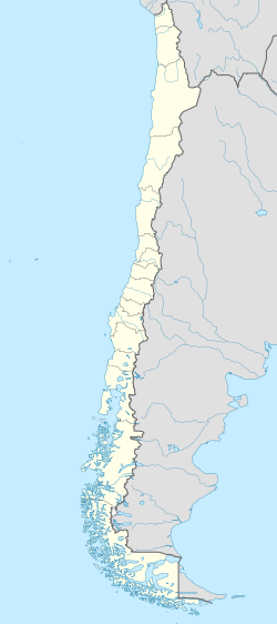
Parinacota Province
Location in Chile
Coordinates: 18°11′47″S69°33′34″W / 18.19639°S 69.55944°W / -18.19639; -69.55944
Country Flag of Chile.svg  Chile
Region Flag of Arica y Parinacota, Chile.svg  Arica y Parinacota
Named for Parinacota Volcano
Capital Putre
Communes General Lagos
Putre
Government
[1]
  Type Provincial
   Presidential Provincial Delegate Wagner Sanhueza Guzmán
Area
[2]
  Total
8,146.9 km2 (3,145.5 sq mi)
Population
 (2002 Census) [2]
  Total
3,156
  Density0.39/km2 (1.0/sq mi)
  Urban
1,235
  Rural
1,921
Sex
[2]
  Men2,106
  Women1,050
Time zone UTC-4 (CLT [3] )
  Summer (DST) UTC-3 (CLST [4] )
Area code 56 + 58
Website Government of Parinacota

Parinacota Province (Spanish : Provincia de Parinacota) is one of two provinces of the Chilean region of Arica y Parinacota. Its capital is Putre. It is named after the Parinacota Volcano.

Contents

History

Arica y Parinacota Region was created on October 8, 2007 under Law 20.175, promulgated on March 23, 2007 by President Michelle Bachelet in the city of Arica. The law divided the former Tarapacá Region into two: the northern portion became the XV Arica y Parinacota Region, and the southern portion remained the I Tarapacá Region.

Geography and demography

According to the 2002 census by the National Statistics Institute (INE), the province spans an area of 8,146.9 km2 (3,146 sq mi) [2] and had a population of 3,156 inhabitants (2,106 men and 1,050 women), giving it a population density of 0.4/km2 (1/sq mi). It is the second least populated province in the country after Antártica Chilena and fifth most sparsely populated province. Between the 1992 and 2002 censuses, the population fell by 17.3% (659 persons). [2]

A 1995 study shows that contrary to the Chilean Spanish spoken in most of Chile there is at least among some of its inhabitants a pronunciation that lacks yeísmo . [5]

Administration

As a province, Parinacota is a second-level administrative division of Chile consisting of two communes: General Lagos in the northern portion and Putre in the south. The town of Putre serves as the provincial capital. The provincial government is led by delegate Wagner Sanhueza Guzmán, who was appointed by president Gabriel Boric. [1]

Related Research Articles

<span class="mw-page-title-main">Arica Province</span> Province in Arica y Parinacota, Chile

Arica Province is one of two provinces of Chile's northernmost region, Arica y Parinacota. The province is bordered on the north by the Tacna Province of Peru, on the south by the Tamarugal Province in the Tarapacá Region, on the east the Parinacota Province and on the west by the Pacific Ocean. Its capital is the port city of Arica.

<span class="mw-page-title-main">Iquique Province</span> Province in Tarapacá, Chile

Iquique Province is one of two provinces in the northern Chilean region of Tarapacá. Its capital is the port city of Iquique.

<span class="mw-page-title-main">Arica</span> City in Arica y Parinacota, Chile

Arica is a commune and a port city with a population of 222,619 in the Arica Province of northern Chile's Arica y Parinacota Region. It is Chile's northernmost city, being located only 18 km (11 mi) south of the border with Peru. The city is the capital of both the Arica Province and the Arica and Parinacota Region. Arica is located at the bend of South America's western coast known as the Arica Bend or Arica Elbow. At the location of the city are two valleys that dissect the Atacama Desert converge: Azapa and Lluta. These valleys provide citrus and olives for export.

<span class="mw-page-title-main">Putre</span> Town and commune in Chile

Putre is a Chilean town and commune, capital of the Parinacota Province in the Arica-Parinacota Region. It is located 130 km (81 mi) east of Arica, at an altitude of 3,500 m (11,483 ft). The town is backdropped by Taapaca volcanic complex.

<span class="mw-page-title-main">Iquique</span> City and Commune in Tarapacá, Chile

Iquique is a port city and commune in northern Chile, capital of both the Iquique Province and Tarapacá Region. It lies on the Pacific coast, west of the Pampa del Tamarugal, which is part of the Atacama Desert. It has a population of 191,468 according to the 2017 census. It is also the main commune of Greater Iquique. The city developed during the heyday of the saltpetre mining in the Atacama Desert in the 19th century. Once a Peruvian city with a large Chilean population, it was conquered by Chile in the War of the Pacific (1879–1883). Today it is one of only two free ports of Chile, the other one being Punta Arenas, in the country's far south.

<span class="mw-page-title-main">Tarapacá Region</span> Region of Chile

The Tarapacá Region is one of Chile's 16 first-order administrative divisions. It comprises two provinces, Iquique and Tamarugal. It borders the Chilean Arica y Parinacota Region to the north, Bolivia's Oruro Department and Potosí Department on the east, Chile's Antofagasta Region to the south and the Pacific Ocean to the west. The port city of Iquique is the region's capital.

<span class="mw-page-title-main">Arica y Parinacota Region</span> Region of Chile

The Arica y Parinacota Region is one of Chile's 16 first order administrative divisions. It comprises two provinces, Arica and Parinacota. It borders Peru's Department of Tacna to the north, Bolivia's La Paz and Oruro departments to the east and Chile's Tarapacá Region to the south. Arica y Parinacota is the 5th smallest, the 3rd least populous and the 6th least densely populated of the regions of Chile. Arica is the region's capital and largest city.

Huara is a Chilean town and commune in Tamarugal Province, Tarapacá Region. It is located 45 km (28 mi) or northeast of Iquique. The village is crossed by the Pan-American Highway and is the crossing point for the road that goes to Oruro in Bolivia. This road also serves as access to the Atacama Giant site and the Volcán Isluga National Park.

<span class="mw-page-title-main">Elqui Province</span> Province in Coquimbo, Chile

Elqui Province is a province in the Chilean region of Coquimbo (IV). The provincial capital is the city of Coquimbo.

<span class="mw-page-title-main">Pozo Almonte</span> City and Commune in Tarapacá, Chile

Pozo Almonte is a city and commune of Chile located in the interior of Atacama Desert. It has been the capital of Tamarugal Province since this province was established in 2007. The city is located at 52 km (32 mi) from Tacapacá Region's capital, Iquique. It has over 15,000 inhabitants. The commune has an area of 13,766 km (8,554 mi) and borders the following communes: Iquique, Alto Hospicio, Huara, Pica, María Elena and Tocopilla.

General Lagos is Chile's northernmost commune in Parinacota Province, Arica and Parinacota Region. Its capital is Visviri.

<span class="mw-page-title-main">Magallanes Province</span> Province in Magallanes y Antártica Chilena, Chile

Magallanes Province is one of four provinces in the southern Chilean region of Magallanes and Antártica Chilena. The provincial capital is the city of Punta Arenas.

<span class="mw-page-title-main">Capitán Prat Province</span> Province in Aysén, Chile

Capitán Prat Province is one of four provinces in the southern Chilean region of Aysén (XI). Its capital is Cochrane. The province is named after the naval hero Arturo Prat.

<span class="mw-page-title-main">Concepción Province, Chile</span> Province in Bío Bío, Chile

Concepción Province is one of four provinces of the Chilean region of Bío Bío (VIII). Its capital, Concepción, is part of the Greater Concepción conurbation, the nation's second largest metropolitan area after Santiago.

<span class="mw-page-title-main">General Carrera Province</span> Province in Aisén, Chile

General Carrera Province is one of four provinces of the southern Chilean region of Aisen (XI). Its capital city is Chile Chico.

<span class="mw-page-title-main">Taapaca</span> Volcano in Chile

Taapaca is a Holocene volcanic complex in northern Chile's Arica y Parinacota Region. Located in the Chilean Andes, it is part of the Central Volcanic Zone of the Andean Volcanic Belt, one of four distinct volcanic chains in South America. The town of Putre lies at the southwestern foot of the volcano.

<span class="mw-page-title-main">Colchane</span> Commune in Tarapacá, Chile

Colchane is a Chilean village and commune in Tamarugal Province, Tarapacá Region.

<span class="mw-page-title-main">Camarones, Chile</span> City and Commune in Arica y Parinacota, Chile

Camarones is a city and commune in the Arica y Parinacota Region in Chile. It forms part of the administrative Arica Province and has a population of 1,220. Its municipality seat is in the town of Cuyo, located next to the Chile Highway 5. Cuyo is the administrative center of the commune and a place of rest for travellers. The main towns are Codpa and Caleta Camarones. The latter is a fishing inlet of only 44 inhabitants. Codpa is the largest town in the commune, located 114 kilometres (71 mi) from the city of Arica. It is an entirely rural commune with almost no tourist activity, and is well known for its uncharted areas. The only Afro-Chilean community in Chile is located in Camarones.

<span class="mw-page-title-main">Tamarugal Province</span> Province in Tarapacá, Chile

Tamarugal Province is one of two provinces in the northern Chilean region of Tarapacá. The capital is the city of Pozo Almonte.

Camiña is a Chilean commune and village in El Tamarugal Province, Tarapacá Region. According to the 2002 census, the commune population was 1,275 and has an area of 2,200.2 km2 (850 sq mi).

References

  1. 1 2 "Gobiernos" (in Spanish). Archived from the original on July 7, 2011. Retrieved February 16, 2011.
  2. 1 2 3 4 5 "Territorial division of Chile" (PDF) (in Spanish). National Statistics Institute. 2007. Retrieved 18 March 2011.
  3. "Chile Time". WorldTimeZones.org. Archived from the original on 2007-09-11. Retrieved 2010-07-28.
  4. "Chile Summer Time". WorldTimeZones.org. Archived from the original on 2007-09-11. Retrieved 2010-07-28.
  5. Wagner, Claudio; Rosas, Claudia (2003). "Geografía de la "ll" en Chile". Estudios Filológicos . 38: 188–200.