Llanquihue Province

Last updated

|

Llanquihue Province
Provincia de Llanquihue
VolcanOsorno-LagoLlanquihue.jpg
Logo de la Gobernacion Provincial de Llanquihue.svg
Provincia de Llanquihue.svg
Location in the Los Lagos Region
Chile location map.svg
Red pog.svg
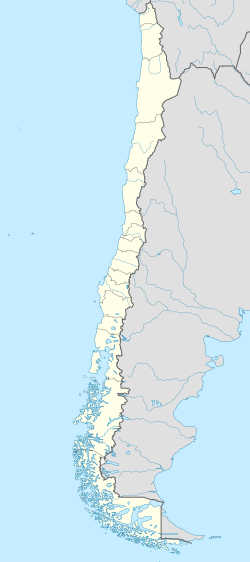
Llanquihue Province
Location in Chile
Coordinates: 41°20′S72°50′W / 41.333°S 72.833°W / -41.333; -72.833
Country Chile
Region Los Lagos
Capital Puerto Montt
Communes
Government
  Type Provincial
   Governor Leticia Oyarce Kruger (UDI)
Area
[1]
  Total
14,876.4 km2 (5,743.8 sq mi)
Population
 (2012 Census) [1]
  Total
368,127
  Density25/km2 (64/sq mi)
  Urban
232,962
  Rural
88,531
Sex
[1]
  Men162,636
  Women158,857
Time zone UTC-4 (CLT [2] )
  Summer (DST) UTC-3 (CLST [3] )
Area code 56 + 65
Website Government of Llanquihue

Llanquihue Province (Spanish : Provincia de Llanquihue) is one of four provinces of the Chilean region of Los Lagos (X). Its capital is Puerto Montt.

Contents

The region is well known for the beauty of its natural environment as well as for the food and seafood from the ports of Puerto Montt and Calbuco.

Settlement history

European settlement of Llanquihue began in 1852 when Germans were encouraged to immigrate to southern Chile and took up wheat farming. A century later, a new wave of Jewish refugees came from Germany in 1945. [4]

Geography

Chile's second largest lake, Lake Llanquihue, is located in the province as well as four volcanoes: Osorno, Calbuco, Puntiagudo and Cerro Tronador.

Llanquihue is a region of forests, rivers and lakes, and the greater part is mountainous. In addition to Lake Llanquihue, there are other large lakes in the eastern part of the province—Puyehue, on the northern frontier, Rupanco, and Todos los Santos. The Calbuco and Osorno volcanoes rise from near its eastern shores, the latter to a height of 7,382 feet (2,250 m). [5]

The outlet of Lake Llanquihue is through Maullín River, the lower course of which is navigable. The other large rivers of the province are the Bueno, which receives the waters of Lakes Puyehue and Rupanco, and the Puelo, which has its rise in a lake of the same name in Argentinq. A short tortuous river in this vicinity, called the Petrohué, affords an outlet for the picturesque lake of Todos los Santos, and enters the Reloncaví Sound near the Puelo. The southern coast of the province is indented by a number of inlets and bays affording good fishing. [5]

Administration

As a province, Llanquihue is a second-level administrative division of Chile, governed by a municipality for each constituent commune (Spanish: comuna). Puerto Montt is the provincial capital. The provincial governor is Francisco Le-Bretón as appointed by the President of Chile.

Communes

Geography and demography

According to the 2002 census by the National Statistics Institute (INE), the province spans an area of 14,876.4 km2 (5,744 sq mi) [1] and had a population of 321,493 inhabitants (162,636 men and 158,857 women), giving it a population density of 21.6/km2 (56/sq mi). Of these, 232,962 (72.5%) lived in urban and 88,531 (27.5%) in rural areas. Between the 1992 and 2002 censuses, the population grew by 22.4% (58,931 persons). [1]

Cities

References

  1. 1 2 3 4 5 "Territorial division of Chile" (PDF) (in Spanish). National Statistics Institute. 2007. Archived from the original (PDF) on 14 November 2010. Retrieved 23 March 2011.
  2. "Chile Time". WorldTimeZones.org. Archived from the original on 2007-09-11. Retrieved 2010-07-28.
  3. "Chile Summer Time". WorldTimeZones.org. Archived from the original on 2007-09-11. Retrieved 2010-07-28.
  4. (in Spanish) Colonización alemana en Llanquihue Archived 2013-01-16 at the Wayback Machine
  5. 1 2 Wikisource-logo.svg One or more of the preceding sentences incorporates text from a publication now in the public domain :  Chisholm, Hugh, ed. (1911). "Llanquihue". Encyclopædia Britannica . Vol. 16 (11th ed.). Cambridge University Press. p. 830.