Palena, Chile

Last updated
Palena
Spanish: Palena
Palena chile.jpg
Palena Chile


Comuna de Palena.svg
Chile location map.svg
Red pog.svg
Palena
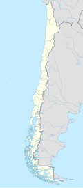
Location in Chile
Coordinates: 43°37′0″S71°48′0″W / 43.61667°S 71.80000°W / -43.61667; -71.80000
Country Chile
Region Los Lagos
Province Palena
Government
[1]
  Type Municipality
   Alcalde Aladin Delgado Casanova (RN)
Area
[2]
  Total2,763.7 km2 (1,067.1 sq mi)
Elevation
353 m (1,158 ft)
Population
 (2012 Census) [2]
  Total1,773
  Density0.64/km2 (1.7/sq mi)
   Urban
0
   Rural
1,690
Sex
[2]
  Men904
  Women786
Time zone UTC−04:00 (CLT [3] )
  Summer (DST) UTC−03:00 (CLST [4] )
Area code 56 + 65
Climate Cfb
Website www.municipalidadpalena.cl

Palena is a Chilean commune located in Palena Province, Los Lagos Region. The commune is named after Palena Lake.

Contents

Demographics

According to the 2002 census of the National Statistics Institute, Palena spans an area of 2,763.7 km2 (1,067 sq mi) and has 1,690 inhabitants (904 men and 786 women), making the commune an entirely rural area. The population grew by 2.2% (37 persons) between the 1992 and 2002 censuses. [2]

Administration

As a commune, Palena is a third level administrative division of Chile administered by a municipal council, headed by an alcalde who is directly elected every four years. The 2008-2012 alcalde is Aladin Delgado Casanova (RN). [1]

Within the electoral divisions of Chile, Palena is represented in the Chamber of Deputies by Gabriel Ascencio (PDC) and Alejandro Santana (RN) as part of the 58th electoral district, together with Castro, Ancud, Quemchi, Dalcahue, Curaco de Vélez, Quinchao, Puqueldón, Chonchi, Queilén, Quellón, Chaitén, Hualaihué and Futaleufú. The commune is represented in the Senate by Camilo Escalona Medina (PS) and Carlos Kuschel Silva (RN) as part of the 17th senatorial constituency (Los Lagos Region).

Climate

Climate data for Palena (Alto Palena)
MonthJanFebMarAprMayJunJulAugSepOctNovDecYear
Mean daily maximum °C (°F)19.3
(66.7)
19.4
(66.9)
18.3
(64.9)
14.7
(58.5)
10.4
(50.7)
7.6
(45.7)
6.3
(43.3)
8.1
(46.6)
11.3
(52.3)
14.1
(57.4)
16.6
(61.9)
18.3
(64.9)
13.7
(56.7)
Daily mean °C (°F)14.3
(57.7)
13.7
(56.7)
12.5
(54.5)
9.6
(49.3)
6.7
(44.1)
4.3
(39.7)
3.0
(37.4)
4.1
(39.4)
6.2
(43.2)
8.6
(47.5)
11.0
(51.8)
12.9
(55.2)
8.9
(48.0)
Mean daily minimum °C (°F)9.1
(48.4)
8.3
(46.9)
7.5
(45.5)
5.7
(42.3)
4.0
(39.2)
1.7
(35.1)
0.8
(33.4)
1.1
(34.0)
2.1
(35.8)
3.8
(38.8)
6.3
(43.3)
8.0
(46.4)
4.9
(40.8)
Average precipitation mm (inches)93.6
(3.69)
72.9
(2.87)
62.8
(2.47)
132.5
(5.22)
247.9
(9.76)
212.9
(8.38)
284.7
(11.21)
121.2
(4.77)
133.6
(5.26)
98.3
(3.87)
95.2
(3.75)
132.5
(5.22)
1,688.1
(66.47)
Source: Meteorología Interactiva [5]

Related Research Articles

<span class="mw-page-title-main">Saavedra, Chile</span> Town and Commune in Araucanía, Chile

Saavedra is a commune of Chile in Cautín Province, Araucanía Region. The principal community and administrative centre of the commune is the town of Puerto Saavedra. The commune is named after the Chilean soldier General Cornelio Saavedra Rodríguez who was placed in charge of the occupation of the Araucanía in 1860. It has the highest percentage—though not the largest number—of Mapuche people in the region. Location for the 1991 movie "La frontera".

<span class="mw-page-title-main">Conchalí</span> City and Commune in Santiago Metro., Chile

Conchalí is a commune of Chile located in Santiago Province, Santiago Metropolitan Region. It is a northwestern suburb of Santiago.

<span class="mw-page-title-main">Pedro Aguirre Cerda, Chile</span> City and Commune in Santiago Metro., Chile

Pedro Aguirre Cerda is a commune of Chile located in Santiago Province, Santiago Metropolitan Region. It is named after President Pedro Aguirre Cerda.

<span class="mw-page-title-main">Dalcahue</span> City and Commune in Los Lagos, Chile

DalcahueSpanish pronunciation:[dalˈkawe] is a port city and a commune in Chiloé Province, on Chiloé Island, Los Lagos Region, Chile.

<span class="mw-page-title-main">San Clemente, Chile</span> City and Commune in Maule, Chile

San Clemente is a city and commune administered by the municipality of San Clemente, located in the Talca Province of Chile's Maule Region.

Los Andes, founded on July 31, 1791 as Santa Rosa de Los Andes, is a Chilean city and commune located in the province of the same name, in Valparaíso Region. It lies on the route between Santiago and Chile's primary border crossing with Argentina by way of the summit of the Uspallata Pass in the Andes mountain range.

Toltén is a Chilean commune located at the lower flows Toltén River at the southern coast of Cautín Province which is part of Araucanía Region. The commune is administered by the municipality Nueva Toltén, the main harbour and town within the commune.

Puyehue is a commune in Chile located in Osorno Province of Los Lagos Region. It is bordered to the south by Rupanco Lake, to the east by the Andes and Argentina, to the north by Puyehue Lake and to the west by Osorno commune. Cardenal Antonio Samoré Pass that links the Los Lagos Region to Argentina lies in the eastern tip of the commune. The comune is administered by Entre Lagos, the main town in Puyehue.

<span class="mw-page-title-main">Quemchi</span> Town and Commune in Los Lagos, Chile

Quemchi is a Chilean town and commune in Los Lagos Region, in Chiloé Province, on the eastern shore of Chiloé Island. It acquired reputation because the famous Chilean writer Francisco Coloane was born near the town.

<span class="mw-page-title-main">Cochamó</span> Commune in Los Lagos, Chile

Cochamó is a Chilean town and commune located in Llanquihue Province, Los Lagos Region. The capital of the commune is the town of Río Puelo, which is named after the Puelo River.

Lago Verde is a Chilean commune located at the headwaters of the Cisnes River in Coyhaique Province, Aisén Region. The commune is administered by the municipality of Lago Verde, the principal settlement.

San Juan de la Costa is a commune of Chile, located in the Osorno Province in the Los Lagos Region. The administration (municipalidad) is located at the hamlet of Puaucho, 34 km west of Osorno. San Juan de la Costa is known for a large proportion of its population being indigenous Huilliches. This commune is characterized by a large coastline suitable for ecotourism, especially balnearios Pucatrihue and Maicolpue, the port of Bahía Mansa, and the ethnic tourism of the Huilliche culture.

San Pablo is a Chilean town and commune located in the Osorno Province in the Los Lagos Region. It is located 27 km from the city and provincial capital of Osorno. The commune is mostly rural. Its activity is almost entirely agricultural and ranching. In the commune also performs Agritourism.

Hualaihué is a Chilean commune located in Palena Province, Los Lagos Region. The communal capital is the town of Hornopirén.

Vilcún is a Chilean town and commune in Cautín Province, Araucanía Region. The town is an important gateway for tourists visiting Conguillío National Park and Llaima volcano.

<span class="mw-page-title-main">Pinto, Chile</span> Town and Commune in Ñuble, Chile

Pinto is a Chilean town and commune in Diguillín Province, Ñuble Region. It is bordered by the commune of Coihueco to the north, Chillán and San Ignacio to the west, and El Carmen and Antuco to the south. The commune shares its eastern border with the Argentine province of Neuquén.

Queilén is a town and commune in Chiloé Province, in the Archipelago of Chiloé in southern Chile. It covers a portion of the southeast of the Greater Island of Chiloé, between the communes of Chonchi, Quellón, Tranqui Island and Acuy Island. For the 2002 census, the population of the town had grown to 1,912 inhabitants, according to INE; the municipality had a population of 5,138.

Quinchao is a Chilean commune located in Chiloé Province, Los Lagos Region. The seat of government lies in the town of Achao on the island.

Ercilla is a Chilean town and commune in the Malleco Province, Araucanía Region. Its name is a tribute to Alonso de Ercilla, who wrote La Araucana.

Los Sauces is a Chilean town and commune in the Malleco Province, Araucanía Region.

References

  1. 1 2 Asociación Chilena de Municipalidades
  2. 1 2 3 4 "National Statistics Institute" (in Spanish). Retrieved 27 January 2010.
  3. "Chile Time". WorldTimeZones.org. Archived from the original on 11 September 2007. Retrieved 26 September 2010.
  4. "Chile Summer Time". WorldTimeZones.org. Archived from the original on 11 September 2007. Retrieved 26 September 2010.
  5. "Información climatológica de estaciones chilenas" (in Spanish). Archived from the original on 9 December 2012. Retrieved 27 May 2024.