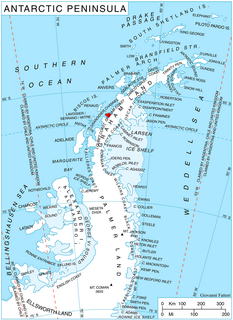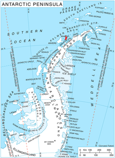
Prospect Point is a headland at the west extremity of Velingrad Peninsula on Graham Coast in Graham Land, nearly 2 nautical miles (3.7 km) south of Ferin Head and immediately east of the Fish Islands. Roughly charted by the British Graham Land Expedition (BGLE) under Rymill, 1934-37. Photographed by Hunting Aerosurveys Ltd. in 1956-57. The name was suggested in 1957 by E. P. Arrowsmith, Governor of the Falkland Islands.

Gilbert Glacier is a glacier about 20 nautical miles (37 km) long flowing south from Nichols Snowfield into Mozart Ice Piedmont, situated in northern Alexander Island, Antarctica.
McDonald Bay is an open bay in the Davis Sea, 10 nautical miles (19 km) wide at its entrance between Adams Island and the Haswell Islands, lying immediately west of Mabus Point on the coast of Antarctica. It was charted by the Australasian Antarctic Expedition under Douglas Mawson, 1911–14, and was named by the Advisory Committee on Antarctic Names after Commander Edwin A. McDonald, U.S. Navy, Commander of the USS Burton Island, flagship of the two icebreakers which supported the U.S. Navy Operation Windmill parties which established astronomical stations along Wilhelm II, Queen Mary, Knox and Budd Coasts during the 1947–48 summer season.

Mabus Point is a point on the coast of Antarctica lying just south of the Haswell Islands, marking the eastern limit of McDonald Bay. It was first charted by the Australasian Antarctic Expedition, 1911–14, under Douglas Mawson, and was recharted by G.D. Blodgett in 1955 from aerial photographs taken by U.S. Navy Operation Highjump, 1946–47. The point was named by the Advisory Committee on Antarctic Names for Lieutenant Commander Howard W. Mabus, U.S. Navy, executive officer of the icebreaker Edisto, who was instrumental in providing close support to U.S. Navy Operation Windmill parties in establishing astronomical control stations along this coast, 1947–48. Mabus Point subsequently became the site of the Soviet scientific station, Mirny.

Bistra Glacier is 1 nautical mile long and 0.4 nautical miles wide glacier on the northwest side of Imeon Range on Smith Island in the South Shetland Islands, Antarctica. It is situated southwest of Chuprene Glacier and northwest of Dragoman Glacier, drains the west slopes of Mount Foster and the north slopes of Slaveykov Peak, and flows northwestwards of Zavet Saddle to enter Drake Passage south of Garmen Point.

Aphrodite Glacier is a glacier 15 nautical miles (28 km) long flowing north to the east coast of the Antarctic Peninsula 3 nautical miles (6 km) west of Victory Nunatak.

Apollo Glacier is a glacier, 9 nautical miles (17 km) long, flowing northeast and joining the lower part of Aphrodite Glacier 2 nautical miles (4 km) from the east coast of the Antarctic Peninsula.

Bartók Glacier is a glacier, 7 nautical miles (13 km) long and 3 nautical miles (6 km) wide, flowing southwest from the southern end of the Elgar Uplands in the northern part of Alexander Island. It was first photographed from the air and roughly mapped by the British Graham Land Expedition in 1937, and more accurately mapped from air photos taken by the Ronne Antarctic Research Expedition, 1947–48, by D. Searle of the Falkland Islands Dependencies Survey in 1960. It was named by the UK Antarctic Place-Names Committee after the Hungarian composer Béla Bartók.
Bob Island is a rocky island 1 nautical mile (2 km) long and 145 metres (480 ft) high, lying 4 nautical miles (7 km) southeast of Cape Errera, on Wiencke Island in the Palmer Archipelago. An island in this vicinity was surveyed and photographed by the Belgian Antarctic Expedition (BelgAE) under Gerlache in 1898. It was originally called "Ile Famine", but in the reports resulting from the expedition it was renamed "Ile Bob". In a survey of the area in 1955, the Falkland Islands Dependencies Survey (FIDS) made a landing on this island. Although it differs somewhat in size and position from the BelgAE reports, the FIDS found it closely resembles the BelgAE photograph and consider it to be the island originally named.

Buromskiy Island is a small island lying 0.6 km (0.37 mi) south of Haswell Island in the Haswell Islands of Antarctica. About 200 m long and 100 m wide, it was discovered and mapped by the Australasian Antarctic Expedition under Douglas Mawson, 1911–14. It was photographed by the Soviet expedition of 1958 and named for N.I. Buromskiy, expedition hydrographer who lost his life in the Antarctic in 1957. It lies 2.7 km north of Mabus Point, the site of Russia's Mirny Station.
Ob' Passage is a passage 0.4 nautical miles (0.7 km) wide between Khmary Island and Mabus Point on the coast of Antarctica. First observed by the Australasian Antarctic Expedition (1911–14) under Mawson. Mapped by the Soviet expedition (1956), who named it for the ship Ob'.
Cronus Glacier is a glacier 6 nautical miles (11 km) long and 3 nautical miles (6 km) wide flowing northwest into Bowman Inlet between the Calypso Cliffs and Crabeater Point on the east coast of the Antarctic Peninsula. It was photographed by the Ronne Antarctic Research Expedition on December 22, 1947, and roughly surveyed by the Falkland Islands Dependencies Survey in December 1958. It was named by the UK Antarctic Place-Names Committee after Cronus, the god of agriculture in Greek mythology.

Stroiteley Islands is a chain of about four small islands in the southern part of the Haswell Islands. They are aligned north-south and lie close to the mainland, 1 nautical mile (1.9 km) west of Mabus Point.
Grimley Glacier is a tributary glacier, 15 nautical miles (28 km) long and 3 nautical miles (6 km) wide, lying 3 nautical miles north of Sunfix Glacier and flowing east-northeast into Casey Glacier in northern Palmer Land, Antarctica. The glacier was photographed from the air by the United States Antarctic Service on September 28, 1940, and by the Ronne Antarctic Research Expedition on December 22, 1947. It was surveyed by the Falkland Islands Dependencies Survey (FIDS) in December 1960 and was named by the UK Antarctic Place-Names Committee for Peter H. Grimley of FIDS, a geologist at Horseshoe Island and Stonington Island in 1960.
Fricker Glacier is a glacier, 10 nautical miles (19 km) long, which lies close north of Monnier Point and flows in a northeasterly direction into the southwest side of Mill Inlet, on the east coast of Graham Land, Antarctica. It was charted by the Falkland Islands Dependencies Survey (FIDS) and photographed from the air by the Ronne Antarctic Research Expedition in 1947, and was named by the FIDS for Karl Fricker, a German Antarctic historian.

Tyulen'i Islands is a group of about three very small islands in the south part of the Haswell Islands, located 1 nautical mile (1.9 km) off the mainland and 1.2 nautical miles (2.2 km) west of Mabus Point.
Rotz Glacier is a tributary glacier 9 nautical miles (17 km) long and 2 nautical miles (3.7 km) wide. It flows west from Wakefield Highland, central Antarctic Peninsula, into Airy Glacier at a point due south of Mount Timosthenes. Photographed by Ronne Antarctic Research Expedition (RARE) on November 27, 1947. Surveyed by Falkland Islands Dependencies Survey (FIDS) in December 1958 and November 1960. Named by United Kingdom Antarctic Place-Names Committee (UK-APC) after Jean Rotz, 16th century French chartmaker and writer on the principles of navigation, who designed an elaborate magnetic compass and became hydrographer to King Henry VIII in 1542.

Lister Glacier is a glacier 5 nautical miles (9 km) long and 1 nautical mile (2 km) wide, draining the northeast slopes of Stribog Mountains and flowing into Bouquet Bay just south of Duclaux Point on the northeast side of Brabant Island, in the Palmer Archipelago, Antarctica.


