
Tuff is a type of rock made of volcanic ash ejected from a vent during a volcanic eruption. Following ejection and deposition, the ash is lithified into a solid rock. Rock that contains greater than 75% ash is considered tuff, while rock containing 25% to 75% ash is described as tuffaceous. Tuff composed of sandy volcanic material can be referred to as volcanic sandstone.

Neptunism is a superseded scientific theory of geology proposed by Abraham Gottlob Werner (1749–1817) in the late 18th century, who proposed that rocks formed from the crystallisation of minerals in the early Earth's oceans.

Forearc is a plate tectonic term referring to a region in a subduction zone between an oceanic trench and the associated volcanic arc. Forearc regions are present along convergent margins and eponymously form 'in front of' the volcanic arcs that are characteristic of convergent plate margins. A back-arc region is the companion region behind the volcanic arc.
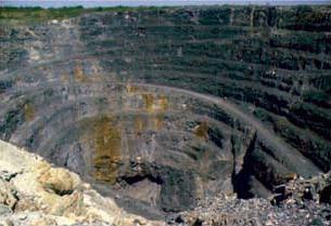
Volcanogenic massive sulfide ore deposits, also known as VMS ore deposits, are a type of metal sulfide ore deposit, mainly copper-zinc which are associated with and created by volcanic-associated hydrothermal events in submarine environments.
In geology, basement and crystalline basement are crystalline rocks lying above the mantle and beneath all other rocks and sediments. They are sometimes exposed at the surface, but often they are buried under miles of rock and sediment. The basement rocks lie below a sedimentary platform or cover, or more generally any rock below sedimentary rocks or sedimentary basins that are metamorphic or igneous in origin. In the same way, the sediments or sedimentary rocks on top of the basement can be called a "cover" or "sedimentary cover".

Mount Elden or Elden Mountain is located in central Coconino County northeast of Flagstaff, Arizona. It takes its name from one of the region's earliest Anglo settlers, John Elden, who, along with his family, established a homestead on the mountain's lower slopes and grazed sheep on the open grasslands below during the late 19th century.

Quetrupillán is a stratovolcano located in Los Ríos Region of Chile. It is situated between Villarrica and Lanín volcanoes, within Villarrica National Park. Geologically, Quetrupillán is located in a tectonic basement block between the main traces of Liquiñe-Ofqui Fault and Reigolil-Pirihueico Fault.

A volcanic belt is a large volcanically active region. Other terms are used for smaller areas of activity, such as volcanic fields. Volcanic belts are found above zones of unusually high temperature where magma is created by partial melting of solid material in the Earth's crust and upper mantle. These areas usually form along tectonic plate boundaries at depths of 10 to 50 kilometres. For example, volcanoes in Mexico and western North America are mostly in volcanic belts, such as the Trans-Mexican Volcanic Belt that extends 900 kilometres (560 mi) from west to east across central-southern Mexico and the Northern Cordilleran Volcanic Province in western Canada.
The Mount Pleasant Caldera is a large eroded Late Devonian volcanic caldera complex, located in the northern Appalachian Mountains of southwestern New Brunswick, Canada. It is one of few noticeable pre-Cenozoic calderas, and its formation is associated to a period of crustal thinning that followed the Acadian orogeny in the northern Appalachian Mountains. It sits relatively near to the coastline.
Prindle Volcano is an isolated basaltic cinder cone located in eastern Alaska, United States, in the headwaters of the East Fork of the Fortymile River, approximately 80 kilometers northeast of Tok, Alaska. The cone is fresh-looking and has a base approximately 900 metres wide. It is the northwesternmost expression of the Northern Cordilleran Volcanic Province. The cinder cone, and an approximately 11-kilometre (6.8-mile) long lava flow which breached the margin of the cone, erupted in the Pleistocene approximately 176,000 years ago. The lava flow extends to the southeast, then turns southwest and continues in a river valley.

The geology of Azerbaijan forms a constituent geological part of the Alpine fold belt. Sedimentary deposits embracing the southwestern parts of the Major and Minor Caucasus, including the intermountain Kur River trough, as well as the Mid- and South Caspian basins consist of diversity fold systems. The Earth's crust thickness in Azerbaijan varies in the range from 38 to 55 km. Its maximum thickness is observed in the Minor Caucasus area, while its minimum thickness is typical for the Talysh foothills. The geological setting of the area consists of sedimentary, volcanic-sedimentary, volcanic and terrestrial deposits embracing almost the entire stratigraphic range beginning from Pre-Cambrian through Holocene time.

Nintoku Seamount or Nintoku Guyot is a seamount and guyot in the Hawaiian-Emperor seamount chain. It is a large, irregularly shaped volcano that last erupted 66 million years ago. Three lava flows have been sampled at Nintoku Seamount; the flows are almost all alkalic (subaerial) lava. It is 56.2 million years old.

Marker horizons are stratigraphic units of the same age and of such distinctive composition and appearance, that, despite their presence in separate geographic locations, there is no doubt about their being of equivalent age (isochronous) and of common origin. Such clear markers facilitate the correlation of strata, and used in conjunction with fossil floral and faunal assemblages and paleomagnetism, permit the mapping of land masses and bodies of water throughout the history of the earth. They usually consist of a relatively thin layer of sedimentary rock that is readily recognized on the basis of either its distinct physical characteristics or fossil content and can be mapped over a very large geographic area. As a result, a key bed is useful for correlating sequences of sedimentary rocks over a large area. Typically, key beds were created as the result of either instantaneous events or very short episodes of the widespread deposition of a specific types of sediment. As the result, key beds often can be used for both mapping and correlating sedimentary rocks and dating them. Volcanic ash beds and impact spherule beds, and specific megaturbidites are types of key beds created by instantaneous events. The widespread accumulation of distinctive sediments over a geologically short period of time have created key beds in the form of peat beds, coal beds, shell beds, marine bands, black shales in cyclothems, and oil shales. A well-known example of a key bed is the global layer of iridium-rich impact ejecta that marks the Cretaceous–Paleogene boundary.
Calabozos is a Holocene caldera in central Chile's Maule Region. Part of the Chilean Andes' volcanic segment, it is considered a member of the Southern Volcanic Zone (SVZ), one of the three distinct volcanic belts of South America. This most active section of the Andes runs along central Chile's western edge, and includes more than 70 of Chile's stratovolcanoes and volcanic fields. Calabozos lies in an extremely remote area of poorly glaciated mountains.
In geology, a horizon is either a bedding surface where there is marked change in the lithology within a sequence of sedimentary or volcanic rocks, or a distinctive layer or thin bed with a characteristic lithology or fossil content within a sequence. Examples of the former can include things such as volcanic eruptions as well as things such as meteorite impacts and tsunamis. Examples of the latter include things such as ice ages and other large climate events, as well as large but temporary geological features and changes such as inland oceans. In the interpretation of seismic reflection data, horizons are the reflectors picked on individual profiles. These reflectors represent a change in rock properties across a boundary between two layers of rock, particularly seismic velocity and density. It can also represent changes in the density of the material and the composition of it and the pressure under which it was produced. Thus, not only do the properties change but so too do the conditions of formation and other differences in the rock. The horizons can sometimes be very prominent, such as visible changes in cliff sides, to extremely subtle chemical differences.
Amethyst Mountain, el. 9,609 feet (2,929 m) is the highest peak and central part of a northwest – southeast trending ridge that lies between the Lamar River to the northeast and Deep Creek to the southwest within Park County, Wyoming. From northwest to southeast, this ridge consists of Specimen Ridge, Amethyst Mountain, and the Mirror Plateau in Yellowstone National Park. The nearest town is Silver Gate, Montana, which is 19.2 miles away.
Volcano-sedimentary may refer to:
In geology an intra-arc basin is a sedimentary basin that exists amidst a volcanic arc. Being located next to volcanoes intra-arc basins tend to host Volcano-sedimentary sequences. Cura-Mallín at the border of Chile and Argentina is an example of an intra-arc basin.
The geology of Cameroon is almost universally Precambrian metamorphic and igneous basement rock, formed in the Archean as part of the Congo Craton and the Central African Mobile Zone and covered in laterite, recent sediments and soils. Some parts of the country have sequences of sedimentary rocks from the Paleozoic, Mesozoic and Cenozoic as well as volcanic rock produced by the 1600 kilometer Cameroon Volcanic Line, which includes the still-active Mount Cameroon. The country is notable for gold, diamonds and some onshore and offshore oil and gas.

Volcaniclastics are geologic materials composed of broken fragments (clasts) of volcanic rock. These encompass all clastic volcanic materials, regardless of what process fragmented the rock, how it was subsequently transported, what environment it was deposited in, or whether nonvolcanic material is mingled with the volcanic clasts. The United States Geological Survey defines volcaniclastics somewhat more narrowly, to include only rock composed of volcanic rock fragments that have been transported some distance from their place of origin.