Voljevac (Gornji Vakuf)

Last updated
Voljevac
Village
Voljevac.jpg
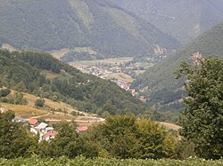
View of Voljevac Landscape
Bosnia and Herzegovina location map.svg
Red pog.svg
Voljevac
Coordinates: 43°52′43″N17°39′33″E / 43.8786°N 17.6592°E / 43.8786; 17.6592
Country Flag of Bosnia and Herzegovina.svg  Bosnia and Herzegovina
Entity Federation of Bosnia and Herzegovina
Canton Flag of Central Bosnia.svg Central Bosnia
Municipality Coat of Arms of Gornji Vakuf-Uskoplje.gif Gornji Vakuf-Uskoplje
Area
  Total
1.78 sq mi (4.60 km2)
Population
 (2013)
  Total
688
  Density390/sq mi (150/km2)
Time zone UTC+1 (CET)
  Summer (DST) UTC+2 (CEST)

Voljevac is a village in the municipality of Gornji Vakuf, Bosnia and Herzegovina. [1]

Demographics

According to the 2013 census, its population was 688. [2]

Ethnicity in 2013
EthnicityNumberPercentage
Bosniaks 67698.3%
other/undeclared121.7%
Total688100%

References

  1. Official results from the book: Ethnic composition of Bosnia-Herzegovina population, by municipalities and settlements, 1991. census, Zavod za statistiku Bosne i Hercegovine - Bilten no.234, Sarajevo 1991.
  2. "Naseljena Mjesta 1991/2013" (in Bosnian). Statistical Office of Bosnia and Herzegovina . Retrieved November 13, 2021.