This article includes a list of references, related reading or external links, but its sources remain unclear because it lacks inline citations . (October 2014) (Learn how and when to remove this template message) |
Volos/Nea Ionia Airport Κρατικός Αερολιμένας Βόλου/Νέας Ιωνίας | |||||||||||
---|---|---|---|---|---|---|---|---|---|---|---|
Summary | |||||||||||
Airport type | Defunct/Demolished | ||||||||||
Operator | Hellenic Civil Aviation Authority | ||||||||||
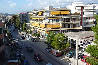
Location | Volos | ||||||||||
Elevation AMSL | 38 m / 125 ft | ||||||||||
Coordinates | 39°23′0.06″N22°55′02.84″E / 39.3833500°N 22.9174556°E Coordinates: 39°23′0.06″N22°55′02.84″E / 39.3833500°N 22.9174556°E | ||||||||||
Runways | |||||||||||
| |||||||||||
(There is nothing left of the airport) |
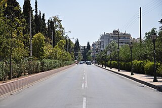
Volos/Nea Ionia Airport (Greek : Κρατικός Αερολιμένας Βόλου/Νέας Ιωνίας) ( ICAO : LGVO) was a joint public and military airport, situated at Nea Ionia, Volos. It was established in 1948 with a runway of 970m./3,190 ft. In 1954 the runway length was reduced to 650m./2,138 ft. and at that time the airport was exclusively used by the Hellenic Army. The airport finally closed in 1981, its infrastructure abandoned and left to decay. The runway was located where the new Volos Ring Road is situated today.
Greek is an independent branch of the Indo-European family of languages, native to Greece, Cyprus and other parts of the Eastern Mediterranean and the Black Sea. It has the longest documented history of any living Indo-European language, spanning more than 3000 years of written records. Its writing system has been the Greek alphabet for the major part of its history; other systems, such as Linear B and the Cypriot syllabary, were used previously. The alphabet arose from the Phoenician script and was in turn the basis of the Latin, Cyrillic, Armenian, Coptic, Gothic, and many other writing systems.
The ICAOairport code or location indicator is a four-letter code designating aerodromes around the world. These codes, as defined by the International Civil Aviation Organization and published in ICAO Document 7910: Location Indicators, are used by air traffic control and airline operations such as flight planning.
The Hellenic Army, formed in 1828, is the land force of Greece. Along with the Hellenic Air Force (HAF) and the Hellenic Navy (HN), it makes up the Hellenic Armed Forces. It is currently the largest branch of the three. The army is headed by the chief of the Hellenic Army General Staff (HAGS), which in turn is under the command of Hellenic National Defence General Staff (HNDGS).
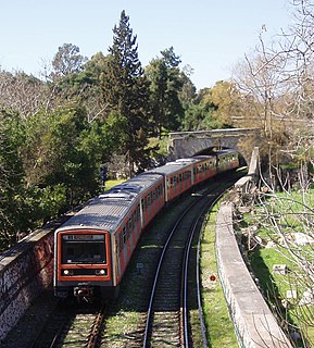
The airport was replaced by Nea Anchialos National Airport, which began operations in 1991 and sought to cover the needs of the area of Central Greece, filling in the gap of the old defunct Volos Airport.
Nea Aghialos National Airport is an airport located near the town of Nea Anchialos in Greece. It serves the city of Volos and is also known as Volos Central Greece Airport or Volos Nea Anchialos Airport of Central Greece.
Transport in Greece have undergone significant changes in the past two decades, vastly modernizing the country's infrastructure and transportation. Although ferry transport between islands remains the prominent method of transport between the nation's islands, improvements to the road infrastructure, rail, urban transport, and airports have all led to a vast improvement in transportation. These upgrades have played a key role in supporting Greece's eonomy, which in the past decade has come to rely heavily on the construction industry.
Magnesia, deriving from the tribe name Magnetes, is one of the regional units of Greece. It is part of the region of Thessaly. Its capital is the city of Volos. About 70% of the population of Magnesia live in the Greater Volos area, which is the second-largest city in Thessaly and the third busiest commercial port in Greece. According to the most recent census (2011), the population stands at 190,010. The regional unit hosts 2,000,000 tourists annually. Magnesia is represented in the Greek Parliament by six seats. Its main agricultural products are wheat, cotton, tomatoes, grapes, olives, apples and honey.
Highways in Greece are generally organized so that the odd-numbered highways are of north-south alignment and even numbered highways are of east-west alignment. However, there are many exceptions.
Volos is a coastal port city in Thessaly situated midway on the Greek mainland, about 330 kilometres north of Athens and 220 kilometres south of Thessaloniki. It is the capital of the Magnesia regional unit. Volos is the only outlet to the sea from Thessaly, the country's largest agricultural region. With a population of 144,449 (2011), it is an important industrial centre, while its port provides a bridge between Europe and Asia.
Nea Ionia is a northern suburb of Athens, Greece, and a municipality of the Attica region. It was named after Ionia, the region in Anatolia from which many Greeks migrated in the 1920s as a part of the Population exchange between Greece and Turkey.
Nea Filadelfeia is a suburb of Athens, Greece. Since the 2011 local government reform it is part of the municipality Filadelfeia-Chalkidona, of which it is the seat and a municipal unit. The municipal unit has an area of 2.850 km2. It was named after the Anatolian city Filadelfeia, now Alaşehir in Turkey, and it was settled by Greek refugees from Asia Minor after the Greco-Turkish War (1919-1922).
Nea Ionia is a city and a former municipality in Magnesia, Thessaly, Greece. Since the 2011 local government reform it is part of the municipality Volos, of which it is a municipal unit. It borders the city of Volos. The population at the 2011 census was 33,815 inhabitants. Its land area is 63.314 km². The name "New Ionia" refers to refugees from western Anatolia that settled in the area after the Greco-Turkish War (1919-1922).
Greek National Road 30 is a single carriageway road in central Greece. It connects the cities of Arta and Volos, via Trikala and Karditsa.
The Krafsidonas is with a length of 12 km the longest torrent that runs solely in the interior of Volos. It has its origin in the central Pelion Mountains, flowing southwest to Pagasetic Gulf, Greece.
Paul Soulikias, Institut des artists figuratifs (I.A.F.) is a Greek-Canadian artist painter, known primarily for his Canadian landscape scenes.
The Thessaly Football Clubs Association (TFCA) is a football (soccer) organization in the Magnesia prefecture that is part of the Greek Football Federation.
Ionia County Airport is a public airport located 3 mi (5 km) south of Ionia, Michigan. Opened in 1937, the airport is currently owned by Ionia County. It is included in the Federal Aviation Administration (FAA) National Plan of Integrated Airport Systems for 2017–2021, in which it is categorized as a local general aviation facility.
ArGo Airways was a regional airline based in Volos, Greece.
Rieti Airport is an aerodrome located 1.34 nautical miles northwest of Rieti, a city in the Lazio region in Italy. It is also known as G. Ciuffelli Airport.
A.O. Nea Ionia F.C, officially known as Nea Ionia, the "Athletic Union of New Ionia", is a Greek association football club based in the city of Athens, Greece. The club currently compete in the Athens First Division.
Motorway 12 is an extension of Motorway 1 towards the city of Volos and it is also used as a Ring Road of the city. Even though, it has two lanes of direction, there are parts with traffic lights and not all of its parts are under the motorway standards. There are still upgrade works on the road.
The 19th Finswimming World Championships was held in Volos, Greece at the Swimming Pool Neas Ionias “Vasilis Polymeros” from 24 to 28 July 2016.
This article about an airport in Greece is a stub. You can help Wikipedia by expanding it. |