Gorssel is a village in the municipality of Lochem, province of Gelderland, Netherlands. It is located about 9 km southeast of the city centre of Deventer, Overijssel. In 2015, it had a population of 4,043.
Rijsenburg is a former village and municipality in the Dutch province of Utrecht. Presently, it is a part of the single town of Driebergen-Rijsenburg.

Holysloot is a village in the Dutch province of North Holland. It is a part of the municipality of Amsterdam, and lies about 9 km northeast of the city centre. The name Holysloot probably derives from an expression for a "low-lying area at a ditch".

Deil is a village in the Dutch province of Gelderland. It is a part of the municipality of West Betuwe, and lies about 12 km west of Tiel.
Duist is a former municipality in the Dutch province of Utrecht, located between Amersfoort and Bunschoten. The municipality existed between 1818 and 1857, when it was merged with the municipality of Hoogland. When Hoogland was annexed by Amersfoort in 1974, the Duist area was split off, and merged with the municipality of Bunschoten.
Kamerik-Houtdijken is a former municipality in the Dutch province of Utrecht. It existed from 1818 to 1857, after which it merged with 's-Gravesloot, Kamerik-Mijzijde, and Teckop, to form the new municipality of Kamerik.
Catharijne is a former municipality on the west side of the Dutch city of Utrecht. It was a separate municipality between 1818 and 1823, when it merged with the city of Utrecht.
Loenen-Kronenburg was a Dutch municipality from 1817 to '19. Its former territory is now part of Loenen in the province of Utrecht.
Domburg-Buiten is a former municipality in the Dutch province of Zeeland. It existed until 1816, when it merged with Domburg-Binnen to form the new municipality of Domburg.
Zuid- en Noord-Schermer is a former municipality in the Dutch province of North Holland. It existed until 1970, when it became a part of the municipality of Schermer.
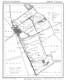
Dorth is a former municipality in the Dutch province of Gelderland. It existed between 1818 and 1831, when it was merged with the village of Gorssel.
Keppel is a former municipality in the Dutch province of Gelderland, consisting of the villages of Laag-Keppel and Hoog-Keppel. It existed until 1818, when it merged with Hummelo to form the new municipality of Hummelo en Keppel.
Biesland was a municipality in the Dutch province of South Holland. It was located to the east of the city of Delft.
Broek was a municipality in the Dutch province of South Holland, located west and north of Gouda. A longer name of the municipality, Broek, Bloemendaal, Broekhuizen, Thuil en het Weegje names the polders that are part of the municipality.

Dubbeldam is a former village in the Dutch province of South Holland. It was located to the east of the city of Dordrecht. It is now a part of that city.

Groeneveld is a former municipality in the Dutch province of South Holland. It was located to the west of the city of Delft. The municipality covered the Groeneveldse Polder, northwest of De Lier, and contained no towns or villages; only the hamlet of Lierhand.

Hodenpijl is a hamlet in the Dutch province of South Holland. It is located 3 km southwest of the centre of Delft, in the municipality of Midden-Delfland.

Hoog en Woud Harnasch is a former municipality in the Dutch province of South Holland. It was located to the west of the city of Delft.
Kethel en Spaland is a former municipality in the Dutch province of South Holland. It was located to the north of the city of Schiedam, and covered the village of Kethel and the hamlet Kandelaar.

Lange Ruige Weide is a former municipality in the Dutch province of South Holland. It was located west of the city of Oudewater, and covered the hamlets of Langeweide and Ruigeweide.