Bilopillia is a city and the administrative center of Bilopillia Raion in Sumy Oblast of northeastern Ukraine. It is located at around 51°8′54″N34°18′3″E, close to Kursk Oblast of Russia. Population: 16,466 (2015 est.)

Brzezina Sułowska is a village in the administrative district of Gmina Milicz, within Milicz County, Lower Silesian Voivodeship, in south-western Poland. Prior to 1945 it was in Germany.
Ogrodnica is a village in the administrative district of Gmina Środa Śląska, within Środa Śląska County, Lower Silesian Voivodeship, in south-western Poland. Prior to 1945 it was in Germany.
Pahar Khel Thal is a town and union council of Lakki Marwat District in Khyber Pakhtunkhwa province of Pakistan. It is located at 32°38'51N 70°52'34E and has an altitude of 254 metres.
Brąchnówko is a village in the administrative district of Gmina Chełmża, within Toruń County, Kuyavian-Pomeranian Voivodeship, in north-central Poland. It lies approximately 7 kilometres (4 mi) south of Chełmża and 14 km (9 mi) north of Toruń.
Gierkowo is a village in the administrative district of Gmina Zławieś Wielka, within Toruń County, Kuyavian-Pomeranian Voivodeship, in north-central Poland. It lies approximately 23 km (14 mi) east of Bydgoszcz and 24 km (15 mi) north-west of Toruń.
Falborek is a village in the administrative district of Gmina Brześć Kujawski, within Włocławek County, Kuyavian-Pomeranian Voivodeship, in north-central Poland.
Kurzebiela is a village in the administrative district of Gmina Strzelno, within Mogilno County, Kuyavian-Pomeranian Voivodeship, in north-central Poland. It lies approximately 3 kilometres (2 mi) south-west of Strzelno, 15 km (9 mi) east of Mogilno, 57 km (35 mi) south-west of Toruń, and 57 km (35 mi) south of Bydgoszcz.
Stary Wylezin is a village in the administrative district of Gmina Kowiesy, within Skierniewice County, Łódź Voivodeship, in central Poland. It lies approximately 2 kilometres (1 mi) south of Kowiesy, 22 km (14 mi) south-east of Skierniewice, and 68 km (42 mi) east of the regional capital Łódź.
Brzozów is a village in the administrative district of Gmina Skierniewice, within Skierniewice County, Łódź Voivodeship, in central Poland. It lies approximately 10 kilometres (6 mi) south of Skierniewice and 45 km (28 mi) east of the regional capital Łódź.
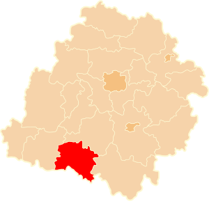
Głęboka is a village in the administrative district of Gmina Kocmyrzów-Luborzyca, within Kraków County, Lesser Poland Voivodeship, in southern Poland. It lies approximately 18 km (11 mi) north-east of the regional capital Kraków. The village is located in the historical region Galicia.
Radwanów is a village in the administrative district of Gmina Słupia Konecka, within Końskie County, Świętokrzyskie Voivodeship, in south-central Poland. It lies approximately 3 kilometres (2 mi) north of Słupia, 26 km (16 mi) south-west of Końskie, and 38 km (24 mi) north-west of the regional capital Kielce.
Styków is a village in the administrative district of Gmina Brody, within Starachowice County, Świętokrzyskie Voivodeship, in south-central Poland. It lies approximately 6 kilometres (4 mi) south-west of Brody, 8 km (5 mi) south-east of Starachowice, and 40 km (25 mi) east of the regional capital Kielce.
Daszew is a village in the administrative district of Gmina Pniewy, within Grójec County, Masovian Voivodeship, in east-central Poland.
Kolonia Seredzice is a village in the administrative district of Gmina Iłża, within Radom County, Masovian Voivodeship, in east-central Poland. It lies approximately 4 kilometres (2 mi) south-west of Iłża, 29 km (18 mi) south of Radom, and 120 km (75 mi) south of Warsaw.
Aniołka-Parcele is a settlement in the administrative district of Gmina Trzcinica, within Kępno County, Greater Poland Voivodeship, in west-central Poland.

Żerdziny is a village in the administrative district of Gmina Pietrowice Wielkie, within Racibórz County, Silesian Voivodeship, in southern Poland, close to the Czech border. It lies approximately 5 kilometres (3 mi) east of Pietrowice Wielkie, 7 km (4 mi) west of Racibórz, and 64 km (40 mi) west of the regional capital Katowice.
Świerkówko is a settlement in the administrative district of Gmina Koczała, within Człuchów County, Pomeranian Voivodeship, in northern Poland. It lies approximately 8 kilometres (5 mi) south-east of Koczała, 28 km (17 mi) north-west of Człuchów, and 113 km (70 mi) south-west of the regional capital Gdańsk.
Wieprznica is a village in the administrative district of Gmina Kościerzyna, within Kościerzyna County, Pomeranian Voivodeship, in northern Poland. It lies approximately 7 kilometres (4 mi) north-west of Kościerzyna and 54 km (34 mi) south-west of the regional capital Gdańsk.
Krupá is a village and municipality in Kolín District in the Central Bohemian Region of the Czech Republic.