Horyniec-Zdrój is a village in Lubaczów County, Subcarpathian Voivodeship, in south-eastern Poland, about 4 kilometres (2.5 mi) from the border with Ukraine. It is the seat of the gmina called Gmina Horyniec-Zdrój. It lies approximately 18 kilometres (11 mi) east of Lubaczów and 99 km (62 mi) east of the regional capital Rzeszów. The village has a population of 2,700.
Gmina Lubaczów is a rural gmina in Lubaczów County, Subcarpathian Voivodeship, in south-eastern Poland, on the border with Ukraine. Its seat is the town of Lubaczów, although the town is not part of the territory of the gmina.

Dziewięcierz is a village in the administrative district of Gmina Horyniec-Zdrój, within Lubaczów County, Subcarpathian Voivodeship, in south-eastern Poland, close to the border with Ukraine. It lies approximately 27 kilometres (17 mi) east of Lubaczów and 108 km (67 mi) east of the regional capital Rzeszów.

Krzywe is a village in the administrative district of Gmina Horyniec-Zdrój, within Lubaczów County, Subcarpathian Voivodeship, in south-eastern Poland, close to the border with Ukraine. It lies approximately 5 kilometres (3 mi) west of Horyniec-Zdrój, 14 km (9 mi) east of Lubaczów, and 95 km (59 mi) east of the regional capital Rzeszów.
Mrzygłody Lubyckie is a village in the administrative district of Gmina Horyniec-Zdrój, within Lubaczów County, Subcarpathian Voivodeship, in south-eastern Poland, close to the border with Ukraine. It lies approximately 29 kilometres (18 mi) north-east of Lubaczów and 109 km (68 mi) east of the regional capital Rzeszów.
Nowe Brusno is a village in the administrative district of Gmina Horyniec-Zdrój, within Lubaczów County, Subcarpathian Voivodeship, in south-eastern Poland, close to the border with Ukraine. It lies approximately 7 kilometres (4 mi) north-west of Horyniec-Zdrój, 16 km (10 mi) north-east of Lubaczów, and 96 km (60 mi) east of the regional capital Rzeszów.
Nowiny Horynieckie is a village in the administrative district of Gmina Horyniec-Zdrój, within Lubaczów County, Subcarpathian Voivodeship, in south-eastern Poland, close to the border with Ukraine. It lies approximately 21 kilometres (13 mi) east of Lubaczów and 101 km (63 mi) east of the regional capital Rzeszów.

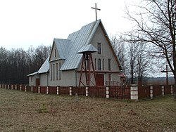
Podemszczyzna is a village in the administrative district of Gmina Horyniec-Zdrój, within Lubaczów County, Subcarpathian Voivodeship, in south-eastern Poland, close to the border with Ukraine. It lies approximately 15 kilometres (9 mi) north-east of Lubaczów and 95 km (59 mi) east of the regional capital Rzeszów.
Polanka Horyniecka is a village in the administrative district of Gmina Horyniec-Zdrój, within Lubaczów County, Subcarpathian Voivodeship, in south-eastern Poland, close to the border with Ukraine. It lies approximately 18 kilometres (11 mi) north-east of Lubaczów and 98 km (61 mi) east of the regional capital Rzeszów.

Prusie is a village in the administrative district of Gmina Horyniec-Zdrój, within Lubaczów County, Subcarpathian Voivodeship, in south-eastern Poland, close to the border with Ukraine. It lies approximately 32 kilometres (20 mi) east of Lubaczów and 112 km (70 mi) east of the regional capital Rzeszów.
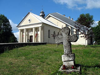
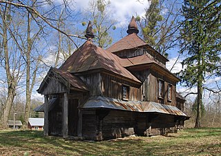
Radruż is a village in the administrative district of Gmina Horyniec-Zdrój, within Lubaczów County, Subcarpathian Voivodeship, in south-eastern Poland, close to the border with Ukraine. It lies approximately 21 kilometres (13 mi) east of Lubaczów and 101 km (63 mi) east of the regional capital Rzeszów.
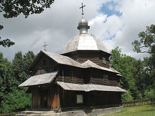
Werchrata is a village in the administrative district of Gmina Horyniec-Zdrój, within Lubaczów County, Subcarpathian Voivodeship, in south-eastern Poland, close to the border with Ukraine. It lies approximately 27 kilometres (17 mi) east of Lubaczów and 108 km (67 mi) east of the regional capital Rzeszów.
Krowica Hołodowska is a village in the administrative district of Gmina Lubaczów, within Lubaczów County, Subcarpathian Voivodeship, in south-eastern Poland, close to the border with Ukraine. It lies approximately 12 kilometres (7 mi) south-east of Lubaczów and 89 km (55 mi) east of the regional capital Rzeszów.
Lisie Jamy is a village in the administrative district of Gmina Lubaczów, within Lubaczów County, Subcarpathian Voivodeship, in south-eastern Poland, close to the border with Ukraine. It lies approximately 3 kilometres (2 mi) south-east of Lubaczów and 84 km (52 mi) east of the regional capital Rzeszów.
Wólka Krowicka is a village in the administrative district of Gmina Lubaczów, within Lubaczów County, Subcarpathian Voivodeship, in south-eastern Poland, close to the border with Ukraine. It lies approximately 7 kilometres (4 mi) south-east of Lubaczów and 86 km (53 mi) east of the regional capital Rzeszów.
Jędrzejówka is a village in the administrative district of Gmina Narol, within Lubaczów County, Subcarpathian Voivodeship, in south-eastern Poland. It lies approximately 4 kilometres (2 mi) south of Narol, 23 km (14 mi) north-east of Lubaczów, and 100 km (62 mi) east of the regional capital Rzeszów.

Płazów is a village in the administrative district of Gmina Narol, within Lubaczów County, Subcarpathian Voivodeship, in south-eastern Poland. It lies approximately 7 kilometres (4 mi) south-west of Narol, 20 km (12 mi) north-east of Lubaczów, and 95 km (59 mi) east of the regional capital Rzeszów.
Ruda Różaniecka is a village in the administrative district of Gmina Narol, within Lubaczów County, Subcarpathian Voivodeship, in south-eastern Poland. It lies approximately 11 kilometres (7 mi) west of Narol, 18 km (11 mi) north of Lubaczów, and 90 km (56 mi) east of the regional capital Rzeszów.
Wólka Żmijowska is a village in the administrative district of Gmina Wielkie Oczy, within Lubaczów County, Subcarpathian Voivodeship, in south-eastern Poland, close to the border with Ukraine. It lies approximately 5 kilometres (3 mi) north-east of Wielkie Oczy, 15 km (9 mi) south-east of Lubaczów, and 86 km (53 mi) east of the regional capital Rzeszów.
Żmijowiska is a village in the administrative district of Gmina Wielkie Oczy, within Lubaczów County, Subcarpathian Voivodeship, in south-eastern Poland, close to the border with Ukraine. It lies approximately 2 kilometres (1 mi) south-east of Wielkie Oczy, 18 km (11 mi) south of Lubaczów, and 85 km (53 mi) east of the regional capital Rzeszów.